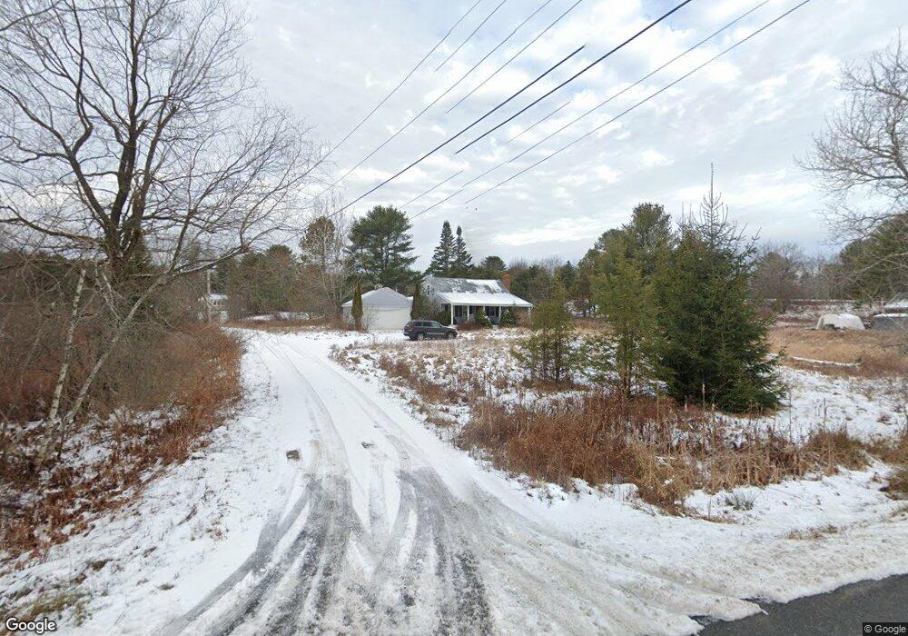
2 Golden Grove Ln Freeport, ME 04032
Estimated Value: $287,000 - $460,000
2
Beds
2
Baths
1,452
Sq Ft
$273/Sq Ft
Est. Value
About This Home
This home is located at 2 Golden Grove Ln, Freeport, ME 04032 and is currently estimated at $396,132, approximately $272 per square foot. 2 Golden Grove Ln is a home located in Cumberland County with nearby schools including Morse Street School, Mast Landing School, and Freeport Middle School.
Ownership History
Date
Name
Owned For
Owner Type
Purchase Details
Closed on
Sep 29, 2025
Sold by
Treehouse Series V T and Us Bank Tna Tr
Bought by
2 Golden Grove Ln Llc
Current Estimated Value
Home Financials for this Owner
Home Financials are based on the most recent Mortgage that was taken out on this home.
Original Mortgage
$315,000
Outstanding Balance
$315,000
Interest Rate
6.58%
Mortgage Type
New Conventional
Estimated Equity
$81,132
Purchase Details
Closed on
Jun 23, 2009
Sold by
Dermody David J and Dermody Jennifer L
Bought by
Roy Brad M
Home Financials for this Owner
Home Financials are based on the most recent Mortgage that was taken out on this home.
Original Mortgage
$158,100
Interest Rate
4.91%
Mortgage Type
Purchase Money Mortgage
Create a Home Valuation Report for This Property
The Home Valuation Report is an in-depth analysis detailing your home's value as well as a comparison with similar homes in the area
Home Values in the Area
Average Home Value in this Area
Purchase History
| Date | Buyer | Sale Price | Title Company |
|---|---|---|---|
| 2 Golden Grove Ln Llc | $177,000 | -- | |
| Roy Brad M | -- | -- |
Source: Public Records
Mortgage History
| Date | Status | Borrower | Loan Amount |
|---|---|---|---|
| Open | 2 Golden Grove Ln Llc | $315,000 | |
| Previous Owner | Roy Brad M | $158,100 |
Source: Public Records
Tax History Compared to Growth
Tax History
| Year | Tax Paid | Tax Assessment Tax Assessment Total Assessment is a certain percentage of the fair market value that is determined by local assessors to be the total taxable value of land and additions on the property. | Land | Improvement |
|---|---|---|---|---|
| 2024 | $3,171 | $237,500 | $126,500 | $111,000 |
| 2023 | $2,922 | $212,500 | $114,900 | $97,600 |
| 2022 | $2,741 | $200,800 | $103,200 | $97,600 |
| 2021 | $2,681 | $200,800 | $103,200 | $97,600 |
| 2020 | $2,584 | $184,600 | $95,500 | $89,100 |
| 2019 | $2,475 | $173,100 | $90,200 | $82,900 |
| 2018 | $2,510 | $166,800 | $82,400 | $84,400 |
| 2017 | $2,408 | $161,100 | $80,500 | $80,600 |
| 2016 | $2,386 | $151,000 | $76,300 | $74,700 |
Source: Public Records
Map
Nearby Homes
- 42A Wardtown Rd
- 3 Ron Henry Ln
- 140 Grant Rd
- 16 Curtis Rd
- 7 Hideaway Dr
- 12 Peter Robin Way
- 143 Bragdon Rd
- 1 Fawn Meadow Ln
- Lot #3 Fernwood Dr
- 134 Durham Rd
- 1595 U S Route 1
- 137 Durham Rd
- 713 Old Portland Rd
- Lot #2 Collinsbrook Rd
- 127 Brown Rd
- 31 Allen Range Rd
- 0 Prout Rd
- 1260 Us Route 1
- 15 Tinkers Way
- 4 Harper's Trail
- 85 Wardtown Rd
- 89 Wardtown Rd
- Off Wardtown Rd
- 20 Golden Grove Ln
- 72 Curtis Rd
- 91 Wardtown Rd
- 12 Golden Grove Ln
- 83 Wardtown Rd
- 88 Wardtown Rd
- 92 Wardtown Rd
- 79 Wardtown Rd
- 64 Curtis Rd
- 71 Curtis Rd
- 3 Frenchs Run
- 3 Frenchs Run Unit LOT B
- 3 Frenchs Run Unit Lot A
- 80 Wardtown Rd
- 61 Curtis Rd
- 96 Wardtown Rd
- 95 Wardtown Rd