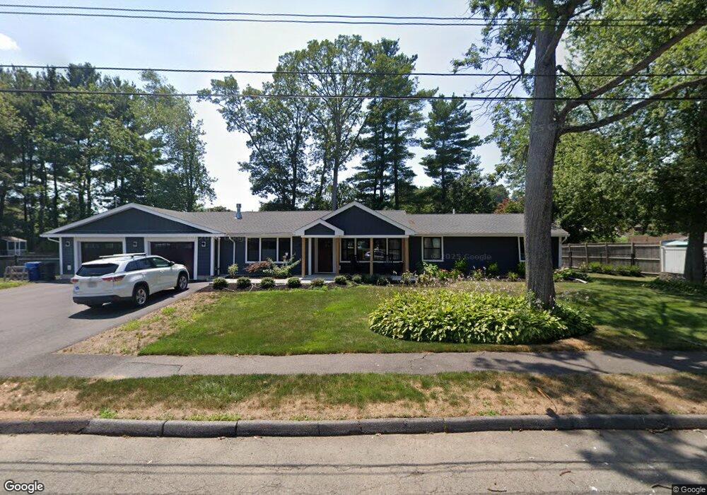
2 Gwinnett Rd Unit 1 Peabody, MA 01960
West Peabody NeighborhoodEstimated Value: $742,000 - $861,000
3
Beds
3
Baths
1,833
Sq Ft
$438/Sq Ft
Est. Value
About This Home
This home is located at 2 Gwinnett Rd Unit 1, Peabody, MA 01960 and is currently estimated at $802,690, approximately $437 per square foot. 2 Gwinnett Rd Unit 1 is a home located in Essex County with nearby schools including Peabody Veterans Memorial High School, Covenant Christian Academy, and Our Lady Of Assumption School.
Ownership History
Date
Name
Owned For
Owner Type
Purchase Details
Closed on
Jan 31, 2017
Sold by
Adele Ruccolo Irt
Bought by
Ceicys Ian
Current Estimated Value
Home Financials for this Owner
Home Financials are based on the most recent Mortgage that was taken out on this home.
Original Mortgage
$318,400
Outstanding Balance
$213,075
Interest Rate
4.16%
Mortgage Type
New Conventional
Estimated Equity
$589,615
Purchase Details
Closed on
Oct 5, 1979
Bought by
Adele Ruccolo Irt
Create a Home Valuation Report for This Property
The Home Valuation Report is an in-depth analysis detailing your home's value as well as a comparison with similar homes in the area
Home Values in the Area
Average Home Value in this Area
Purchase History
| Date | Buyer | Sale Price | Title Company |
|---|---|---|---|
| Ceicys Ian | $398,000 | -- | |
| Adele Ruccolo Irt | -- | -- |
Source: Public Records
Mortgage History
| Date | Status | Borrower | Loan Amount |
|---|---|---|---|
| Open | Ceicys Ian | $318,400 |
Source: Public Records
Tax History Compared to Growth
Tax History
| Year | Tax Paid | Tax Assessment Tax Assessment Total Assessment is a certain percentage of the fair market value that is determined by local assessors to be the total taxable value of land and additions on the property. | Land | Improvement |
|---|---|---|---|---|
| 2025 | $6,939 | $749,300 | $327,800 | $421,500 |
| 2024 | $5,969 | $654,500 | $327,800 | $326,700 |
| 2023 | $5,612 | $589,500 | $273,200 | $316,300 |
| 2022 | $5,599 | $554,400 | $237,600 | $316,800 |
| 2021 | $5,157 | $491,600 | $216,000 | $275,600 |
| 2020 | $5,100 | $474,900 | $216,000 | $258,900 |
| 2019 | $5,043 | $458,000 | $216,000 | $242,000 |
| 2018 | $4,073 | $355,400 | $192,900 | $162,500 |
| 2017 | $4,035 | $343,100 | $192,900 | $150,200 |
| 2016 | $4,183 | $350,900 | $192,900 | $158,000 |
| 2015 | $3,772 | $306,700 | $192,900 | $113,800 |
Source: Public Records
Map
Nearby Homes
- 17 Samoset Rd
- 1 Maddabon Place
- 106 Winona St
- 56 Lake St
- 8 Elginwood Rd
- 402 Pine Brook Dr
- 903 Pine Brook Dr
- 2 Curwen Rd
- 41 Pine St Unit 13
- 67 Russell St
- 1303 Foxwood Cir
- 1301 Foxwood Cir Unit 1301
- 7 Livingston Dr
- 35 Grey Ln
- 4 Whipple Rd
- 1 Danforth St
- 25 Chatham Way
- 37 Grey Ln
- 7 Yorkshire Dr
- 154 Newbury St Unit 38
- 2 Gwinnett Rd
- 5 Waldens Hill Dr
- 3 Waldens Hill Dr
- 4 Gwinnett Rd
- 3 Gwinnett Rd
- 1 Gwinnett Rd
- 7 Waldens Hill Dr
- 1 Waldens Hill Dr
- 6 Braxton Rd
- 11 Lisburn St
- 4 Walden Hill Dr
- 6 Gwinnett Rd
- 6 Waldens Hill Dr
- 4 Waldens Hill Dr
- 7 Gwinnett Rd
- 9 Waldens Hill Dr
- 4 Braxton Rd
- 2 Walden Hill Dr
- 8 Waldens Hill Dr
- 2 Antrim Rd