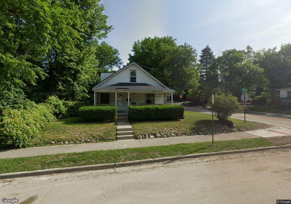
2 Hazel Ave Pontiac, MI 48341
Estimated Value: $98,000 - $150,000
2
Beds
1
Bath
941
Sq Ft
$142/Sq Ft
Est. Value
About This Home
This home is located at 2 Hazel Ave, Pontiac, MI 48341 and is currently estimated at $133,762, approximately $142 per square foot. 2 Hazel Ave is a home located in Oakland County with nearby schools including Walt Whitman Elementary School, Pontiac Middle School, and Pontiac High School.
Ownership History
Date
Name
Owned For
Owner Type
Purchase Details
Closed on
Oct 6, 2011
Sold by
Federal Deposit Insurance Corporation
Bought by
New York Community Bank
Current Estimated Value
Purchase Details
Closed on
Jul 27, 2010
Sold by
Munce Brian
Bought by
Federal Deposit Insurance Corporation
Purchase Details
Closed on
Jan 6, 2009
Sold by
Munce Brian
Bought by
Amtrust Bank and Ohio Savings Bank
Purchase Details
Closed on
Feb 12, 2003
Sold by
Masnari Carolyn
Bought by
Munce Brian B
Purchase Details
Closed on
Nov 22, 1996
Sold by
Young Lester M and Young Mary Lee
Bought by
Munce Brian and Masnari Carolyn
Create a Home Valuation Report for This Property
The Home Valuation Report is an in-depth analysis detailing your home's value as well as a comparison with similar homes in the area
Home Values in the Area
Average Home Value in this Area
Purchase History
| Date | Buyer | Sale Price | Title Company |
|---|---|---|---|
| New York Community Bank | -- | Metropolitan | |
| Federal Deposit Insurance Corporation | $32,625 | None Available | |
| Amtrust Bank | $21,000 | None Available | |
| Munce Brian B | -- | Philip R Seaver Title Co Inc | |
| Munce Brian | $31,500 | Philip R Seaver Title Co Inc |
Source: Public Records
Tax History Compared to Growth
Tax History
| Year | Tax Paid | Tax Assessment Tax Assessment Total Assessment is a certain percentage of the fair market value that is determined by local assessors to be the total taxable value of land and additions on the property. | Land | Improvement |
|---|---|---|---|---|
| 2024 | $887 | $48,670 | $0 | $0 |
| 2023 | $845 | $42,780 | $0 | $0 |
| 2022 | $880 | $36,710 | $0 | $0 |
| 2021 | $856 | $28,610 | $0 | $0 |
| 2020 | $769 | $25,430 | $0 | $0 |
| 2019 | $823 | $22,490 | $0 | $0 |
| 2018 | $788 | $18,740 | $0 | $0 |
| 2017 | $755 | $16,910 | $0 | $0 |
| 2016 | $781 | $14,020 | $0 | $0 |
| 2015 | -- | $13,030 | $0 | $0 |
| 2014 | -- | $12,810 | $0 | $0 |
| 2011 | -- | $19,270 | $0 | $0 |
Source: Public Records
Map
Nearby Homes
- 26 Edna Ave
- 12 Edna Ave
- 14 Riverbank Dr Unit 300-114
- 25 Riverbank Dr Unit 300-125
- 27 Riverbank Dr Unit 300-127
- 8 Myra Ave
- 10 Wenonah Dr
- 21 Canal Dr Unit 300-021
- 871 Menominee Rd
- 14 Canal Dr Unit 300-014
- 10 Niagara Ave
- 181 Navajo Ave
- 49 Canal Dr Unit 300-049
- 38 Canal Dr Unit 300-038
- 990 Voorheis Rd
- 985 James K Blvd
- 260 Cherokee Rd
- 147 Draper Ave
- 166 Cherokee Rd
- 243 Cherokee Rd