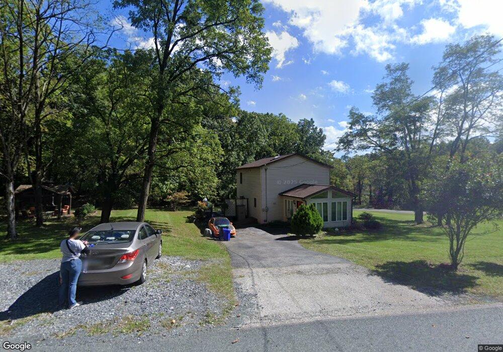
2 High Trail Unit 269 Fairfield, PA 17320
Estimated Value: $308,607 - $342,000
3
Beds
2
Baths
1,576
Sq Ft
$209/Sq Ft
Est. Value
About This Home
This home is located at 2 High Trail Unit 269, Fairfield, PA 17320 and is currently estimated at $329,152, approximately $208 per square foot. 2 High Trail Unit 269 is a home located in Adams County with nearby schools including Fairfield Area Elementary School, Fairfield Area Middle School, and Fairfield Area High School.
Ownership History
Date
Name
Owned For
Owner Type
Purchase Details
Closed on
Oct 13, 2010
Sold by
Citibank Na
Bought by
Russell Nicole A
Current Estimated Value
Home Financials for this Owner
Home Financials are based on the most recent Mortgage that was taken out on this home.
Original Mortgage
$121,735
Interest Rate
4.22%
Mortgage Type
Purchase Money Mortgage
Purchase Details
Closed on
Jun 9, 2010
Sold by
Middleton Sean Michael and Middleton Kelly C
Bought by
Citibank Na
Purchase Details
Closed on
Feb 28, 2005
Sold by
Puhala Susan Faith
Bought by
Middleton Sean M and Middleton Kelly C
Home Financials for this Owner
Home Financials are based on the most recent Mortgage that was taken out on this home.
Original Mortgage
$178,500
Interest Rate
6.9%
Mortgage Type
Adjustable Rate Mortgage/ARM
Create a Home Valuation Report for This Property
The Home Valuation Report is an in-depth analysis detailing your home's value as well as a comparison with similar homes in the area
Home Values in the Area
Average Home Value in this Area
Purchase History
| Date | Buyer | Sale Price | Title Company |
|---|---|---|---|
| Russell Nicole A | $125,500 | -- | |
| Citibank Na | $1,942 | -- | |
| Middleton Sean M | $178,500 | -- |
Source: Public Records
Mortgage History
| Date | Status | Borrower | Loan Amount |
|---|---|---|---|
| Previous Owner | Russell Nicole A | $121,735 | |
| Previous Owner | Middleton Sean M | $178,500 |
Source: Public Records
Tax History Compared to Growth
Tax History
| Year | Tax Paid | Tax Assessment Tax Assessment Total Assessment is a certain percentage of the fair market value that is determined by local assessors to be the total taxable value of land and additions on the property. | Land | Improvement |
|---|---|---|---|---|
| 2025 | $4,178 | $207,500 | $88,500 | $119,000 |
| 2024 | $3,946 | $207,500 | $88,500 | $119,000 |
| 2023 | $3,739 | $207,500 | $88,500 | $119,000 |
| 2022 | $3,739 | $207,500 | $88,500 | $119,000 |
| 2021 | $3,640 | $207,500 | $88,500 | $119,000 |
| 2020 | $3,607 | $207,500 | $88,500 | $119,000 |
| 2019 | $3,548 | $207,500 | $88,500 | $119,000 |
| 2018 | $3,511 | $207,500 | $88,500 | $119,000 |
| 2017 | $3,391 | $207,500 | $88,500 | $119,000 |
| 2016 | -- | $207,500 | $88,500 | $119,000 |
| 2015 | -- | $207,500 | $88,500 | $119,000 |
| 2014 | -- | $236,500 | $92,000 | $144,500 |
Source: Public Records
Map
Nearby Homes
- 12 Deborah Trail
- 9 Alice Trail
- 10 Susan Trail
- 8 Polly Trail Unit 224
- 27 Gladys Trail Unit 110
- 17 Connie Trail Unit 314
- 13 Connie Trail
- 19 Connie Trail
- 15 Connie Trail
- 25 Shirley Trail
- 3 Possum Trail
- 15 Hilltop Trail
- 45 Shirley Trail Unit 127
- 10 Echo Trail
- 35 Warren Trail
- 39 Eagles Trail
- 37 Raven Trail Unit 306
- 18 Robin Trail Unit 55
- 31 Eagles Trail
- 9 & 7 Deer Trail
- 8 High Trail
- 3 Lynn Trail Unit 435
- 5 High Trail
- Lots 3 & 5 High Trail
- 10 High Trail
- 85 Skylark Trail Unit 334
- 94 Skylark Trail Unit 224
- 12 High Trail
- 11 High Trail Unit 263
- 76 Skylark Trail Unit 439
- 79 Skylark Trail Unit 337
- 96 Skylark Trail
- 5 Louise Trail Unit 433
- 34 Veronica Trail
- 93 Skylark Trail Unit 330
- 27 Lee Trail
- 6 Louise Trail
- 16 Deborah Trail Unit 310
- 95 Skylark Trail Unit 329
- 23 Lee Trail Unit 313