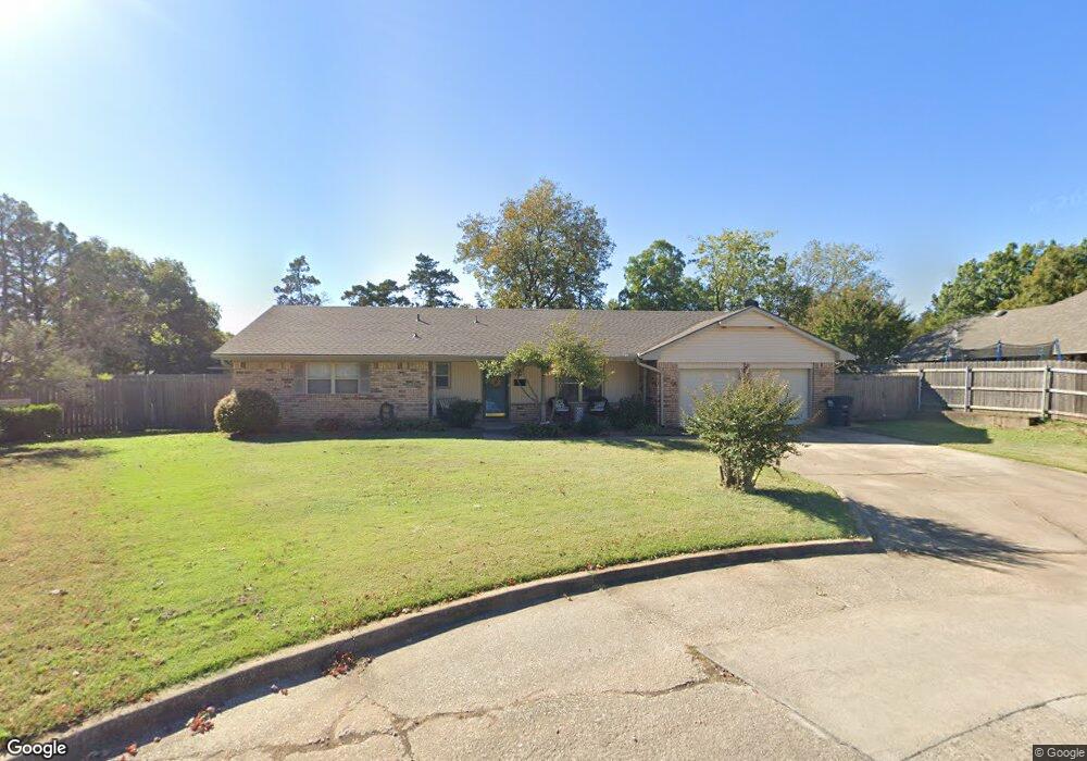
2 Hughes Cir Shawnee, OK 74804
Estimated Value: $165,000 - $231,000
3
Beds
2
Baths
1,722
Sq Ft
$113/Sq Ft
Est. Value
About This Home
This home is located at 2 Hughes Cir, Shawnee, OK 74804 and is currently estimated at $194,899, approximately $113 per square foot. 2 Hughes Cir is a home located in Pottawatomie County with nearby schools including Will Rogers Elementary School, Shawnee Middle School, and Shawnee High School.
Ownership History
Date
Name
Owned For
Owner Type
Purchase Details
Closed on
May 15, 2017
Sold by
Day Bruce
Bought by
Crane Canaan and Crane Stephanie
Current Estimated Value
Purchase Details
Closed on
Sep 29, 2000
Sold by
Thomas Charles and Thomas Jean M
Bought by
Heilman Gary and Heilman Laura E
Purchase Details
Closed on
May 5, 1992
Sold by
Thomas Charles and Thomas M
Bought by
Thomas Charles and Thomas M
Create a Home Valuation Report for This Property
The Home Valuation Report is an in-depth analysis detailing your home's value as well as a comparison with similar homes in the area
Home Values in the Area
Average Home Value in this Area
Purchase History
| Date | Buyer | Sale Price | Title Company |
|---|---|---|---|
| Crane Canaan | $100,000 | First American Title | |
| Heilman Gary | $106,000 | -- | |
| Thomas Charles | -- | -- |
Source: Public Records
Tax History Compared to Growth
Tax History
| Year | Tax Paid | Tax Assessment Tax Assessment Total Assessment is a certain percentage of the fair market value that is determined by local assessors to be the total taxable value of land and additions on the property. | Land | Improvement |
|---|---|---|---|---|
| 2024 | $1,156 | $11,614 | $2,100 | $9,514 |
| 2023 | $1,156 | $11,061 | $2,520 | $8,541 |
| 2022 | $1,135 | $11,061 | $2,520 | $8,541 |
| 2021 | $1,115 | $11,061 | $2,520 | $8,541 |
| 2020 | $1,151 | $11,387 | $2,520 | $8,867 |
| 2019 | $1,206 | $11,549 | $2,520 | $9,029 |
| 2018 | $1,228 | $12,000 | $2,520 | $9,480 |
| 2017 | $1,324 | $14,123 | $2,520 | $11,603 |
| 2016 | $1,372 | $14,446 | $2,520 | $11,926 |
| 2015 | $1,340 | $14,395 | $2,520 | $11,875 |
| 2014 | $1,519 | $16,182 | $1,680 | $14,502 |
Source: Public Records
Map
Nearby Homes
- 401 E Federal St
- 2001 N Mckinley Ave
- 806 E Midland St
- 1822 N Phil Ave
- 2415 N Minnesota Cir
- 1712 N Pennsylvania Ave
- 1901 N Bell Ave
- 2021 N Broadway Ave
- 1817 N Bell Ave
- 1816 N Bell Ave
- 108 E Pulaski St
- 10 W Midland St
- 27 N Rice Ave
- 1510 N Union Ave
- 0 Independence and Minnesota St
- 3306 N Oklahoma Ave
- 202 W Franklin St
- 1925 N Park Ave
- 1602 N Bdwy
- 1607 N Beard Ave
- 2 S Hughes Cir
- 3 Hughes Cir
- 501 E Federal St
- 4 Hughes Cir
- 515 E Federal St
- 5 Hughes Cir
- 2007 N Minnesota Ave
- 1933 N Minnesota Ave
- 2002 N Minnesota Ave
- 2004 N Minnesota Ave
- 415 E Federal St
- 2010 N Minnesota Ave
- 2003 N Minnesota Ave
- 2009 N Minnesota Ave
- 2006 N Minnesota Ave
- 2006 N Tucker Ave
- 1807 Larkin Ln
- 1808 Larkin Ln
- 1921 Carleton Ln
- 2002 N Tucker Ave