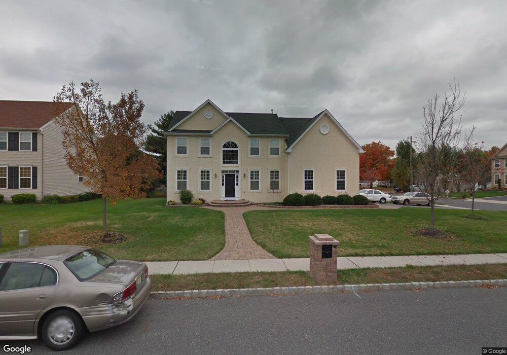
2 Jason Cir Penns Grove, NJ 08069
Estimated Value: $430,000 - $614,000
4
Beds
3
Baths
2,730
Sq Ft
$178/Sq Ft
Est. Value
About This Home
This home is located at 2 Jason Cir, Penns Grove, NJ 08069 and is currently estimated at $485,697, approximately $177 per square foot. 2 Jason Cir is a home located in Salem County with nearby schools including Lafayette-Pershing Elementary School, Field Street Elementary School, and Paul W. Carleton Elementary School.
Ownership History
Date
Name
Owned For
Owner Type
Purchase Details
Closed on
Jun 30, 2006
Current Estimated Value
Home Financials for this Owner
Home Financials are based on the most recent Mortgage that was taken out on this home.
Original Mortgage
$297,689
Interest Rate
7.99%
Mortgage Type
Purchase Money Mortgage
Create a Home Valuation Report for This Property
The Home Valuation Report is an in-depth analysis detailing your home's value as well as a comparison with similar homes in the area
Home Values in the Area
Average Home Value in this Area
Purchase History
| Date | Buyer | Sale Price | Title Company |
|---|---|---|---|
| -- | $330,800 | -- | |
| Moon Rashika J | $330,766 | Commonwealth Land Title Insu |
Source: Public Records
Mortgage History
| Date | Status | Borrower | Loan Amount |
|---|---|---|---|
| Previous Owner | Moon Rashika J | $297,689 |
Source: Public Records
Tax History Compared to Growth
Tax History
| Year | Tax Paid | Tax Assessment Tax Assessment Total Assessment is a certain percentage of the fair market value that is determined by local assessors to be the total taxable value of land and additions on the property. | Land | Improvement |
|---|---|---|---|---|
| 2025 | $13,039 | $235,100 | $23,500 | $211,600 |
| 2024 | $12,601 | $235,100 | $23,500 | $211,600 |
| 2023 | $12,601 | $235,100 | $23,500 | $211,600 |
| 2022 | $12,148 | $235,100 | $23,500 | $211,600 |
| 2021 | $11,623 | $235,100 | $23,500 | $211,600 |
| 2020 | $11,776 | $235,100 | $23,500 | $211,600 |
| 2019 | $11,826 | $235,100 | $23,500 | $211,600 |
| 2018 | $11,695 | $289,900 | $30,500 | $259,400 |
| 2017 | $11,735 | $289,900 | $30,500 | $259,400 |
| 2016 | $11,292 | $289,900 | $30,500 | $259,400 |
| 2015 | $10,816 | $289,900 | $30,500 | $259,400 |
| 2014 | $10,697 | $289,900 | $30,500 | $259,400 |
Source: Public Records
Map
Nearby Homes
- 15 1/2 N Miller Ave
- 0 Cumberland Ave
- 99 N Virginia Ave
- 150 Penns Grove Auburn Rd
- 0 Lincoln Avenue & Cumberland
- 114 Deming Ave
- 39 41 Cumberland Ave
- 136 Penns Grove Auburn Rd
- 83 Willis St
- 45 S Virginia Ave
- 34 38 Cumberland Ave
- 59-61 Walnut St
- 32 Walnut St
- 55 57 Walnut St
- 210 Penns Grove Auburn Rd
- 279 Logwood Ave
- 142 N Dolbow Ave
- 15 Walnut St
- 32 Westminster Ave
- 31 Elvin Ave