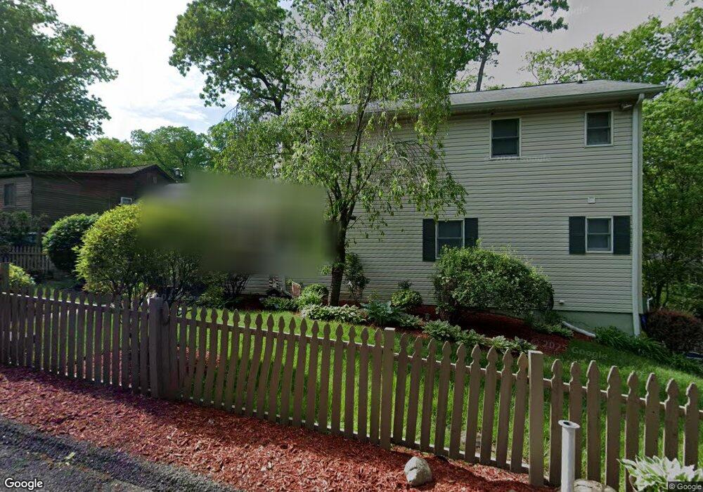
2 Ka Ton Nah Trail Byram Township, NJ 07821
Estimated Value: $353,000 - $536,000
--
Bed
--
Bath
1,970
Sq Ft
$225/Sq Ft
Est. Value
About This Home
This home is located at 2 Ka Ton Nah Trail, Byram Township, NJ 07821 and is currently estimated at $443,568, approximately $225 per square foot. 2 Ka Ton Nah Trail is a home located in Sussex County with nearby schools including Byram Lakes Elementary School, Byram Township Intermediate School, and Lenape Val Regional High School.
Ownership History
Date
Name
Owned For
Owner Type
Purchase Details
Closed on
Mar 26, 2008
Sold by
Bell Michael and Bell Bonnie L
Bought by
Prohaska Scott J and Taylor Prohaska Elinor A
Current Estimated Value
Home Financials for this Owner
Home Financials are based on the most recent Mortgage that was taken out on this home.
Original Mortgage
$296,200
Outstanding Balance
$185,566
Interest Rate
5.76%
Mortgage Type
VA
Estimated Equity
$258,002
Purchase Details
Closed on
Aug 28, 1997
Sold by
Teut Kathleen and Bryer Kathleen E
Bought by
Bell Michael and Kadar Bonnie L
Create a Home Valuation Report for This Property
The Home Valuation Report is an in-depth analysis detailing your home's value as well as a comparison with similar homes in the area
Home Values in the Area
Average Home Value in this Area
Purchase History
| Date | Buyer | Sale Price | Title Company |
|---|---|---|---|
| Prohaska Scott J | $290,000 | None Available | |
| Bell Michael | $106,000 | First American Title Ins Co |
Source: Public Records
Mortgage History
| Date | Status | Borrower | Loan Amount |
|---|---|---|---|
| Open | Prohaska Scott J | $296,200 |
Source: Public Records
Tax History Compared to Growth
Tax History
| Year | Tax Paid | Tax Assessment Tax Assessment Total Assessment is a certain percentage of the fair market value that is determined by local assessors to be the total taxable value of land and additions on the property. | Land | Improvement |
|---|---|---|---|---|
| 2025 | $9,031 | $235,800 | $80,300 | $155,500 |
| 2024 | $8,871 | $235,800 | $80,300 | $155,500 |
| 2023 | $8,871 | $235,800 | $80,300 | $155,500 |
| 2022 | $8,630 | $235,800 | $80,300 | $155,500 |
| 2021 | $8,498 | $235,800 | $80,300 | $155,500 |
| 2020 | $8,427 | $235,800 | $80,300 | $155,500 |
| 2019 | $8,416 | $235,800 | $80,300 | $155,500 |
| 2018 | $8,359 | $235,800 | $80,300 | $155,500 |
| 2017 | $8,213 | $235,800 | $80,300 | $155,500 |
| 2016 | $8,076 | $235,800 | $80,300 | $155,500 |
| 2015 | $7,873 | $235,800 | $80,300 | $155,500 |
| 2014 | $7,831 | $235,800 | $80,300 | $155,500 |
Source: Public Records
Map
Nearby Homes
- 34 Allamuchy Trail
- 8 Hillcrest Trail
- 19 Division Ln
- 7 Lakeview Trail
- 2 Cabin Spring Trail
- 129 N Shore Rd
- 24 S Shore Rd
- 5 Harding Rd
- 3 Knute Dr
- 1 Pine Park
- 6 Jans Way
- 0 Decker Pond Airport Rd Unit 3945534
- 27 Mountainview Dr
- 8 Cub Lake Rd
- 52 Tamarack Rd
- 75 Shore Rd
- 51 Scenic Dr
- 78 Hillside Terrace
- 36 Sleepy Hollow Rd
- 18 Spruce Dr
- 4 Ka Ton Nah Trail
- 3 Ka-Ton-ah Trail
- 7 Tote Rd
- 25 Allamuchy Trail
- 1 Ka Ton Nah Trail
- 12 Tote Rd
- 3 Ka Ton Nah Trail
- 9 Tote Rd
- 6 Ka Ton Nah Trail
- 6 Tote Rd
- 1 High To Ga Trail
- 5 Ka Ton Nah Trail
- 20 Allamuchy Trail
- 26 Allamuchy Trail
- 2 Wo To Ga Pass
- 7 Ka Ton Nah Trail
- 14 Tote Rd
- 19 Allamuchy Trail
- 2 High To Ga Trail
- 8 Ka Ton Nah Trail