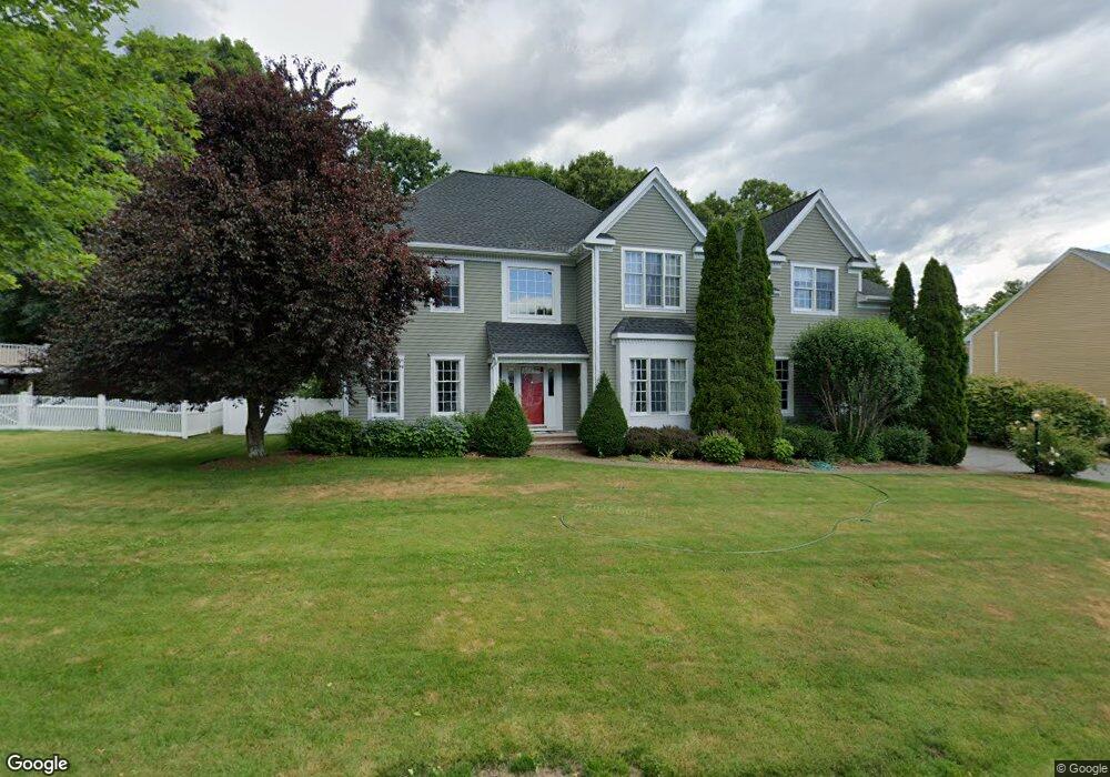
2 Katie Path Natick, MA 01760
Estimated Value: $1,539,000 - $1,794,000
4
Beds
4
Baths
3,320
Sq Ft
$493/Sq Ft
Est. Value
About This Home
This home is located at 2 Katie Path, Natick, MA 01760 and is currently estimated at $1,635,975, approximately $492 per square foot. 2 Katie Path is a home located in Middlesex County with nearby schools including Natick High School, J F Kennedy Middle School, and Johnson Elementary School.
Ownership History
Date
Name
Owned For
Owner Type
Purchase Details
Closed on
Jun 22, 1999
Sold by
Trask Inc
Bought by
Shanno Michael L and Shanno Karen L
Current Estimated Value
Home Financials for this Owner
Home Financials are based on the most recent Mortgage that was taken out on this home.
Original Mortgage
$240,000
Outstanding Balance
$62,983
Interest Rate
6.99%
Mortgage Type
Purchase Money Mortgage
Estimated Equity
$1,572,992
Create a Home Valuation Report for This Property
The Home Valuation Report is an in-depth analysis detailing your home's value as well as a comparison with similar homes in the area
Home Values in the Area
Average Home Value in this Area
Purchase History
| Date | Buyer | Sale Price | Title Company |
|---|---|---|---|
| Shanno Michael L | $544,900 | -- |
Source: Public Records
Mortgage History
| Date | Status | Borrower | Loan Amount |
|---|---|---|---|
| Open | Shanno Michael L | $100,000 | |
| Open | Shanno Michael L | $240,000 |
Source: Public Records
Tax History
| Year | Tax Paid | Tax Assessment Tax Assessment Total Assessment is a certain percentage of the fair market value that is determined by local assessors to be the total taxable value of land and additions on the property. | Land | Improvement |
|---|---|---|---|---|
| 2025 | $16,554 | $1,384,100 | $487,700 | $896,400 |
| 2024 | $16,027 | $1,307,300 | $462,000 | $845,300 |
| 2023 | $14,661 | $1,159,900 | $430,100 | $729,800 |
| 2022 | $14,478 | $1,085,300 | $388,100 | $697,200 |
| 2021 | $8,518 | $1,035,200 | $383,000 | $652,200 |
| 2020 | $11,704 | $1,019,900 | $367,700 | $652,200 |
| 2019 | $8,362 | $1,019,900 | $367,700 | $652,200 |
| 2018 | $12,366 | $947,600 | $354,900 | $592,700 |
| 2017 | $12,480 | $925,100 | $343,300 | $581,800 |
| 2016 | $12,478 | $919,500 | $343,300 | $576,200 |
| 2015 | $11,679 | $845,100 | $343,300 | $501,800 |
Source: Public Records
Map
Nearby Homes
- 5 Lanes End
- 34 Walden Dr Unit 5
- 30 Walden Dr Unit 7
- 8 Walden Dr Unit 13
- 46 Silver Hill Ln Unit 1
- 1 Post Oak Ln Unit 19
- 36 Silver Hill Ln Unit 21
- 3 Silver Hill Ln Unit 6
- 79 Speen St
- 28 Sylvester Rd
- 26 Wellesley Ave Unit B
- 52 Village Brook Ln Unit 14
- 57 Village Brook Ln Unit 5
- 27 Stillman St
- 8 Village Way Unit 11
- 15 Village Way Unit 8
- 44 Village Hill Ln
- 29 Village Rock Ln Unit 6
- 4 Village Rock Ln Unit 9
- 21 Village Rock Ln Unit 4
- 4 Katie Path
- 34 Prescott Ave
- 28 Pheasant Hollow Rd
- 1 Katie Path
- 3 Katie Path
- 6 Katie Path
- 26 Pheasant Hollow Rd
- 12 Kylie Ln
- 8 Karen Ln
- 29 Pheasant Hollow Rd
- 5 Katie Path
- 30 Pheasant Hollow Rd
- 31 Pheasant Hollow Rd
- 24 Pheasant Hollow Rd
- 30 Prescott Ave
- 33 Pheasant Hollow Rd
- 11 Kylie Ln
- 4 Karen Ln
- 32 Pheasant Hollow Rd
- 2 Samuel Path
Your Personal Tour Guide
Ask me questions while you tour the home.