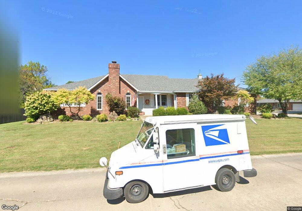
2 Keith Dr Granite City, IL 62040
Estimated Value: $248,499 - $359,000
3
Beds
4
Baths
2,245
Sq Ft
$140/Sq Ft
Est. Value
About This Home
This home is located at 2 Keith Dr, Granite City, IL 62040 and is currently estimated at $314,625, approximately $140 per square foot. 2 Keith Dr is a home located in Madison County with nearby schools including Granite City High School, Metro East Montessori School, and St. Elizabeth Elementary School.
Ownership History
Date
Name
Owned For
Owner Type
Purchase Details
Closed on
Oct 7, 2005
Sold by
Phillips James L and Phillips Freda
Bought by
Burnett Ralph R and Burnett Lynette A
Current Estimated Value
Home Financials for this Owner
Home Financials are based on the most recent Mortgage that was taken out on this home.
Original Mortgage
$157,000
Outstanding Balance
$84,668
Interest Rate
5.88%
Mortgage Type
Fannie Mae Freddie Mac
Estimated Equity
$229,957
Create a Home Valuation Report for This Property
The Home Valuation Report is an in-depth analysis detailing your home's value as well as a comparison with similar homes in the area
Home Values in the Area
Average Home Value in this Area
Purchase History
| Date | Buyer | Sale Price | Title Company |
|---|---|---|---|
| Burnett Ralph R | $197,000 | First American Title Ins Co |
Source: Public Records
Mortgage History
| Date | Status | Borrower | Loan Amount |
|---|---|---|---|
| Open | Burnett Ralph R | $157,000 |
Source: Public Records
Tax History Compared to Growth
Tax History
| Year | Tax Paid | Tax Assessment Tax Assessment Total Assessment is a certain percentage of the fair market value that is determined by local assessors to be the total taxable value of land and additions on the property. | Land | Improvement |
|---|---|---|---|---|
| 2024 | $6,352 | $83,230 | $9,860 | $73,370 |
| 2023 | $6,352 | $75,020 | $8,890 | $66,130 |
| 2022 | $6,246 | $68,740 | $8,150 | $60,590 |
| 2021 | $5,737 | $64,460 | $7,640 | $56,820 |
| 2020 | $5,576 | $61,560 | $7,300 | $54,260 |
| 2019 | $5,381 | $58,350 | $6,920 | $51,430 |
| 2018 | $5,235 | $56,650 | $6,720 | $49,930 |
| 2017 | $5,113 | $58,750 | $6,970 | $51,780 |
| 2016 | $5,234 | $58,750 | $6,970 | $51,780 |
| 2015 | $4,697 | $58,750 | $6,970 | $51,780 |
| 2014 | $4,697 | $58,750 | $6,970 | $51,780 |
| 2013 | $4,697 | $58,750 | $6,970 | $51,780 |
Source: Public Records
Map
Nearby Homes
- 3112 Parkview Dr
- 3019 Mockingbird Ln
- 3000 Mockingbird Ln
- 2932 Mockingbird Ln
- 2639 Mathew Ct
- 2809 Beth Ann Ct
- 3272 Kilarney Dr
- 3713 Justine Dr
- 3601 Cargill Rd
- 2465 St Clair
- 3203 Newell Dr
- 2336 Emert Ave
- 3247 Erin Dr
- 3617 Justine Dr
- 00 Raes Creek Ct
- 2817 Maryville Rd
- 17 Del Rio Ave
- 52 Villa Dr
- 4021 Sara St
- 2912 Ash Ave
- 3109 Mockingbird Ln
- 2625 Westmoreland Dr
- 1 Keith Dr
- 3113 Mockingbird Ln
- 3 Keith Dr
- 3104 Mockingbird Ln
- 3108 Mockingbird Ln
- 2621 Westmoreland Dr
- 3100 Mockingbird Ln
- 3112 Mockingbird Ln
- 3043 Mockingbird Ln
- 3117 Mockingbird Ln
- 2637 Westmoreland Dr
- 7 Mark Ct
- 3116 Mockingbird Ln
- 1 Mark Ct
- 2605 Whipporwill Ln
- 19 Meadowlark Ct
- 3056 Mockingbird Ln
- 2620 Westmoreland Dr