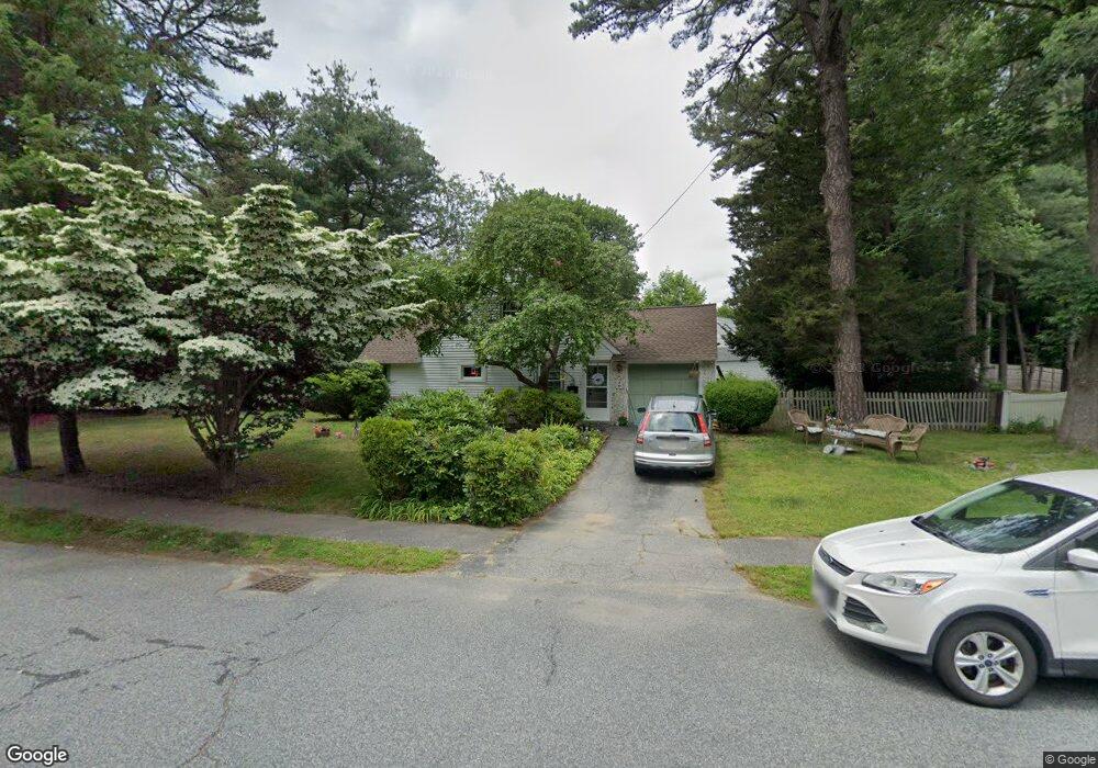
2 Kelsey Rd Natick, MA 01760
Estimated Value: $658,000 - $737,000
3
Beds
2
Baths
1,280
Sq Ft
$543/Sq Ft
Est. Value
About This Home
This home is located at 2 Kelsey Rd, Natick, MA 01760 and is currently estimated at $695,182, approximately $543 per square foot. 2 Kelsey Rd is a home located in Middlesex County with nearby schools including Natick High School, J F Kennedy Middle School, and Brown Elementary School.
Ownership History
Date
Name
Owned For
Owner Type
Purchase Details
Closed on
Feb 28, 1995
Sold by
Hansen Richard O and Hansen Raycliff C
Bought by
Heroux Joseph P and Heroux Christine L
Current Estimated Value
Home Financials for this Owner
Home Financials are based on the most recent Mortgage that was taken out on this home.
Original Mortgage
$145,900
Interest Rate
9.17%
Mortgage Type
Purchase Money Mortgage
Purchase Details
Closed on
Nov 13, 1987
Sold by
Perez Julio
Bought by
Hansen Richard D
Home Financials for this Owner
Home Financials are based on the most recent Mortgage that was taken out on this home.
Original Mortgage
$135,900
Interest Rate
11.13%
Mortgage Type
Purchase Money Mortgage
Create a Home Valuation Report for This Property
The Home Valuation Report is an in-depth analysis detailing your home's value as well as a comparison with similar homes in the area
Home Values in the Area
Average Home Value in this Area
Purchase History
| Date | Buyer | Sale Price | Title Company |
|---|---|---|---|
| Heroux Joseph P | $142,000 | -- | |
| Hansen Richard D | $151,000 | -- |
Source: Public Records
Mortgage History
| Date | Status | Borrower | Loan Amount |
|---|---|---|---|
| Open | Hansen Richard D | $156,778 | |
| Closed | Hansen Richard D | $150,550 | |
| Closed | Hansen Richard D | $145,900 | |
| Previous Owner | Hansen Richard D | $135,900 |
Source: Public Records
Tax History
| Year | Tax Paid | Tax Assessment Tax Assessment Total Assessment is a certain percentage of the fair market value that is determined by local assessors to be the total taxable value of land and additions on the property. | Land | Improvement |
|---|---|---|---|---|
| 2025 | $6,659 | $556,800 | $429,800 | $127,000 |
| 2024 | $6,456 | $526,600 | $404,500 | $122,100 |
| 2023 | $6,408 | $507,000 | $388,900 | $118,100 |
| 2022 | $5,683 | $426,000 | $353,200 | $72,800 |
| 2021 | $5,610 | $412,200 | $333,000 | $79,200 |
| 2020 | $5,595 | $411,100 | $317,900 | $93,200 |
| 2019 | $5,225 | $411,100 | $317,900 | $93,200 |
| 2018 | $5,003 | $383,400 | $302,700 | $80,700 |
| 2017 | $4,638 | $343,800 | $258,400 | $85,400 |
| 2016 | $4,370 | $322,000 | $237,400 | $84,600 |
| 2015 | $4,342 | $314,200 | $237,400 | $76,800 |
Source: Public Records
Map
Nearby Homes
- 21 Kelsey Rd
- 15 Edwards Rd
- 8 Edwards Road Aka 12
- 142 Mill St
- 26 Wellesley Ave Unit B
- 54 Pilgrim Rd
- 79 Speen St
- 4 Curtis Rd
- 46 Silver Hill Ln Unit 1
- 8 Village Way Unit 11
- 3 Oxbow Rd
- 1 Post Oak Ln Unit 19
- 15 Village Way Unit 8
- 57 Village Brook Ln Unit 5
- 10 Nolin St
- 11 Village Rock Ln Unit 21
- 52 Village Brook Ln Unit 14
- 34 Walden Dr Unit 5
- 2 Walden Dr Unit 2
- 30 Walden Dr Unit 7
Your Personal Tour Guide
Ask me questions while you tour the home.