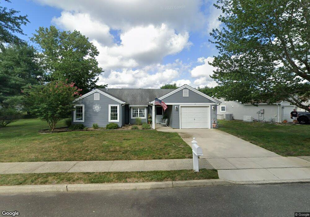
2 Lancaster Ct Forked River, NJ 08731
Estimated Value: $362,000 - $413,000
2
Beds
2
Baths
1,405
Sq Ft
$272/Sq Ft
Est. Value
About This Home
This home is located at 2 Lancaster Ct, Forked River, NJ 08731 and is currently estimated at $382,419, approximately $272 per square foot. 2 Lancaster Ct is a home located in Ocean County with nearby schools including Lacey Township High School.
Ownership History
Date
Name
Owned For
Owner Type
Purchase Details
Closed on
Nov 23, 2016
Sold by
Davis Richard E and Davis Patricia A
Bought by
Mannello Kimberly M
Current Estimated Value
Home Financials for this Owner
Home Financials are based on the most recent Mortgage that was taken out on this home.
Original Mortgage
$148,000
Outstanding Balance
$119,192
Interest Rate
3.52%
Mortgage Type
New Conventional
Estimated Equity
$263,227
Purchase Details
Closed on
Nov 3, 2011
Sold by
Simon Kevin D and Sarcone Gail M
Bought by
Davis Richard E and Davis Patricia A
Home Financials for this Owner
Home Financials are based on the most recent Mortgage that was taken out on this home.
Original Mortgage
$126,650
Interest Rate
3.27%
Mortgage Type
New Conventional
Purchase Details
Closed on
Oct 30, 1997
Sold by
Seagord Grace and Seagord Gary E
Bought by
Simon Herman and Simon Dorothy
Create a Home Valuation Report for This Property
The Home Valuation Report is an in-depth analysis detailing your home's value as well as a comparison with similar homes in the area
Home Values in the Area
Average Home Value in this Area
Purchase History
| Date | Buyer | Sale Price | Title Company |
|---|---|---|---|
| Mannello Kimberly M | $185,000 | -- | |
| Davis Richard E | $149,000 | Fidelity Natl Title Ins Co | |
| Simon Herman | $117,000 | -- |
Source: Public Records
Mortgage History
| Date | Status | Borrower | Loan Amount |
|---|---|---|---|
| Open | Mannello Kimberly M | $148,000 | |
| Previous Owner | Davis Richard E | $126,650 |
Source: Public Records
Tax History
| Year | Tax Paid | Tax Assessment Tax Assessment Total Assessment is a certain percentage of the fair market value that is determined by local assessors to be the total taxable value of land and additions on the property. | Land | Improvement |
|---|---|---|---|---|
| 2025 | $3,831 | $151,200 | $48,000 | $103,200 |
| 2024 | $3,582 | $151,200 | $48,000 | $103,200 |
Source: Public Records
Map
Nearby Homes
- 38 Sheffield Dr
- 4 Kent Ct
- 1440 Leguene Ave
- 0000 Earie Way
- 1988 Brookdale Dr
- 1326 Leguene Ave
- 1660 Joffre Rd
- 1303 Cypress St
- 1223 Sylvania Place
- 1216 Taylor Ln
- 0 Lakeside Dr S Unit 22601319
- 101 Clearwater Dr
- 22 Saltspray Dr
- 102 Maria Loretta Ln
- 1972 Glen Oak Dr
- 9 Hollywood Blvd S
- 321 Letts Ave
- 463 Ensign Rd
- 576 Vaughn Ave
- 123 Oakwood Place
- 3 Lancaster Ct
- 42 Sheffield Dr
- 40 Sheffield Dr
- 44 Sheffield Dr
- 4 Lancaster Ct
- 11 Lancaster Ct
- 12 Lancaster Ct
- 10 Lancaster Ct
- 46 Sheffield Dr
- 9 Lancaster Ct
- 13 Lancaster Ct
- 36 Sheffield Dr
- 5 Lancaster Ct
- 48 Sheffield Dr
- 8 Lancaster Ct
- 53 Sheffield Dr
- 51 Sheffield Dr
- 14 Lancaster Ct
- 55 Sheffield Dr
- 6 Lancaster Ct
Your Personal Tour Guide
Ask me questions while you tour the home.