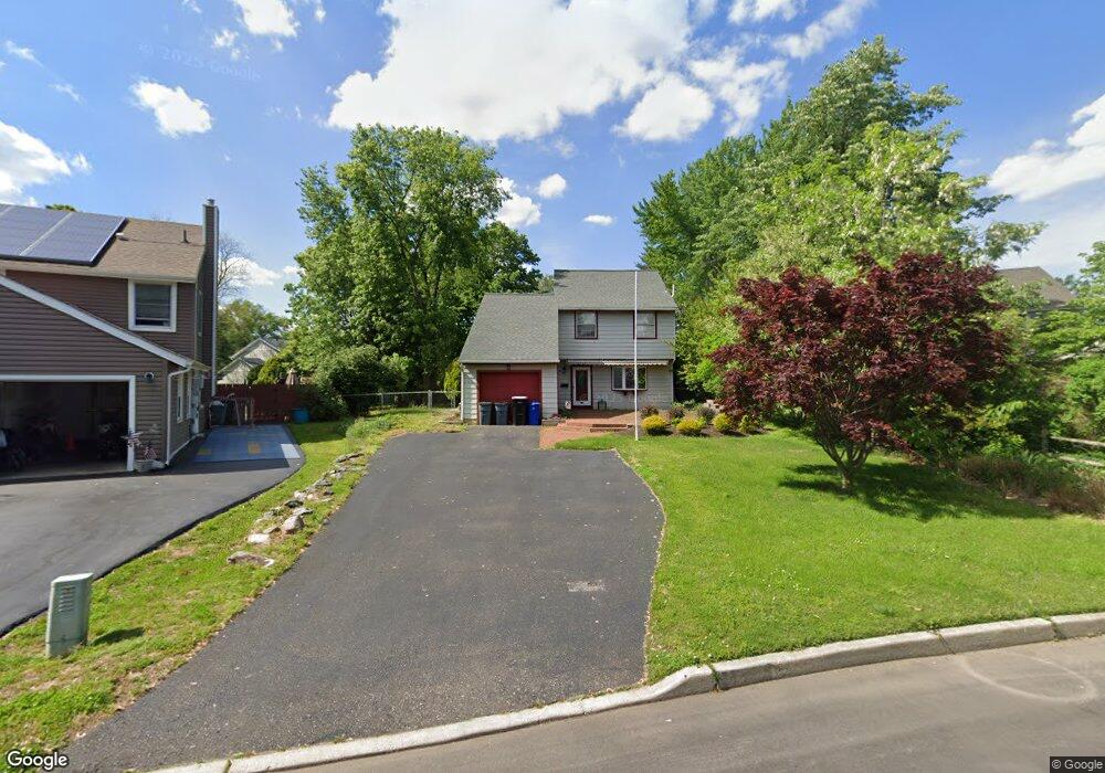
2 Linden Ct Blackwood, NJ 08012
Estimated Value: $320,384 - $447,000
--
Bed
--
Bath
2,063
Sq Ft
$187/Sq Ft
Est. Value
About This Home
This home is located at 2 Linden Ct, Blackwood, NJ 08012 and is currently estimated at $385,346, approximately $186 per square foot. 2 Linden Ct is a home with nearby schools including Glen Landing Middle School, Triton High School, and St. Teresa Regional School.
Ownership History
Date
Name
Owned For
Owner Type
Purchase Details
Closed on
Dec 9, 2016
Sold by
Schwartzburt Perry John and Schwartzburt Jeanette P
Bought by
Raftery Colleen and Raftery Kevin
Current Estimated Value
Home Financials for this Owner
Home Financials are based on the most recent Mortgage that was taken out on this home.
Original Mortgage
$166,920
Outstanding Balance
$135,199
Interest Rate
3.62%
Mortgage Type
FHA
Estimated Equity
$250,147
Purchase Details
Closed on
Jul 15, 1987
Bought by
Schwartzburt Perry J and Schwartzburt Jeanette
Create a Home Valuation Report for This Property
The Home Valuation Report is an in-depth analysis detailing your home's value as well as a comparison with similar homes in the area
Home Values in the Area
Average Home Value in this Area
Purchase History
| Date | Buyer | Sale Price | Title Company |
|---|---|---|---|
| Raftery Colleen | $170,000 | None Available | |
| Schwartzburt Perry J | $93,500 | -- |
Source: Public Records
Mortgage History
| Date | Status | Borrower | Loan Amount |
|---|---|---|---|
| Open | Raftery Colleen | $166,920 |
Source: Public Records
Tax History Compared to Growth
Tax History
| Year | Tax Paid | Tax Assessment Tax Assessment Total Assessment is a certain percentage of the fair market value that is determined by local assessors to be the total taxable value of land and additions on the property. | Land | Improvement |
|---|---|---|---|---|
| 2025 | $8,088 | $188,100 | $57,700 | $130,400 |
| 2024 | $7,846 | $188,100 | $57,700 | $130,400 |
| 2023 | $7,846 | $188,100 | $57,700 | $130,400 |
| 2022 | $7,789 | $188,100 | $57,700 | $130,400 |
| 2021 | $7,597 | $188,100 | $57,700 | $130,400 |
| 2020 | $7,597 | $188,100 | $57,700 | $130,400 |
| 2019 | $7,432 | $188,100 | $57,700 | $130,400 |
| 2018 | $7,402 | $188,100 | $57,700 | $130,400 |
| 2017 | $8,829 | $231,600 | $57,700 | $173,900 |
| 2016 | $8,639 | $231,600 | $57,700 | $173,900 |
| 2015 | $8,030 | $231,600 | $57,700 | $173,900 |
| 2014 | $7,997 | $231,600 | $57,700 | $173,900 |
Source: Public Records
Map
Nearby Homes
- 2 Katherine Ct
- 360 Lower Landing Rd
- 200 W Landing Rd
- 137 Brewer Ave
- 5 Heathrow Ct
- 1643 Charter Oak Ave
- 330 Price Ave
- 239 Woodland Ave
- 32 Lake Ave
- 110 Lake Ave
- 219 Chestnut St
- 104 Lake Ave
- 1432 Boxwood Dr
- 116 Station Ave
- 1280 Hurffville Rd
- 15 Gravers Ln
- 516 Huntington Ave
- 120 1st
- 1284 Hurffville Rd
- 405 Melvin Ave