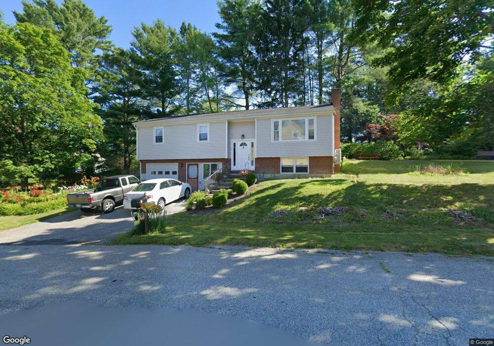
2 Manning Place Lewiston, ME 04240
Estimated Value: $284,000 - $329,000
3
Beds
2
Baths
1,143
Sq Ft
$271/Sq Ft
Est. Value
About This Home
This home is located at 2 Manning Place, Lewiston, ME 04240 and is currently estimated at $310,118, approximately $271 per square foot. 2 Manning Place is a home with nearby schools including Raymond A. Geiger Elementary School, Lewiston Middle School, and Lewiston High School.
Create a Home Valuation Report for This Property
The Home Valuation Report is an in-depth analysis detailing your home's value as well as a comparison with similar homes in the area
Home Values in the Area
Average Home Value in this Area
Tax History
| Year | Tax Paid | Tax Assessment Tax Assessment Total Assessment is a certain percentage of the fair market value that is determined by local assessors to be the total taxable value of land and additions on the property. | Land | Improvement |
|---|---|---|---|---|
| 2025 | $3,367 | $102,700 | $23,280 | $79,420 |
| 2024 | $3,263 | $102,700 | $23,280 | $79,420 |
| 2023 | $3,081 | $102,700 | $23,280 | $79,420 |
| 2022 | $2,927 | $102,700 | $23,280 | $79,420 |
| 2021 | $2,902 | $102,700 | $23,280 | $79,420 |
| 2020 | $2,944 | $102,700 | $23,280 | $79,420 |
| 2019 | $2,968 | $102,660 | $23,280 | $79,380 |
| 2018 | $2,943 | $102,660 | $23,280 | $79,380 |
| 2017 | $2,877 | $102,660 | $23,280 | $79,380 |
| 2016 | $2,827 | $102,660 | $23,280 | $79,380 |
| 2015 | $2,810 | $102,660 | $23,280 | $79,380 |
| 2014 | $2,730 | $102,660 | $23,280 | $79,380 |
| 2013 | $2,714 | $102,660 | $23,280 | $79,380 |
Source: Public Records
Map
Nearby Homes
- 457 College St
- 4 Manning Place
- 3 Manning Place
- 465 College St
- 1 Manning Ave
- 462 College St
- 454 College St
- 6 Manning Place
- 445 College St
- 469 College St
- 5 Manning Place
- 466 College St
- 3 Halstead Terrace
- 450 College St
- 443 College St
- 5 Manning Ave
- 8 Manning Place
- 473 College St
- 470 College St
- 5 Halstead Terrace
Your Personal Tour Guide
Ask me questions while you tour the home.