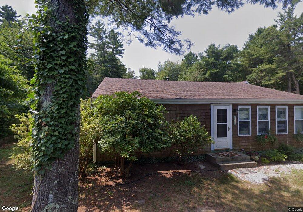
2 Mansfield Ave Marion, MA 02738
Estimated Value: $504,000 - $562,000
3
Beds
1
Bath
1,053
Sq Ft
$508/Sq Ft
Est. Value
About This Home
This home is located at 2 Mansfield Ave, Marion, MA 02738 and is currently estimated at $535,174, approximately $508 per square foot. 2 Mansfield Ave is a home located in Plymouth County with nearby schools including Old Rochester Regional High School and Tabor Academy.
Ownership History
Date
Name
Owned For
Owner Type
Purchase Details
Closed on
Dec 28, 2001
Sold by
Mandly Mark J and Brier Michelle R
Bought by
Brown Rebecca L
Current Estimated Value
Purchase Details
Closed on
Aug 27, 1993
Sold by
Ares Beverlyn
Bought by
Viera Donald P and Viera Michelle R
Create a Home Valuation Report for This Property
The Home Valuation Report is an in-depth analysis detailing your home's value as well as a comparison with similar homes in the area
Home Values in the Area
Average Home Value in this Area
Purchase History
| Date | Buyer | Sale Price | Title Company |
|---|---|---|---|
| Brown Rebecca L | $179,000 | -- | |
| Viera Donald P | $70,000 | -- |
Source: Public Records
Mortgage History
| Date | Status | Borrower | Loan Amount |
|---|---|---|---|
| Open | Viera Donald P | $225,000 | |
| Closed | Viera Donald P | $34,000 | |
| Closed | Viera Donald P | $177,000 |
Source: Public Records
Tax History Compared to Growth
Tax History
| Year | Tax Paid | Tax Assessment Tax Assessment Total Assessment is a certain percentage of the fair market value that is determined by local assessors to be the total taxable value of land and additions on the property. | Land | Improvement |
|---|---|---|---|---|
| 2025 | $4,011 | $430,400 | $180,900 | $249,500 |
| 2024 | $3,907 | $421,900 | $168,900 | $253,000 |
| 2023 | $3,940 | $417,400 | $217,100 | $200,300 |
| 2022 | $3,523 | $324,700 | $148,400 | $176,300 |
| 2021 | $3,319 | $293,200 | $129,900 | $163,300 |
| 2020 | $3,281 | $280,400 | $129,900 | $150,500 |
| 2019 | $3,005 | $272,400 | $129,900 | $142,500 |
| 2018 | $3,015 | $263,300 | $137,700 | $125,600 |
| 2017 | $2,918 | $255,700 | $137,700 | $118,000 |
| 2016 | $2,635 | $233,000 | $112,000 | $121,000 |
| 2015 | $2,419 | $217,700 | $112,000 | $105,700 |
Source: Public Records
Map
Nearby Homes
- 131 Dexter Rd
- 00 Delano Rd
- 7 Seahorse Way
- Lot 77E Seahorse
- Lot 77D Seahorse
- 0 Cross Neck Rd Unit 73420524
- 0 Cross Neck Rd Unit 73420525
- 11 Joanne Dr
- 4 Rebecca Dr
- 0 Cromesett Rd (Off) Unit 73385395
- 25 Hammetts Cove Rd
- 26 Washington Dr
- 929 Point Rd
- 174 Wareham Rd
- 12 Taft St
- 58 Delano Rd
- 58 Shady Ln
- 0 Delano Rd
- 4 Blackhall Ct
- 245 Wareham Rd