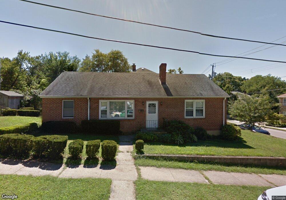
2 Maple St Sleepy Hollow, NY 10591
Estimated Value: $690,000 - $779,000
3
Beds
1
Bath
1,200
Sq Ft
$596/Sq Ft
Est. Value
About This Home
This home is located at 2 Maple St, Sleepy Hollow, NY 10591 and is currently estimated at $715,547, approximately $596 per square foot. 2 Maple St is a home located in Westchester County with nearby schools including John Paulding School, W L Morse School, and Washington Irving Interm School.
Ownership History
Date
Name
Owned For
Owner Type
Purchase Details
Closed on
Jan 11, 2018
Sold by
Barboza Ii Stephen J and Barboza Jewel
Bought by
Schmidt Heather A and Trujillo Anthony D
Current Estimated Value
Home Financials for this Owner
Home Financials are based on the most recent Mortgage that was taken out on this home.
Original Mortgage
$431,521
Outstanding Balance
$363,499
Interest Rate
3.87%
Mortgage Type
FHA
Estimated Equity
$352,048
Purchase Details
Closed on
Jul 24, 2002
Sold by
Gross Fred and Gross Richard
Bought by
Gross Eve
Create a Home Valuation Report for This Property
The Home Valuation Report is an in-depth analysis detailing your home's value as well as a comparison with similar homes in the area
Home Values in the Area
Average Home Value in this Area
Purchase History
| Date | Buyer | Sale Price | Title Company |
|---|---|---|---|
| Schmidt Heather A | $439,500 | Advantage Title Agency | |
| Gross Eve | -- | The Judicial Title Ins Agenc |
Source: Public Records
Mortgage History
| Date | Status | Borrower | Loan Amount |
|---|---|---|---|
| Open | Schmidt Heather A | $431,521 |
Source: Public Records
Tax History Compared to Growth
Tax History
| Year | Tax Paid | Tax Assessment Tax Assessment Total Assessment is a certain percentage of the fair market value that is determined by local assessors to be the total taxable value of land and additions on the property. | Land | Improvement |
|---|---|---|---|---|
| 2024 | $18,187 | $80,000 | $43,900 | $36,100 |
| 2023 | $16,895 | $80,000 | $43,900 | $36,100 |
| 2022 | $14,258 | $80,000 | $43,900 | $36,100 |
| 2021 | $14,012 | $80,000 | $43,900 | $36,100 |
| 2020 | $13,780 | $80,000 | $43,900 | $36,100 |
| 2019 | $1,901 | $80,000 | $43,900 | $36,100 |
| 2018 | $13,287 | $80,000 | $43,900 | $36,100 |
| 2017 | $0 | $80,000 | $43,900 | $36,100 |
| 2016 | $13,213 | $80,000 | $43,900 | $36,100 |
| 2015 | -- | $5,900 | $650 | $5,250 |
| 2014 | -- | $5,900 | $650 | $5,250 |
| 2013 | -- | $5,900 | $650 | $5,250 |
Source: Public Records
Map
Nearby Homes
- 37 Devries Ave
- 57 Cobb Ln
- 46 Andrews Ln
- 34 Andrews Ln
- 42 Andrews Ln
- 4 Lighthouse Landing Unit 318
- 4 Lighthouse Landing Unit 208
- 4 Lighthouse Landing Unit 224
- 4 Lighthouse Landing Unit 301
- 4 Lighthouse Landing Unit PH518
- 4 Lighthouse Landing Unit PH515
- 4 Lighthouse Landing Unit PH520
- 4 Lighthouse Landing Unit PH519
- 4 Lighthouse Landing Unit 209
- 4 Lighthouse Landing Unit 203
- 4 Lighthouse Landing Unit TH02
- 4 Lighthouse Landing Unit 421
- 4 Lighthouse Landing Unit 414
- 4 Lighthouse Landing Unit 319
- 4 Lighthouse Landing Unit 312