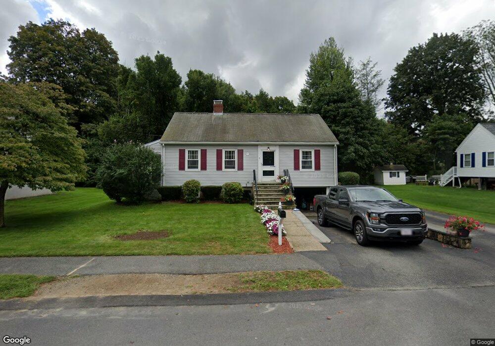
2 Marston Rd East Walpole, MA 02032
Estimated Value: $659,815 - $799,000
3
Beds
1
Bath
1,615
Sq Ft
$434/Sq Ft
Est. Value
About This Home
This home is located at 2 Marston Rd, East Walpole, MA 02032 and is currently estimated at $701,704, approximately $434 per square foot. 2 Marston Rd is a home located in Norfolk County with nearby schools including Old Post Road School, Walpole Middle School, and Walpole High School.
Ownership History
Date
Name
Owned For
Owner Type
Purchase Details
Closed on
May 30, 1991
Sold by
Nichols Elisabeth E
Bought by
Dunne John L
Current Estimated Value
Purchase Details
Closed on
Mar 30, 1990
Sold by
Silvestro Domenic
Bought by
Mariono Alfred C
Create a Home Valuation Report for This Property
The Home Valuation Report is an in-depth analysis detailing your home's value as well as a comparison with similar homes in the area
Home Values in the Area
Average Home Value in this Area
Purchase History
| Date | Buyer | Sale Price | Title Company |
|---|---|---|---|
| Dunne John L | $132,000 | -- | |
| Mariono Alfred C | $147,500 | -- |
Source: Public Records
Mortgage History
| Date | Status | Borrower | Loan Amount |
|---|---|---|---|
| Open | Mariono Alfred C | $205,000 | |
| Closed | Mariono Alfred C | $144,000 | |
| Closed | Mariono Alfred C | $116,500 |
Source: Public Records
Tax History Compared to Growth
Tax History
| Year | Tax Paid | Tax Assessment Tax Assessment Total Assessment is a certain percentage of the fair market value that is determined by local assessors to be the total taxable value of land and additions on the property. | Land | Improvement |
|---|---|---|---|---|
| 2025 | $7,556 | $588,900 | $326,300 | $262,600 |
| 2024 | $7,340 | $555,200 | $313,700 | $241,500 |
| 2023 | $7,121 | $512,700 | $272,800 | $239,900 |
| 2022 | $6,735 | $465,800 | $252,600 | $213,200 |
| 2021 | $6,350 | $427,900 | $238,300 | $189,600 |
| 2020 | $6,287 | $419,400 | $224,800 | $194,600 |
| 2019 | $6,069 | $401,900 | $216,200 | $185,700 |
| 2018 | $5,664 | $370,900 | $207,700 | $163,200 |
| 2017 | $5,473 | $357,000 | $199,700 | $157,300 |
| 2016 | $5,195 | $333,900 | $191,800 | $142,100 |
| 2015 | $4,883 | $311,000 | $174,300 | $136,700 |
| 2014 | $4,711 | $298,900 | $174,300 | $124,600 |
Source: Public Records
Map
Nearby Homes
- 0 Charlotte Rd
- Unit 11 Powder House Ln Unit 11
- 8 Powder House Ln Unit 2
- Unit 12 Powder House Ln Unit 12
- Unit 3 Powder House Ln Unit 3
- 11 Park Ln
- 7 Washington Green
- 363 - 367 Washington St
- 34 Austin St Unit 1L
- 5 Atwood Ave
- 22 Coolidge Rd
- 486 Washington St
- 70 Endicott St Unit 404
- 70 Endicott St Unit 1306
- 270 Moosehill Rd
- 531 Walpole St
- 1086 Washington St
- 83 Dean St
- 130 Dean St
- 38 Cape Club Dr Unit 38
- 4 Marston Rd
- 60 Pleasant St
- 48 Pleasant St
- 68 Pleasant St Unit C
- 68 Pleasant St Unit B
- 68 Pleasant St Unit A
- 7 Marston Rd
- 6 Marston Rd
- 9 Marston Rd
- 42 Pleasant St
- 11 Charlotte Rd
- 8 Marston Rd
- 19 Charlotte Rd
- 11 Calvert Rd
- 154 Union St
- 57 Pleasant St
- 72 Pleasant St
- 67 Pleasant St
- 67 Pleasant St
- 67 Pleasant St Unit studio