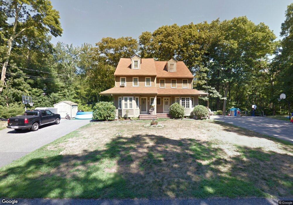
2 Maryalice Way Mansfield, MA 02048
Estimated Value: $468,157 - $586,000
3
Beds
2
Baths
1,776
Sq Ft
$289/Sq Ft
Est. Value
About This Home
This home is located at 2 Maryalice Way, Mansfield, MA 02048 and is currently estimated at $513,039, approximately $288 per square foot. 2 Maryalice Way is a home located in Bristol County with nearby schools including Everett W. Robinson Elementary School, Jordan/Jackson Elementary School, and Harold L. Qualters Middle School.
Ownership History
Date
Name
Owned For
Owner Type
Purchase Details
Closed on
Aug 14, 2007
Sold by
Salerno Cathy A and Kennedy Cathy A
Bought by
Gingras Pamela J
Current Estimated Value
Home Financials for this Owner
Home Financials are based on the most recent Mortgage that was taken out on this home.
Original Mortgage
$100,000
Interest Rate
6.72%
Mortgage Type
Purchase Money Mortgage
Purchase Details
Closed on
May 1, 1989
Sold by
Mcclanahan M A
Bought by
Kennedy Steven
Create a Home Valuation Report for This Property
The Home Valuation Report is an in-depth analysis detailing your home's value as well as a comparison with similar homes in the area
Home Values in the Area
Average Home Value in this Area
Purchase History
| Date | Buyer | Sale Price | Title Company |
|---|---|---|---|
| Gingras Pamela J | $300,000 | -- | |
| Kennedy Steven | $135,900 | -- |
Source: Public Records
Mortgage History
| Date | Status | Borrower | Loan Amount |
|---|---|---|---|
| Open | Kennedy Steven | $110,000 | |
| Closed | Gingras Pamela J | $100,000 | |
| Previous Owner | Kennedy Steven | $113,800 | |
| Previous Owner | Kennedy Steven | $112,500 | |
| Previous Owner | Kennedy Steven | $13,204 |
Source: Public Records
Tax History
| Year | Tax Paid | Tax Assessment Tax Assessment Total Assessment is a certain percentage of the fair market value that is determined by local assessors to be the total taxable value of land and additions on the property. | Land | Improvement |
|---|---|---|---|---|
| 2025 | $6,119 | $464,600 | $0 | $464,600 |
| 2024 | $5,616 | $416,000 | $0 | $416,000 |
| 2023 | $5,342 | $379,100 | $0 | $379,100 |
| 2022 | $5,329 | $351,300 | $0 | $351,300 |
| 2021 | $5,083 | $330,900 | $0 | $330,900 |
| 2020 | $4,848 | $315,600 | $0 | $315,600 |
| 2019 | $4,803 | $315,600 | $0 | $315,600 |
| 2018 | $4,564 | $293,100 | $0 | $293,100 |
| 2017 | $4,402 | $293,100 | $0 | $293,100 |
| 2016 | $4,061 | $263,500 | $0 | $263,500 |
| 2015 | $3,784 | $244,100 | $0 | $244,100 |
Source: Public Records
Map
Nearby Homes
- 166 Chauncy St
- 25 Kingman Ave
- 150 Rumford Ave Unit 110
- 22 Pleasant St Unit B
- 266 N Main St Unit 3
- 619 N Main St
- 356 Central St
- 28 Court St
- 122 Samoset Ave
- 44 Fairfield Park Unit 44
- 46 Hope St
- 97 East St
- 1769 West St
- 233 Central St
- 631 East St Unit L101
- 157 Central St
- 7 Fieldstone Dr
- 1 Deer Path Ln
- 261 East St
- 155 South St
- 4 Maryalice Way
- 87 Highland Ave Unit 3
- 87-89 Highland Ave
- 99 Highland Ave
- 3 Maryalice Way
- 81 Highland Ave
- 103 Highland Ave
- 88 Highland Ave
- 77 Draper Ave
- 96 Highland Ave
- 136 Highland Ave
- 100 Highland Ave
- 82 Highland Ave
- 69 Highland Ave
- 73 Draper Ave Unit 75
- 18 Howe St
- 22 Howe St
- 104 Highland Ave
- 135 Highland Ave
- 132 Highland Ave
Your Personal Tour Guide
Ask me questions while you tour the home.