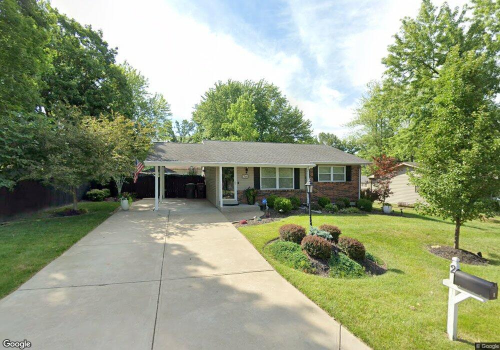
2 Mayfield Rd Saint Peters, MO 63376
Estimated Value: $236,691 - $280,000
2
Beds
1
Bath
960
Sq Ft
$273/Sq Ft
Est. Value
About This Home
This home is located at 2 Mayfield Rd, Saint Peters, MO 63376 and is currently estimated at $262,173, approximately $273 per square foot. 2 Mayfield Rd is a home located in St. Charles County with nearby schools including Lewis & Clark Elementary School, Dr. Bernard J. Dubray Middle School, and Fort Zumwalt East High School.
Ownership History
Date
Name
Owned For
Owner Type
Purchase Details
Closed on
Apr 24, 2017
Sold by
Bechtold David J and Bechtold Julie A
Bought by
Julie A Bechtold Revocable Trust
Current Estimated Value
Purchase Details
Closed on
Aug 18, 2000
Sold by
Krumm Julie A and Krumm David J
Bought by
Bechtold David J and Bechtold Julie A
Home Financials for this Owner
Home Financials are based on the most recent Mortgage that was taken out on this home.
Original Mortgage
$71,250
Interest Rate
8.15%
Create a Home Valuation Report for This Property
The Home Valuation Report is an in-depth analysis detailing your home's value as well as a comparison with similar homes in the area
Home Values in the Area
Average Home Value in this Area
Purchase History
| Date | Buyer | Sale Price | Title Company |
|---|---|---|---|
| Julie A Bechtold Revocable Trust | -- | None Available | |
| Bechtold David J | -- | -- |
Source: Public Records
Mortgage History
| Date | Status | Borrower | Loan Amount |
|---|---|---|---|
| Closed | Bechtold David J | $71,250 |
Source: Public Records
Tax History Compared to Growth
Tax History
| Year | Tax Paid | Tax Assessment Tax Assessment Total Assessment is a certain percentage of the fair market value that is determined by local assessors to be the total taxable value of land and additions on the property. | Land | Improvement |
|---|---|---|---|---|
| 2025 | $2,662 | $41,336 | -- | -- |
| 2023 | $2,660 | $37,158 | $0 | $0 |
| 2022 | $2,154 | $28,121 | $0 | $0 |
| 2021 | $2,151 | $28,121 | $0 | $0 |
| 2020 | $2,044 | $25,878 | $0 | $0 |
| 2019 | $2,039 | $25,878 | $0 | $0 |
| 2018 | $1,897 | $23,112 | $0 | $0 |
| 2017 | $1,888 | $23,112 | $0 | $0 |
| 2016 | $1,790 | $21,854 | $0 | $0 |
| 2015 | $1,677 | $21,854 | $0 | $0 |
| 2014 | $1,556 | $19,846 | $0 | $0 |
Source: Public Records
Map
Nearby Homes
- 138 Rhythm Point Dr
- 763 Estes Park Dr
- 525 Ryehill Dr
- 1 Brookmont @ Ryehill Manor
- 809 Estes Park Dr
- 50 Oak Hill Ln
- 622 Settlers Cir
- 568 Prairie Home Dr
- Winslow Plan at Ryehill Manor
- Carver Plan at Ryehill Manor
- Stratton Plan at Ryehill Manor
- Lansford Plan at Ryehill Manor
- Brookmont Plan at Ryehill Manor
- Parker Plan at Ryehill Manor
- Waverly Plan at Ryehill Manor
- Whitehall Plan at Ryehill Manor
- 528 Selene St
- 7418 Mexico Rd #100 Rd
- 59 Savannah Hill Dr
- 406 S Church St Unit 128
- 4 Mayfield Rd
- 39 Countryside Dr
- 37 Countryside Dr
- 35 Countryside Dr
- 6 Mayfield Rd
- 3 Mayfield Rd
- 1 Mayfield Rd
- 43 Countryside Dr
- 5 Mayfield Rd
- 33 Countryside Dr
- 7 Mayfield Rd
- 38 Countryside Dr
- 40 Countryside Dr
- 45 Countryside Dr
- 36 Countryside Dr
- 31 Countryside Dr
- 2 Yellowstone Ct
- 42 Countryside Dr
- 34 Countryside Dr
- 1 Yellowstone Ct