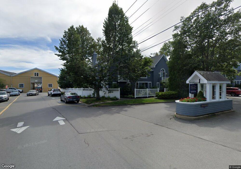
2 McFarland Point Dr Unit 16 Boothbay Harbor, ME 04538
Estimated Value: $864,985 - $998,000
2
Beds
1
Bath
2,360
Sq Ft
$395/Sq Ft
Est. Value
About This Home
This home is located at 2 McFarland Point Dr Unit 16, Boothbay Harbor, ME 04538 and is currently estimated at $931,996, approximately $394 per square foot. 2 McFarland Point Dr Unit 16 is a home located in Lincoln County with nearby schools including Boothbay Region Elementary School and Boothbay Region High School.
Ownership History
Date
Name
Owned For
Owner Type
Purchase Details
Closed on
Apr 11, 2019
Sold by
Kilgore Margarete R and Kilgore Roger V
Bought by
Kilgore Roger V and Kilgore Margarete R
Current Estimated Value
Purchase Details
Closed on
Mar 28, 2019
Sold by
Roger V Kilgore Lt
Bought by
Kilgore Roger V and Kilgore Margarete R
Purchase Details
Closed on
Jul 15, 2014
Sold by
Bailey Mary A
Bought by
Roger V Kilgore Lt and Kilgore Roger V
Create a Home Valuation Report for This Property
The Home Valuation Report is an in-depth analysis detailing your home's value as well as a comparison with similar homes in the area
Home Values in the Area
Average Home Value in this Area
Purchase History
| Date | Buyer | Sale Price | Title Company |
|---|---|---|---|
| Kilgore Roger V | -- | -- | |
| Kilgore Roger V | -- | -- | |
| Roger V Kilgore Lt | -- | -- |
Source: Public Records
Tax History Compared to Growth
Tax History
| Year | Tax Paid | Tax Assessment Tax Assessment Total Assessment is a certain percentage of the fair market value that is determined by local assessors to be the total taxable value of land and additions on the property. | Land | Improvement |
|---|---|---|---|---|
| 2024 | $4,757 | $503,400 | $200,000 | $303,400 |
| 2023 | $4,505 | $503,400 | $200,000 | $303,400 |
| 2022 | $4,203 | $503,400 | $200,000 | $303,400 |
| 2019 | $4,149 | $347,200 | $200,000 | $147,200 |
| 2018 | $4,028 | $347,200 | $200,000 | $147,200 |
| 2017 | $3,958 | $347,200 | $200,000 | $147,200 |
| 2016 | $3,889 | $347,200 | $200,000 | $147,200 |
| 2014 | $3,784 | $347,200 | $200,000 | $147,200 |
| 2013 | -- | $347,200 | $200,000 | $147,200 |
Source: Public Records
Map
Nearby Homes
- 26 Sea St
- 12 Sea St
- 53 Commercial St
- 27 Townsend Ave
- 34 Townsend Ave
- 37 Townsend Ave
- 66 Townsend Avenue & 43 Oak St
- 43 Oak St
- 66 Townsend Ave
- 31 Bay St
- 58 Roads End Rd
- 74 & 76 Bay St
- 1 Cedar Ln Unit 1
- 3 Cedar Ln Unit 3
- 17 Cedar Ln Unit 17
- 302 Townsend Ave
- 127 Appalachee Rd
- 978 Wiscasset Rd
- 14 Pinkie Ln
- 5 Massachusetts Ave
- 2 McFarland Point Dr Unit 36
- 2 McFarland Point Dr Unit 34
- 2 McFarland Point Dr Unit 32
- 2 McFarland Point Dr Unit 31
- 2 McFarland Point Dr Unit 30
- 2 McFarland Point Dr Unit 29
- 2 McFarland Point Dr Unit 28
- 2 McFarland Point Dr Unit 25
- 2 McFarland Point Dr Unit 24
- 2 McFarland Point Dr Unit 23
- 2 McFarland Point Dr Unit 22
- 2 McFarland Point Dr Unit 21
- 2 McFarland Point Dr Unit 17
- 2 McFarland Point Dr Unit 15
- 2 McFarland Point Dr Unit 14
- 2 McFarland Point Dr Unit 13
- 2 McFarland Point Dr Unit 12
- 2 McFarland Point Dr Unit 11
- 2 McFarland Point Dr Unit 10
- 2 McFarland Point Dr Unit 8