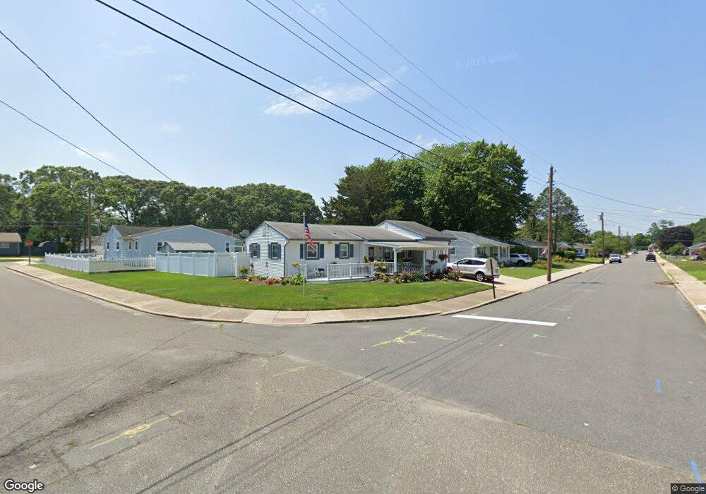
2 Merion Dr Somers Point, NJ 08244
Estimated Value: $353,000 - $397,770
3
Beds
2
Baths
1,166
Sq Ft
$323/Sq Ft
Est. Value
About This Home
This home is located at 2 Merion Dr, Somers Point, NJ 08244 and is currently estimated at $376,943, approximately $323 per square foot. 2 Merion Dr is a home located in Atlantic County with nearby schools including Mainland Regional High School, ChARTer TECH High School for the Performing Arts, and Saint Joseph Regional School.
Ownership History
Date
Name
Owned For
Owner Type
Purchase Details
Closed on
Sep 9, 2005
Sold by
Mcandrew Robert
Bought by
Phillips David and Phillips Madelyn
Current Estimated Value
Home Financials for this Owner
Home Financials are based on the most recent Mortgage that was taken out on this home.
Original Mortgage
$117,740
Outstanding Balance
$61,390
Interest Rate
5.84%
Mortgage Type
Purchase Money Mortgage
Estimated Equity
$315,553
Purchase Details
Closed on
Jan 29, 1993
Sold by
Mcandrew Jeanette
Bought by
Mcandrew Jeanette and Mcandrew Robert T
Purchase Details
Closed on
Oct 23, 1989
Sold by
Schwindt Marilyn and Schwindt Mullins,Rubye P
Bought by
Mcandrew Jeanette
Create a Home Valuation Report for This Property
The Home Valuation Report is an in-depth analysis detailing your home's value as well as a comparison with similar homes in the area
Home Values in the Area
Average Home Value in this Area
Purchase History
| Date | Buyer | Sale Price | Title Company |
|---|---|---|---|
| Phillips David | $145,000 | -- | |
| Mcandrew Jeanette | -- | -- | |
| Mcandrew Jeanette | $97,000 | -- |
Source: Public Records
Mortgage History
| Date | Status | Borrower | Loan Amount |
|---|---|---|---|
| Open | Phillips David | $117,740 |
Source: Public Records
Tax History
| Year | Tax Paid | Tax Assessment Tax Assessment Total Assessment is a certain percentage of the fair market value that is determined by local assessors to be the total taxable value of land and additions on the property. | Land | Improvement |
|---|---|---|---|---|
| 2025 | $6,372 | $178,200 | $67,700 | $110,500 |
| 2024 | $6,372 | $178,200 | $67,700 | $110,500 |
| 2023 | $5,954 | $178,200 | $67,700 | $110,500 |
| 2022 | $5,954 | $178,200 | $67,700 | $110,500 |
| 2021 | $5,865 | $178,200 | $67,700 | $110,500 |
| 2020 | $5,745 | $178,200 | $67,700 | $110,500 |
| 2019 | $5,489 | $175,200 | $67,700 | $107,500 |
| 2018 | $5,450 | $177,700 | $67,700 | $110,000 |
| 2017 | $5,255 | $177,700 | $67,700 | $110,000 |
| 2016 | $5,016 | $177,700 | $67,700 | $110,000 |
| 2015 | $4,965 | $177,700 | $67,700 | $110,000 |
| 2014 | $4,798 | $177,700 | $67,700 | $110,000 |
Source: Public Records
Map
Nearby Homes
- 12 Colwick Dr
- 120 Jordan Rd
- 100 Colwick Dr
- 901 W New York Ave
- 608 9th St
- 7 Nassau Rd
- 604 9th St
- 710 W New York Ave
- 13 Gulph Mill Rd
- 515 9th St
- 101 Haddon Rd
- 906 New Rd
- 715 Massachusetts Ave
- 657 5th St
- Bethany Plan at Greate Bay - The Links at Greate Bay Villas
- 705 Jesse Dr Unit 705
- 2503 Jesse Dr Unit 2503
- 426 7th St
- Cadence Plan at Greate Bay - The Links at Greate Bay Towns
- Aria Plan at Greate Bay - The Links at Greate Bay Towns
Your Personal Tour Guide
Ask me questions while you tour the home.