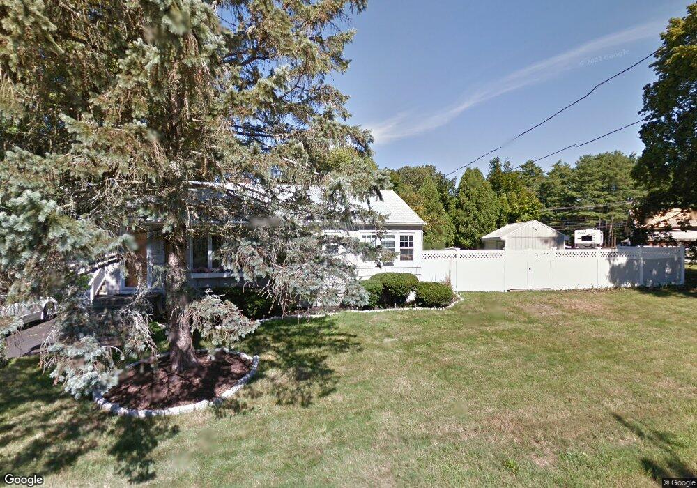
2 Middle Rd Amesbury, MA 01913
Estimated Value: $503,000 - $586,000
2
Beds
1
Bath
1,000
Sq Ft
$544/Sq Ft
Est. Value
About This Home
This home is located at 2 Middle Rd, Amesbury, MA 01913 and is currently estimated at $543,565, approximately $543 per square foot. 2 Middle Rd is a home located in Essex County with nearby schools including Amesbury High School and Amesbury Seventh-Day Adventist School.
Ownership History
Date
Name
Owned For
Owner Type
Purchase Details
Closed on
Dec 2, 2016
Sold by
Doyle John F and Doyle Milagros T
Bought by
Doyle John F
Current Estimated Value
Home Financials for this Owner
Home Financials are based on the most recent Mortgage that was taken out on this home.
Original Mortgage
$242,300
Outstanding Balance
$198,865
Interest Rate
3.52%
Mortgage Type
New Conventional
Estimated Equity
$344,700
Purchase Details
Closed on
May 23, 2007
Sold by
Moore Lindsay M and Pappas Lindsay M
Bought by
Doyle John F and Doyle Milagros T
Home Financials for this Owner
Home Financials are based on the most recent Mortgage that was taken out on this home.
Original Mortgage
$291,000
Interest Rate
6.27%
Mortgage Type
Purchase Money Mortgage
Create a Home Valuation Report for This Property
The Home Valuation Report is an in-depth analysis detailing your home's value as well as a comparison with similar homes in the area
Home Values in the Area
Average Home Value in this Area
Purchase History
| Date | Buyer | Sale Price | Title Company |
|---|---|---|---|
| Doyle John F | -- | -- | |
| Doyle John F | $291,000 | -- |
Source: Public Records
Mortgage History
| Date | Status | Borrower | Loan Amount |
|---|---|---|---|
| Open | Doyle John F | $242,300 | |
| Previous Owner | Moore Lindsay M | $291,000 | |
| Previous Owner | Moore Lindsay M | $210,000 | |
| Previous Owner | Moore Lindsay M | $11,000 | |
| Previous Owner | Moore Lindsay M | $180,000 |
Source: Public Records
Tax History
| Year | Tax Paid | Tax Assessment Tax Assessment Total Assessment is a certain percentage of the fair market value that is determined by local assessors to be the total taxable value of land and additions on the property. | Land | Improvement |
|---|---|---|---|---|
| 2025 | $6,585 | $430,400 | $208,000 | $222,400 |
| 2024 | $6,218 | $397,600 | $196,200 | $201,400 |
| 2023 | $6,078 | $372,000 | $170,600 | $201,400 |
| 2022 | $5,880 | $332,400 | $148,300 | $184,100 |
| 2021 | $5,289 | $289,800 | $114,500 | $175,300 |
| 2020 | $4,742 | $276,000 | $110,200 | $165,800 |
| 2019 | $4,695 | $255,600 | $110,200 | $145,400 |
| 2018 | $4,820 | $253,800 | $105,000 | $148,800 |
| 2017 | $4,521 | $226,600 | $105,000 | $121,600 |
| 2016 | $4,451 | $219,500 | $105,000 | $114,500 |
| 2015 | $4,318 | $210,200 | $105,000 | $105,200 |
| 2014 | $3,942 | $188,000 | $105,000 | $83,000 |
Source: Public Records
Map
Nearby Homes
- 7 Hoyt Ave
- 4 Spindle Tree Ln
- 47 Cutter Ln Unit 47
- 19 Cutter Ln Unit 19
- 1 Hillside Ave Unit 3
- 21 Pond Hill Rd
- 253 Main St
- 4 Greenwood St
- 60 Merrimac St Unit 504
- 26 Bartlett's Reach Unit 26
- 24 1st St
- 14 2nd St
- 21 River St
- 382 Main St
- 48 Orchard St
- 3 Tremont Ave Unit A
- 4 Clark St
- 97 Elm St
- 102R Kimball Rd
- 25 Cedar St Unit 4
- 4 N Hunt Road Extension
- 72a Haverhill Rd
- 72 Haverhill Rd
- 5 Middle Rd
- 6 Middle Rd
- 74 Haverhill Rd
- 1 Middle Rd
- 8 Middle Rd
- 76 Haverhill Rd
- 7 Middle Rd
- 70 Haverhill Rd
- 5 N Hunt Rd
- 10 Middle Rd
- 2 N Hunt Rd
- 78 Haverhill Rd
- 68 Haverhill Rd
- 68 Haverhill Rd Unit 1st Floor
- 80 Haverhill Rd
- 3 N Hunt Rd
- 3 N Hunt Rd
Your Personal Tour Guide
Ask me questions while you tour the home.