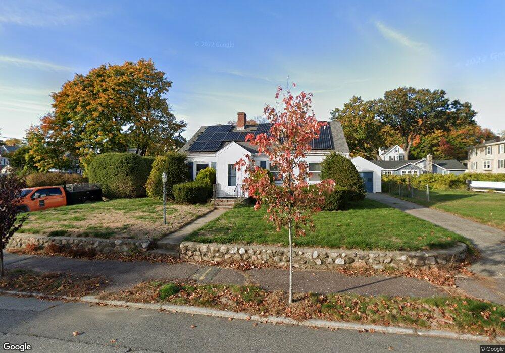
2 Minot St Wakefield, MA 01880
Greenwood NeighborhoodEstimated Value: $666,000 - $831,000
2
Beds
3
Baths
1,814
Sq Ft
$418/Sq Ft
Est. Value
About This Home
This home is located at 2 Minot St, Wakefield, MA 01880 and is currently estimated at $758,040, approximately $417 per square foot. 2 Minot St is a home located in Middlesex County with nearby schools including Wakefield Memorial High School, Melrose Montessori School, and St Mary's School.
Ownership History
Date
Name
Owned For
Owner Type
Purchase Details
Closed on
Dec 16, 2024
Sold by
Mancuso Richard A
Bought by
Richard A Mancuso Ft and Mancuso
Current Estimated Value
Purchase Details
Closed on
Oct 28, 2013
Sold by
Mancuso Evelyn D
Bought by
Mancuso Evelyn D and Mancuso Richard A
Purchase Details
Closed on
Mar 20, 1970
Bought by
Mancuso Evelyn D and Mancuso Richard
Create a Home Valuation Report for This Property
The Home Valuation Report is an in-depth analysis detailing your home's value as well as a comparison with similar homes in the area
Home Values in the Area
Average Home Value in this Area
Purchase History
| Date | Buyer | Sale Price | Title Company |
|---|---|---|---|
| Richard A Mancuso Ft | -- | None Available | |
| Richard A Mancuso Ft | -- | None Available | |
| Mancuso Evelyn D | -- | -- | |
| Mancuso Evelyn D | -- | -- | |
| Mancuso Evelyn D | -- | -- |
Source: Public Records
Tax History Compared to Growth
Tax History
| Year | Tax Paid | Tax Assessment Tax Assessment Total Assessment is a certain percentage of the fair market value that is determined by local assessors to be the total taxable value of land and additions on the property. | Land | Improvement |
|---|---|---|---|---|
| 2025 | $7,682 | $676,800 | $403,600 | $273,200 |
| 2024 | $7,086 | $629,900 | $375,400 | $254,500 |
| 2023 | $6,901 | $588,300 | $350,400 | $237,900 |
| 2022 | $6,479 | $525,900 | $312,900 | $213,000 |
| 2021 | $6,285 | $493,700 | $286,000 | $207,700 |
| 2020 | $5,911 | $462,900 | $268,200 | $194,700 |
| 2019 | $5,544 | $432,100 | $250,300 | $181,800 |
| 2018 | $5,346 | $412,800 | $239,100 | $173,700 |
| 2017 | $5,027 | $385,800 | $223,500 | $162,300 |
| 2016 | $5,311 | $393,700 | $220,600 | $173,100 |
| 2015 | $4,963 | $368,200 | $206,200 | $162,000 |
| 2014 | $4,592 | $359,300 | $201,100 | $158,200 |
Source: Public Records
Map
Nearby Homes
- 24 Myrtle Ave
- 22 Mount Zion Rd
- 95 Greenwood Ave
- 2 Overlook Rd
- 3 Hickory Hill Rd Unit 1
- 15 Shore Rd
- 18 Crosby Rd
- 27 Pratt St
- 1 Ludlow Ave
- 119 W Highland Ave Unit 1
- 81 Spring St
- 6 Castle Clare Cir
- 9 Lovis Ave
- 61 Forest St
- 12 Lovis Ave
- 19 Fellsmere Ave
- 6 Lovis Ave
- 24 Ellsworth Ave
- 569 Franklin St Unit 1
- 569 Franklin St Unit 3