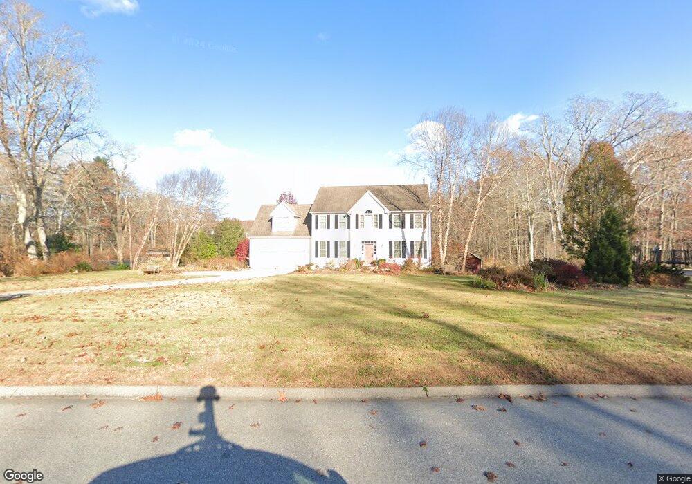
2 Miranda Way East Lyme, CT 06333
Estimated Value: $770,000 - $787,382
4
Beds
3
Baths
3,032
Sq Ft
$257/Sq Ft
Est. Value
About This Home
This home is located at 2 Miranda Way, East Lyme, CT 06333 and is currently estimated at $779,846, approximately $257 per square foot. 2 Miranda Way is a home located in New London County with nearby schools including East Lyme Middle School, East Lyme High School, and Carelot Children's Center - East Lyme.
Ownership History
Date
Name
Owned For
Owner Type
Purchase Details
Closed on
Jun 14, 2007
Sold by
Black Point Constr Co
Bought by
Addison David and Addison Katherine
Current Estimated Value
Home Financials for this Owner
Home Financials are based on the most recent Mortgage that was taken out on this home.
Original Mortgage
$60,000
Interest Rate
6.19%
Create a Home Valuation Report for This Property
The Home Valuation Report is an in-depth analysis detailing your home's value as well as a comparison with similar homes in the area
Home Values in the Area
Average Home Value in this Area
Purchase History
| Date | Buyer | Sale Price | Title Company |
|---|---|---|---|
| Addison David | $549,900 | -- | |
| Addison David | $549,900 | -- |
Source: Public Records
Mortgage History
| Date | Status | Borrower | Loan Amount |
|---|---|---|---|
| Open | Addison David | $310,000 | |
| Closed | Addison David | $365,245 | |
| Closed | Addison David | $60,000 | |
| Closed | Addison David | $392,000 |
Source: Public Records
Tax History Compared to Growth
Tax History
| Year | Tax Paid | Tax Assessment Tax Assessment Total Assessment is a certain percentage of the fair market value that is determined by local assessors to be the total taxable value of land and additions on the property. | Land | Improvement |
|---|---|---|---|---|
| 2025 | $10,270 | $366,660 | $105,630 | $261,030 |
| 2024 | $9,661 | $366,660 | $105,630 | $261,030 |
| 2023 | $9,123 | $366,660 | $105,630 | $261,030 |
| 2022 | $8,741 | $366,660 | $105,630 | $261,030 |
| 2021 | $8,833 | $309,820 | $105,630 | $204,190 |
| 2020 | $8,786 | $309,820 | $105,630 | $204,190 |
| 2019 | $8,734 | $309,820 | $105,630 | $204,190 |
| 2018 | $8,474 | $309,820 | $105,630 | $204,190 |
| 2017 | $8,105 | $309,820 | $105,630 | $204,190 |
| 2016 | $8,072 | $318,290 | $105,630 | $212,660 |
| 2015 | $7,842 | $317,380 | $105,630 | $211,750 |
| 2014 | $7,627 | $317,380 | $105,630 | $211,750 |
Source: Public Records
Map
Nearby Homes
- 496 Boston Post Rd
- 287 Boston Post Rd
- 270 N Bride Brook Rd
- 223 N Bride Brook Rd
- Waramaug Plan at Riverside Reserve
- Highland Plan at Riverside Reserve
- Hayward Plan at Riverside Reserve
- Ashford Plan at Riverside Reserve
- Lillinonah Plan at Riverside Reserve
- 16 Twin Valley Rd
- 18 Twin Valley Rd
- 188 4 Mile River Rd
- 23 Lords Meadow Ln
- 13 Old Post Rd
- 14 Colton Rd
- 5 Old Stagecoach & Boston Post Rd
- 13 Willow Ln
- 15 Short Hills Rd
- 6 Marion Dr
- 15 Freedom Way Unit 92
- 518 Boston Post Rd
- 4 Miranda Way
- 528 Boston Post Rd
- 6 Miranda Way
- 3 Miranda Way
- 7 Plants Dam Rd
- 8 Miranda Way
- 6 Spring Rock Rd
- 0 Plants Dam Rd
- 3 Spring Rock Rd
- 5 Plants Dam Rd
- 8 Spring Rock Rd
- 5 Spring Rock Rd
- 10 Miranda Way
- 540 Boston Post Rd
- 9 Plants Dam Rd
- 7 Spring Rock Rd
- 10 Spring Rock Rd
- 504 Boston Post Rd
- 11 Plants Dam Rd