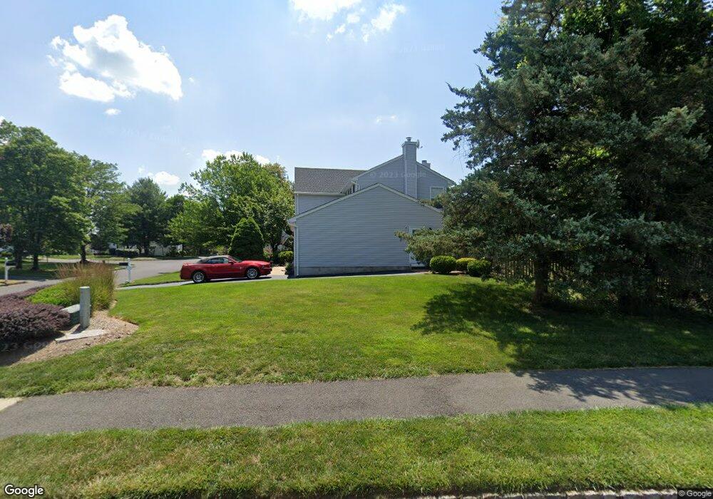
2 Mohegan Trail Branchburg, NJ 08876
Branchburg Township NeighborhoodEstimated Value: $700,502 - $850,000
--
Bed
--
Bath
1,988
Sq Ft
$391/Sq Ft
Est. Value
About This Home
This home is located at 2 Mohegan Trail, Branchburg, NJ 08876 and is currently estimated at $776,376, approximately $390 per square foot. 2 Mohegan Trail is a home located in Somerset County with nearby schools including Whiton Elementary School, Stony Brook School, and Branchburg Central Middle School.
Ownership History
Date
Name
Owned For
Owner Type
Purchase Details
Closed on
Jun 26, 2001
Sold by
Lachney Rowdy
Bought by
Lasko Nancy
Current Estimated Value
Home Financials for this Owner
Home Financials are based on the most recent Mortgage that was taken out on this home.
Original Mortgage
$209,000
Outstanding Balance
$80,894
Interest Rate
7.2%
Estimated Equity
$695,482
Purchase Details
Closed on
May 14, 1999
Sold by
Wallick Susan
Bought by
Lachney Rowdy and Shanley Deborah
Home Financials for this Owner
Home Financials are based on the most recent Mortgage that was taken out on this home.
Original Mortgage
$204,000
Interest Rate
6.9%
Purchase Details
Closed on
Oct 12, 1996
Sold by
Pearce Michael
Bought by
Wallick Susan
Home Financials for this Owner
Home Financials are based on the most recent Mortgage that was taken out on this home.
Original Mortgage
$194,000
Interest Rate
8.22%
Create a Home Valuation Report for This Property
The Home Valuation Report is an in-depth analysis detailing your home's value as well as a comparison with similar homes in the area
Home Values in the Area
Average Home Value in this Area
Purchase History
| Date | Buyer | Sale Price | Title Company |
|---|---|---|---|
| Lasko Nancy | $339,000 | -- | |
| Lachney Rowdy | $255,000 | -- | |
| Wallick Susan | $215,000 | -- |
Source: Public Records
Mortgage History
| Date | Status | Borrower | Loan Amount |
|---|---|---|---|
| Open | Lasko Nancy | $209,000 | |
| Previous Owner | Lachney Rowdy | $204,000 | |
| Previous Owner | Wallick Susan | $194,000 |
Source: Public Records
Tax History Compared to Growth
Tax History
| Year | Tax Paid | Tax Assessment Tax Assessment Total Assessment is a certain percentage of the fair market value that is determined by local assessors to be the total taxable value of land and additions on the property. | Land | Improvement |
|---|---|---|---|---|
| 2025 | $10,507 | $638,500 | $164,100 | $474,400 |
| 2024 | $10,507 | $582,400 | $164,100 | $418,300 |
| 2023 | $10,208 | $545,600 | $164,100 | $381,500 |
| 2022 | $9,945 | $505,100 | $164,100 | $341,000 |
| 2021 | $9,864 | $466,600 | $154,100 | $312,500 |
| 2020 | $9,678 | $451,600 | $154,100 | $297,500 |
| 2019 | $9,488 | $440,300 | $154,100 | $286,200 |
| 2018 | $9,422 | $436,000 | $148,100 | $287,900 |
| 2017 | $9,677 | $444,700 | $142,100 | $302,600 |
| 2016 | $9,583 | $437,600 | $131,100 | $306,500 |
| 2015 | $9,172 | $419,600 | $131,100 | $288,500 |
| 2014 | $8,927 | $413,300 | $123,600 | $289,700 |
Source: Public Records
Map
Nearby Homes
- 33 Iroquois Trail
- 16 Iroquois Trail
- 21 Cheyenne Trail
- 215 Readington Rd
- 23 Buffalo Hollow Rd
- 212 County Line Rd
- 6 Heritage Ct
- 615 Magnolia Ln
- 110 Arbor Way
- 5 Walnut Dr
- 3366 Us Highway 22
- 508 Keenland Ct
- 46 Strawberry Hill Rd
- 2 Carlisle Rd
- 203 Red Crest Ln
- 40 France Dr
- 511 Red Crest Ln
- 9 Weavers Ln
- 3366 Round Hill Rd
- 1601 Breckenridge Dr
- 4 Mohegan Trail
- 3 Mohegan Trail
- 26 Ottawa Trail
- 24 Ottawa Trail
- 6 Mohegan Trail
- 5 Mohegan Trail
- 14 Munsee Trail
- 12 Munsee Trail
- 22 Ottawa Trail
- 10 Munsee Trail
- 8 Munsee Trail
- 28 Ottawa Trail
- 6 Munsee Trail
- 7 Mohegan Trail
- 4 Munsee Trail
- 2 Munsee Trail
- 10 Mohegan Trail
- 19 Munsee Trail
- 20 Ottawa Trail
- 17 Munsee Trail