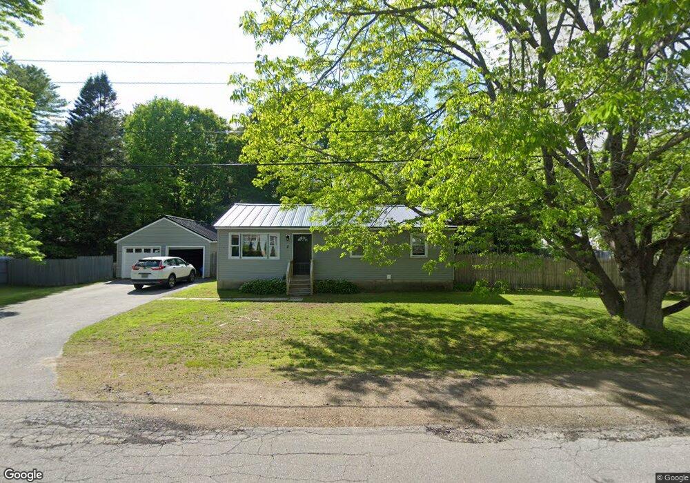
2 Mullins Dr Gardiner, ME 04345
Estimated Value: $245,666 - $306,000
2
Beds
1
Bath
960
Sq Ft
$274/Sq Ft
Est. Value
About This Home
This home is located at 2 Mullins Dr, Gardiner, ME 04345 and is currently estimated at $262,667, approximately $273 per square foot. 2 Mullins Dr is a home with nearby schools including Gardiner Area High School.
Ownership History
Date
Name
Owned For
Owner Type
Purchase Details
Closed on
Dec 4, 2007
Sold by
Guilmette Deborah C and Guilmette Stanley W
Bought by
Love Sarah E and Love Matthew E
Current Estimated Value
Home Financials for this Owner
Home Financials are based on the most recent Mortgage that was taken out on this home.
Original Mortgage
$128,188
Outstanding Balance
$81,155
Interest Rate
6.48%
Mortgage Type
Purchase Money Mortgage
Estimated Equity
$181,512
Create a Home Valuation Report for This Property
The Home Valuation Report is an in-depth analysis detailing your home's value as well as a comparison with similar homes in the area
Home Values in the Area
Average Home Value in this Area
Purchase History
| Date | Buyer | Sale Price | Title Company |
|---|---|---|---|
| Love Sarah E | -- | -- |
Source: Public Records
Mortgage History
| Date | Status | Borrower | Loan Amount |
|---|---|---|---|
| Open | Love Sarah E | $128,188 |
Source: Public Records
Tax History Compared to Growth
Tax History
| Year | Tax Paid | Tax Assessment Tax Assessment Total Assessment is a certain percentage of the fair market value that is determined by local assessors to be the total taxable value of land and additions on the property. | Land | Improvement |
|---|---|---|---|---|
| 2024 | $2,691 | $105,100 | $21,300 | $83,800 |
| 2023 | $2,491 | $105,100 | $21,300 | $83,800 |
| 2022 | $2,333 | $105,100 | $21,300 | $83,800 |
| 2021 | $2,281 | $105,100 | $21,300 | $83,800 |
| 2020 | $2,281 | $105,100 | $21,300 | $83,800 |
| 2019 | $2,281 | $105,100 | $21,300 | $83,800 |
| 2018 | $2,249 | $105,100 | $21,300 | $83,800 |
| 2017 | $2,312 | $105,100 | $21,300 | $83,800 |
| 2016 | $2,260 | $105,100 | $21,300 | $83,800 |
| 2015 | $2,270 | $105,100 | $21,300 | $83,800 |
| 2014 | $2,165 | $105,100 | $21,300 | $83,800 |
Source: Public Records
Map
Nearby Homes
- 11 Cannard St
- 737 River Ave
- 728 River Ave
- 113 Capen Rd
- Lot 24A Riverside Rd
- 1108 River Ave
- Lot 15 Marston Rd
- 1121 River Ave
- 13 Brookside Dr
- 57 Parker Rd
- 520 Marston Rd
- 0 Brunswick Ave
- Lot 7 Marston
- 284 Old Brunswick Rd
- 23 Tilbury Park
- Lot 13 Brunswick Ave
- 1 E Pittston Rd
- 5 Magnolia Ln Unit 1
- 1090 Pittston School St
- Lot 37A Pierce St