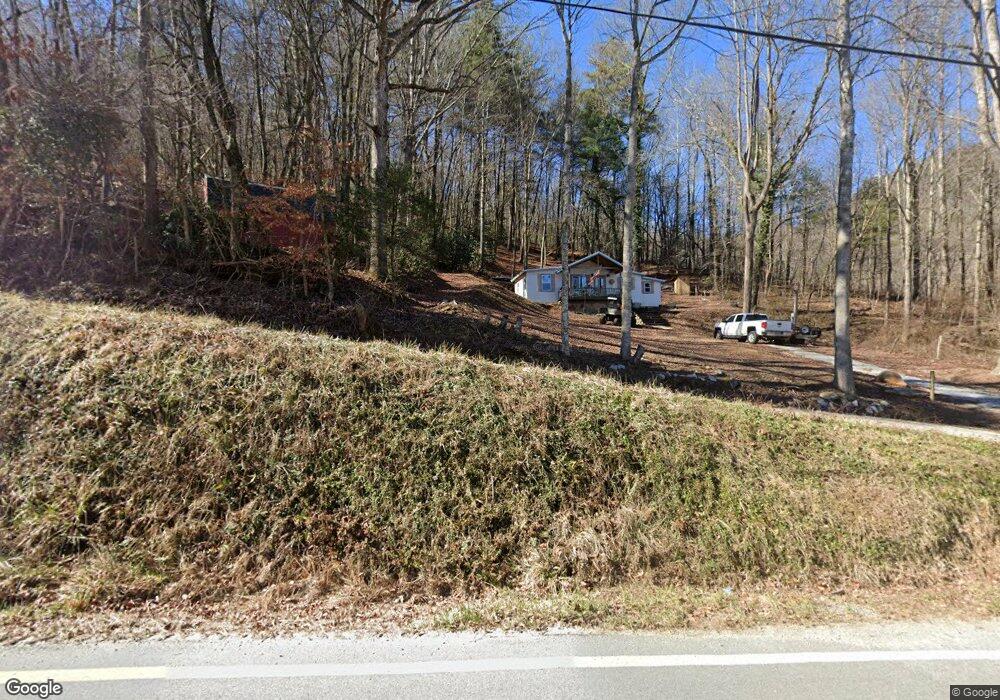
2 N Billy Branch Rd Rabun Gap, GA 30568
Estimated Value: $80,761 - $178,000
1
Bed
1
Bath
714
Sq Ft
$160/Sq Ft
Est. Value
About This Home
This home is located at 2 N Billy Branch Rd, Rabun Gap, GA 30568 and is currently estimated at $114,440, approximately $160 per square foot. 2 N Billy Branch Rd is a home located in Rabun County with nearby schools including Rabun County Primary School and Rabun County High School.
Ownership History
Date
Name
Owned For
Owner Type
Purchase Details
Closed on
May 5, 2017
Sold by
Fowler John W
Bought by
Coffey Michael P and Coffey Kathy W
Current Estimated Value
Purchase Details
Closed on
Nov 1, 1983
Bought by
Fowler John W
Purchase Details
Closed on
Jun 1, 1979
Purchase Details
Closed on
Aug 1, 1975
Purchase Details
Closed on
May 1, 1973
Purchase Details
Closed on
Jun 1, 1968
Create a Home Valuation Report for This Property
The Home Valuation Report is an in-depth analysis detailing your home's value as well as a comparison with similar homes in the area
Home Values in the Area
Average Home Value in this Area
Purchase History
| Date | Buyer | Sale Price | Title Company |
|---|---|---|---|
| Coffey Michael P | $39,500 | -- | |
| Coffey Michael P | $39,500 | -- | |
| Fowler John W | $14,000 | -- | |
| Fowler John W | $14,000 | -- | |
| -- | $17,000 | -- | |
| -- | $17,000 | -- | |
| -- | $9,500 | -- | |
| -- | $9,500 | -- | |
| -- | $8,800 | -- | |
| -- | $8,800 | -- | |
| -- | $3,000 | -- | |
| -- | $3,000 | -- |
Source: Public Records
Tax History
| Year | Tax Paid | Tax Assessment Tax Assessment Total Assessment is a certain percentage of the fair market value that is determined by local assessors to be the total taxable value of land and additions on the property. | Land | Improvement |
|---|---|---|---|---|
| 2025 | $231 | $14,406 | $7,905 | $6,501 |
| 2024 | $226 | $14,076 | $7,905 | $6,171 |
| 2023 | $239 | $13,060 | $7,440 | $5,620 |
| 2022 | $186 | $10,140 | $6,975 | $3,165 |
| 2021 | $173 | $9,224 | $6,510 | $2,714 |
| 2020 | $170 | $8,753 | $6,510 | $2,243 |
| 2019 | $282 | $14,454 | $6,510 | $7,944 |
| 2018 | $283 | $14,454 | $6,510 | $7,944 |
| 2017 | $281 | $14,150 | $7,000 | $7,150 |
| 2016 | $267 | $14,150 | $7,000 | $7,150 |
| 2015 | $256 | $13,268 | $7,000 | $6,268 |
| 2014 | $257 | $13,268 | $7,000 | $6,268 |
Source: Public Records
Map
Nearby Homes
- 0 Blue Ridge Gap Rd Unit 10679893
- LOT 121 Doolittle Dr
- 5019 Wolffork Rd
- 375 Western Way
- 373 Western Way
- 133 Simms Way
- 0 Bob Hoover Trail Unit LOT 78
- 0 Pitts Way Unit 10592369
- 0 Sylvan Lake Dr Unit 47,48 10485897
- 460 Anderson Dr
- 0 Crest Ln Unit LOT 5
- LOT 40 Anderson Dr
- LOT #37 Anderson Dr
- 5192 Wolffork Rd
- 130 Ivy Trail
- 0 Alto Ln Unit 10669756
- 44 Cessna Ln
- 2594 Blue Ridge Gap Rd
- 786 Hope Haven Ln
- LOT 19 Wagstaff Way
- 36 Double Branch Rd
- 70 N Billy Branch Rd
- 3831 Wolffork Rd
- 3784 Wolffork Rd
- 57 N Billy Branch Rd
- 3838 Wolffork Rd
- 3727 Wolffork Rd
- 3572 Wolffork Rd
- 4032 Wolffork 0
- 4031 Wolffork Rd
- 4130 Wolffork Rd
- 3925 Wolffork Rd
- 97 Apple Hollow Ln
- 3423 Wolffork Rd
- 4152 Wolffork Rd
- 4067 Wolffork Rd
- 34 Apple Hollow Ln
- 45 Ward Ln
- 99 Apple Hollow Ln
- 539 Blue Ridge Gap Rd
Your Personal Tour Guide
Ask me questions while you tour the home.