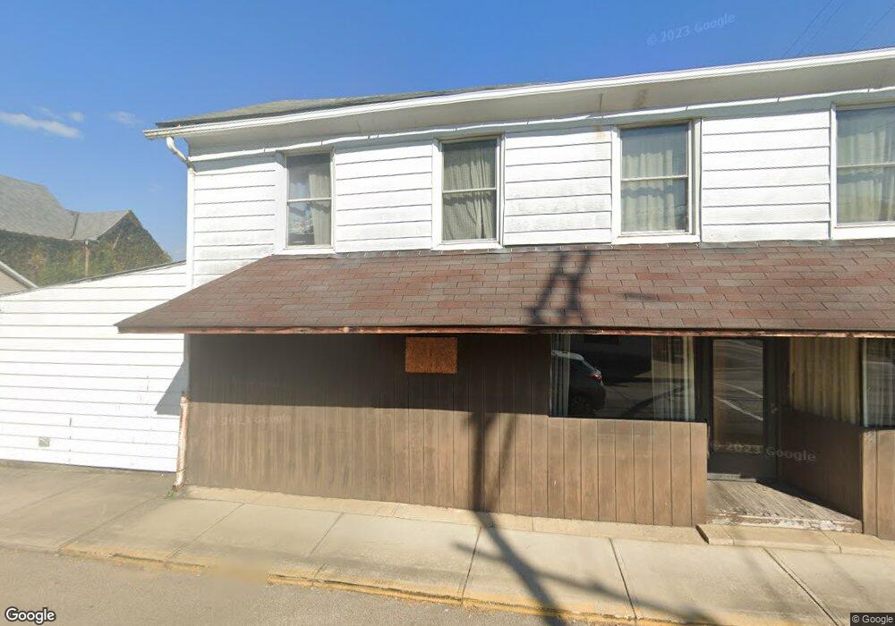
2 N Mulberry St Tremont City, OH 45372
Estimated Value: $79,000 - $228,000
4
Beds
2
Baths
4,284
Sq Ft
$35/Sq Ft
Est. Value
About This Home
This home is located at 2 N Mulberry St, Tremont City, OH 45372 and is currently estimated at $151,123, approximately $35 per square foot. 2 N Mulberry St is a home with nearby schools including Northwestern Elementary School and Northwestern Junior/Senior High School.
Ownership History
Date
Name
Owned For
Owner Type
Purchase Details
Closed on
Mar 22, 2005
Sold by
Rust Joann Marie and Rust Robert
Bought by
Rust Robert and Rust Joann Marie
Current Estimated Value
Home Financials for this Owner
Home Financials are based on the most recent Mortgage that was taken out on this home.
Original Mortgage
$52,800
Outstanding Balance
$27,246
Interest Rate
5.88%
Mortgage Type
Stand Alone Refi Refinance Of Original Loan
Estimated Equity
$123,877
Purchase Details
Closed on
Jun 28, 1989
Create a Home Valuation Report for This Property
The Home Valuation Report is an in-depth analysis detailing your home's value as well as a comparison with similar homes in the area
Home Values in the Area
Average Home Value in this Area
Purchase History
| Date | Buyer | Sale Price | Title Company |
|---|---|---|---|
| Rust Robert | -- | Accurate Title Solutions | |
| -- | $8,000 | -- |
Source: Public Records
Mortgage History
| Date | Status | Borrower | Loan Amount |
|---|---|---|---|
| Open | Rust Robert | $52,800 |
Source: Public Records
Tax History Compared to Growth
Tax History
| Year | Tax Paid | Tax Assessment Tax Assessment Total Assessment is a certain percentage of the fair market value that is determined by local assessors to be the total taxable value of land and additions on the property. | Land | Improvement |
|---|---|---|---|---|
| 2024 | $1,495 | $33,840 | $3,650 | $30,190 |
| 2023 | $1,495 | $33,840 | $3,650 | $30,190 |
| 2022 | $1,539 | $33,840 | $3,650 | $30,190 |
| 2021 | $1,411 | $27,980 | $3,020 | $24,960 |
| 2020 | $1,396 | $27,980 | $3,020 | $24,960 |
| 2019 | $1,411 | $27,980 | $3,020 | $24,960 |
| 2018 | $1,186 | $23,300 | $3,020 | $20,280 |
| 2017 | $1,187 | $23,297 | $3,021 | $20,276 |
| 2016 | $1,162 | $23,297 | $3,021 | $20,276 |
| 2015 | $1,143 | $22,341 | $3,021 | $19,320 |
| 2014 | $1,142 | $22,341 | $3,021 | $19,320 |
| 2013 | $1,134 | $22,341 | $3,021 | $19,320 |
Source: Public Records
Map
Nearby Homes
- 30 Center St
- 6250 Willowdale Rd
- 4211 Grey Stone Crossing
- 4328 Pine Tree Place
- 3802 Lawrenceville Dr
- 593 Hiser Ave
- 4100 Troy Rd Unit 96
- 4100 Troy Rd Unit 12
- 794 Donnelly Ave
- 5646 Springfield-Urbana Pike Unit Lot 88
- 5646 Springfield-Urbana Pike Unit Lot 122
- 5646 Springfield-Urbana Pike Unit Lot 61
- 5646 Springfield-Urbana Pike Unit Lot 127
- 5646 Springfield-Urbana Pike Unit Lot 72
- 4514 Dowden St
- 26 Thomaston Trail
- 880 Brendle Trace Unit 28
- 916 Sawmill Ct
- 970 Forest Edge Ave