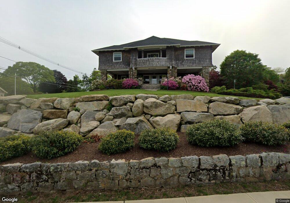
2 Neowam Ave Westerly, RI 02891
Estimated Value: $3,514,000 - $4,056,996
6
Beds
7
Baths
4,632
Sq Ft
$800/Sq Ft
Est. Value
About This Home
This home is located at 2 Neowam Ave, Westerly, RI 02891 and is currently estimated at $3,704,999, approximately $799 per square foot. 2 Neowam Ave is a home located in Washington County with nearby schools including Westerly High School.
Ownership History
Date
Name
Owned For
Owner Type
Purchase Details
Closed on
Aug 4, 2015
Sold by
Wetumanetu Realty Llc
Bought by
Wood Christopher P and Wood Melissa L
Current Estimated Value
Purchase Details
Closed on
Aug 16, 2013
Sold by
Wood John P and Wood Pauline B
Bought by
Wetumanetu Realty Llc
Create a Home Valuation Report for This Property
The Home Valuation Report is an in-depth analysis detailing your home's value as well as a comparison with similar homes in the area
Home Values in the Area
Average Home Value in this Area
Purchase History
| Date | Buyer | Sale Price | Title Company |
|---|---|---|---|
| Wood Christopher P | -- | -- | |
| Wetumanetu Realty Llc | -- | -- |
Source: Public Records
Mortgage History
| Date | Status | Borrower | Loan Amount |
|---|---|---|---|
| Previous Owner | Wetumanetu Realty Llc | $393,000 | |
| Previous Owner | Wetumanetu Realty Llc | $417,000 | |
| Previous Owner | Wetumanetu Realty Llc | $250,000 |
Source: Public Records
Tax History Compared to Growth
Tax History
| Year | Tax Paid | Tax Assessment Tax Assessment Total Assessment is a certain percentage of the fair market value that is determined by local assessors to be the total taxable value of land and additions on the property. | Land | Improvement |
|---|---|---|---|---|
| 2025 | $23,747 | $3,339,900 | $2,166,400 | $1,173,500 |
| 2024 | $20,536 | $2,093,400 | $1,277,000 | $816,400 |
| 2023 | $19,572 | $2,034,500 | $1,277,000 | $757,500 |
| 2022 | $19,450 | $2,034,500 | $1,277,000 | $757,500 |
| 2021 | $19,769 | $1,716,100 | $1,109,600 | $606,500 |
| 2020 | $19,409 | $1,716,100 | $1,109,600 | $606,500 |
| 2019 | $19,220 | $1,716,100 | $1,109,600 | $606,500 |
| 2018 | $19,391 | $1,632,200 | $1,109,600 | $522,600 |
| 2017 | $18,917 | $1,632,200 | $1,109,600 | $522,600 |
| 2016 | $19,064 | $1,632,200 | $1,109,600 | $522,600 |
| 2015 | $17,118 | $1,582,100 | $1,027,500 | $554,600 |
| 2014 | -- | $1,582,100 | $1,027,500 | $554,600 |
Source: Public Records
Map
Nearby Homes