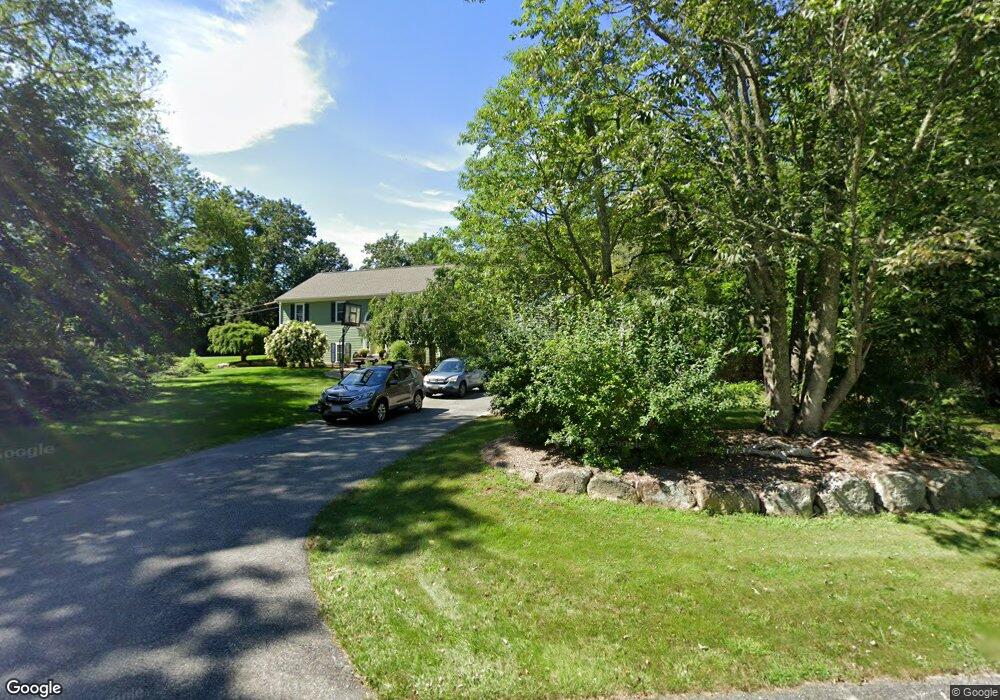
2 Oakridge Ln Westport, MA 02790
Brownell/Giffords Corner NeighborhoodEstimated Value: $572,410 - $739,000
3
Beds
--
Bath
1,554
Sq Ft
$415/Sq Ft
Est. Value
About This Home
This home is located at 2 Oakridge Ln, Westport, MA 02790 and is currently estimated at $644,603, approximately $414 per square foot. 2 Oakridge Ln is a home located in Bristol County with nearby schools including Alice A. Macomber Primary School, Westport Elementary School, and Westport Middle-High School.
Ownership History
Date
Name
Owned For
Owner Type
Purchase Details
Closed on
May 24, 1996
Sold by
165 Cw T
Bought by
Manchester Alfred and Manchester Ana Paula
Current Estimated Value
Home Financials for this Owner
Home Financials are based on the most recent Mortgage that was taken out on this home.
Original Mortgage
$161,800
Interest Rate
8.01%
Mortgage Type
Purchase Money Mortgage
Create a Home Valuation Report for This Property
The Home Valuation Report is an in-depth analysis detailing your home's value as well as a comparison with similar homes in the area
Home Values in the Area
Average Home Value in this Area
Purchase History
| Date | Buyer | Sale Price | Title Company |
|---|---|---|---|
| Manchester Alfred | $170,375 | -- |
Source: Public Records
Mortgage History
| Date | Status | Borrower | Loan Amount |
|---|---|---|---|
| Open | Manchester Alfred | $203,000 | |
| Closed | Manchester Alfred | $161,800 |
Source: Public Records
Tax History Compared to Growth
Tax History
| Year | Tax Paid | Tax Assessment Tax Assessment Total Assessment is a certain percentage of the fair market value that is determined by local assessors to be the total taxable value of land and additions on the property. | Land | Improvement |
|---|---|---|---|---|
| 2025 | $3,426 | $459,900 | $195,100 | $264,800 |
| 2024 | $3,414 | $441,700 | $180,800 | $260,900 |
| 2023 | $3,225 | $395,200 | $158,400 | $236,800 |
| 2022 | $3,211 | $378,600 | $158,400 | $220,200 |
| 2021 | $3,020 | $350,300 | $144,000 | $206,300 |
| 2020 | $2,905 | $344,600 | $138,300 | $206,300 |
| 2019 | $2,641 | $319,300 | $126,300 | $193,000 |
| 2018 | $2,868 | $351,100 | $165,300 | $185,800 |
| 2017 | $2,693 | $337,900 | $165,300 | $172,600 |
| 2016 | $2,566 | $324,400 | $165,300 | $159,100 |
| 2015 | $2,615 | $329,700 | $169,000 | $160,700 |
Source: Public Records
Map
Nearby Homes
- 118 Charlotte White Rd
- 8 Strawberry Ln
- 118 Charlotte White Rd Extension
- 0 Hidden Glen Ln
- 978 Sodom Rd
- Lot 0 Marcotte
- 6 Angel Ct
- 4 Main Rd
- 15 Village Way
- 47 Fallon Dr
- 7 Village Way
- 8 Village Way
- 218 American Legion Hwy
- 308 Robert St
- 837 Main Rd
- 47 Robert St
- 40 Robert St
- 771 Sanford Rd
- 47 Devol Ave
- 33 Moniz Dr
- 1 Oak Ridge Ln
- 1 Oakridge Ln
- 8 Oakridge Ln
- 121 Charlotte White Rd
- 14 Oakridge Ln
- 14 Oak Ridge Ln
- 7 Oakridge Ln
- 1 Morning Dove Dr
- 1 Fernmarsh Ln
- 115 Charlotte White Rd
- 3 Fernmarsh Ln
- 165 Charlotte White Rd
- 15 Oakridge Ln
- 15 Oak Ridge Ln
- 107 Charlotte White Rd
- 9 Morning Dove Dr
- 2 Fernmarsh Ln
- 7 Fernmarsh Ln
- 2 Morning Dove Dr
- 19 Oakridge Ln