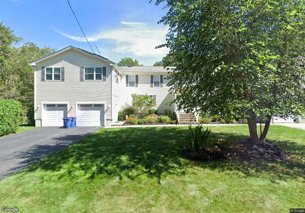
2 Oakstone Way Westport, MA 02790
Booth/Handy Four Corners NeighborhoodEstimated Value: $588,000 - $791,000
3
Beds
2
Baths
3,079
Sq Ft
$228/Sq Ft
Est. Value
About This Home
This home is located at 2 Oakstone Way, Westport, MA 02790 and is currently estimated at $703,165, approximately $228 per square foot. 2 Oakstone Way is a home located in Bristol County with nearby schools including Alice A. Macomber Primary School, Westport Elementary School, and Westport Middle-High School.
Ownership History
Date
Name
Owned For
Owner Type
Purchase Details
Closed on
Sep 29, 2005
Sold by
Feinberg Robert M
Bought by
Oliver Susan B and Oliver Todd C
Current Estimated Value
Home Financials for this Owner
Home Financials are based on the most recent Mortgage that was taken out on this home.
Original Mortgage
$225,600
Outstanding Balance
$121,360
Interest Rate
5.84%
Mortgage Type
Purchase Money Mortgage
Estimated Equity
$581,805
Create a Home Valuation Report for This Property
The Home Valuation Report is an in-depth analysis detailing your home's value as well as a comparison with similar homes in the area
Home Values in the Area
Average Home Value in this Area
Purchase History
| Date | Buyer | Sale Price | Title Company |
|---|---|---|---|
| Oliver Susan B | $282,000 | -- |
Source: Public Records
Mortgage History
| Date | Status | Borrower | Loan Amount |
|---|---|---|---|
| Open | Oliver Susan B | $225,600 | |
| Closed | Oliver Susan B | $42,300 | |
| Previous Owner | Oliver Susan B | $136,800 | |
| Previous Owner | Oliver Susan B | $135,000 |
Source: Public Records
Tax History Compared to Growth
Tax History
| Year | Tax Paid | Tax Assessment Tax Assessment Total Assessment is a certain percentage of the fair market value that is determined by local assessors to be the total taxable value of land and additions on the property. | Land | Improvement |
|---|---|---|---|---|
| 2025 | $4,873 | $654,100 | $0 | $654,100 |
| 2024 | $4,993 | $645,900 | $0 | $645,900 |
| 2023 | $4,856 | $595,100 | $0 | $595,100 |
| 2022 | $4,077 | $506,400 | $0 | $506,400 |
| 2021 | $4,077 | $473,000 | $0 | $473,000 |
| 2020 | $3,702 | $439,100 | $0 | $439,100 |
| 2019 | $3,718 | $449,600 | $0 | $449,600 |
| 2018 | $3,099 | $379,300 | $0 | $379,300 |
| 2017 | $3,058 | $383,700 | $0 | $383,700 |
| 2016 | $2,751 | $347,800 | $0 | $347,800 |
| 2015 | $1,928 | $243,100 | $0 | $243,100 |
Source: Public Records
Map
Nearby Homes
- 118 Charlotte White Rd
- 8 Strawberry Ln
- 118 Charlotte White Rd Extension
- 0 Hidden Glen Ln
- 978 Sodom Rd
- Lot 0 Marcotte
- 6 Angel Ct
- 15 Village Way
- 4 Main Rd
- 7 Village Way
- 8 Village Way
- 47 Fallon Dr
- 837 Main Rd
- 837 Main Road & Lot 2
- 218 American Legion Hwy
- 308 Robert St
- 101 Adamsville Rd
- 47 Robert St
- 40 Robert St
- 771 Sanford Rd
- 4 Oakstone Way
- 4 Oakstone Way Unit B
- 2 Oak Stone Way
- 2 Oak Stone Way Unit 2
- 8 Oakstone Way
- 16 Oakstone Way
- 4 Oak Stone Way Unit B
- 100 Charlotte White Rd
- 24 Oakstone Way
- 2 Fernmarsh Ln
- 7 Fernmarsh Ln
- 96 Charlotte White Rd
- 10 Fernmarsh Ln
- 103 Charlotte White Rd
- 90 Charlotte White Rd Unit 92
- 14 Fernmarsh Ln
- 1 Fernmarsh Ln
- 49 Longwood Dr
- 107 Charlotte White Rd
- 115 Charlotte White Rd