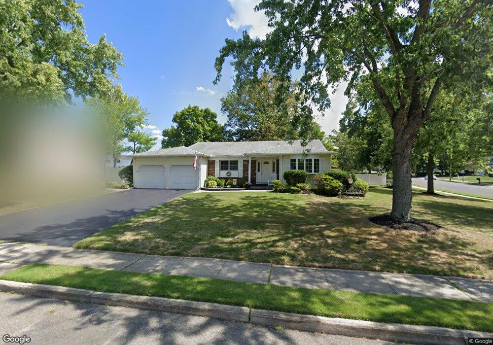
2 Oxcart Ln Trenton, NJ 08619
University City NeighborhoodEstimated Value: $521,000 - $579,000
--
Bed
--
Bath
1,778
Sq Ft
$307/Sq Ft
Est. Value
About This Home
This home is located at 2 Oxcart Ln, Trenton, NJ 08619 and is currently estimated at $545,723, approximately $306 per square foot. 2 Oxcart Ln is a home located in Mercer County with nearby schools including University Heights/H.D. Morrison Elementary School, Richard C. Crockett Middle School, and Nottingham High School - North.
Ownership History
Date
Name
Owned For
Owner Type
Purchase Details
Closed on
Oct 22, 2003
Sold by
Herrmann Regina
Bought by
Degregory John and Degregory Joan
Current Estimated Value
Home Financials for this Owner
Home Financials are based on the most recent Mortgage that was taken out on this home.
Original Mortgage
$65,000
Interest Rate
5.98%
Mortgage Type
Purchase Money Mortgage
Create a Home Valuation Report for This Property
The Home Valuation Report is an in-depth analysis detailing your home's value as well as a comparison with similar homes in the area
Home Values in the Area
Average Home Value in this Area
Purchase History
| Date | Buyer | Sale Price | Title Company |
|---|---|---|---|
| Degregory John | $305,000 | -- |
Source: Public Records
Mortgage History
| Date | Status | Borrower | Loan Amount |
|---|---|---|---|
| Previous Owner | Degregory John | $65,000 |
Source: Public Records
Tax History Compared to Growth
Tax History
| Year | Tax Paid | Tax Assessment Tax Assessment Total Assessment is a certain percentage of the fair market value that is determined by local assessors to be the total taxable value of land and additions on the property. | Land | Improvement |
|---|---|---|---|---|
| 2025 | $10,364 | $294,100 | $101,400 | $192,700 |
| 2024 | $9,714 | $294,100 | $101,400 | $192,700 |
| 2023 | $9,714 | $294,100 | $101,400 | $192,700 |
| 2022 | $9,561 | $294,100 | $101,400 | $192,700 |
| 2021 | $10,479 | $294,100 | $101,400 | $192,700 |
| 2020 | $9,420 | $294,100 | $101,400 | $192,700 |
| 2019 | $9,191 | $294,100 | $101,400 | $192,700 |
| 2018 | $9,082 | $294,100 | $101,400 | $192,700 |
| 2017 | $8,888 | $294,100 | $101,400 | $192,700 |
| 2016 | $7,952 | $294,100 | $101,400 | $192,700 |
| 2015 | $8,368 | $176,200 | $63,500 | $112,700 |
| 2014 | $8,248 | $176,200 | $63,500 | $112,700 |
Source: Public Records
Map
Nearby Homes
- 7 Oxcart Ln
- 411 Flock Rd
- 126 Cooney Ave
- 19 Martin Ln
- 16 Guilford Ln
- 474 Paxson Ave
- 10 Whitman Rd
- 583 Edinburg Rd Unit MER
- 7 Saranac Rd
- 39 Saint Clair Ave
- 542 Mercerville-Edinburg Rd
- 421 Paxson Ave
- 924 Hughes Dr
- 13 Blairmore Dr
- 5 Delotto Dr
- 3 Sedgwick Rd
- 413 Paxson Ave
- 112 Douglas Ave
- 397 Edinburg Rd Unit MER
- 728 Hughes Dr