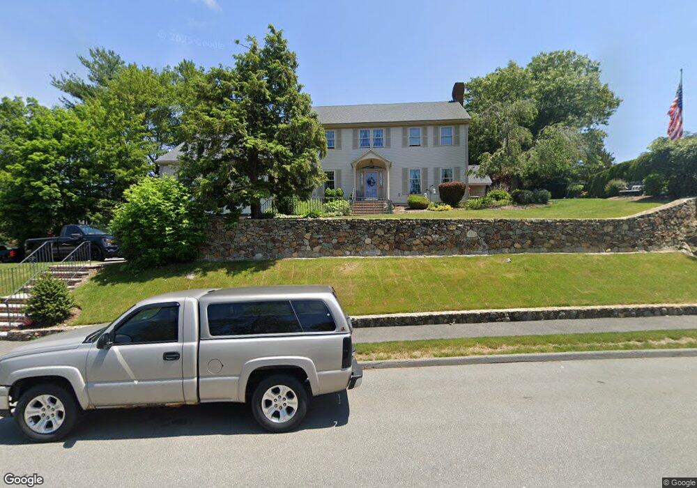
2 Partridge Ln Saugus, MA 01906
Oakland Vale NeighborhoodEstimated Value: $1,300,123 - $1,483,000
4
Beds
4
Baths
5,402
Sq Ft
$258/Sq Ft
Est. Value
About This Home
This home is located at 2 Partridge Ln, Saugus, MA 01906 and is currently estimated at $1,393,781, approximately $258 per square foot. 2 Partridge Ln is a home located in Essex County with nearby schools including Saugus High School, Pioneer Charter School Of Science II, and Melrose Montessori School.
Ownership History
Date
Name
Owned For
Owner Type
Purchase Details
Closed on
Jan 16, 1985
Bought by
Wetherbee Mark A and Wetherbee Debra A
Current Estimated Value
Create a Home Valuation Report for This Property
The Home Valuation Report is an in-depth analysis detailing your home's value as well as a comparison with similar homes in the area
Home Values in the Area
Average Home Value in this Area
Purchase History
| Date | Buyer | Sale Price | Title Company |
|---|---|---|---|
| Wetherbee Mark A | -- | -- |
Source: Public Records
Mortgage History
| Date | Status | Borrower | Loan Amount |
|---|---|---|---|
| Open | Wetherbee Mark A | $136,000 | |
| Open | Wetherbee Mark A | $250,000 | |
| Closed | Wetherbee Mark A | $35,000 |
Source: Public Records
Tax History Compared to Growth
Tax History
| Year | Tax Paid | Tax Assessment Tax Assessment Total Assessment is a certain percentage of the fair market value that is determined by local assessors to be the total taxable value of land and additions on the property. | Land | Improvement |
|---|---|---|---|---|
| 2025 | $12,065 | $1,129,700 | $455,100 | $674,600 |
| 2024 | $11,728 | $1,101,200 | $440,100 | $661,100 |
| 2023 | $10,905 | $968,500 | $355,100 | $613,400 |
| 2022 | $10,151 | $845,200 | $308,100 | $537,100 |
| 2021 | $10,195 | $826,200 | $289,100 | $537,100 |
| 2020 | $9,681 | $812,200 | $289,100 | $523,100 |
| 2019 | $9,572 | $785,900 | $289,100 | $496,800 |
| 2018 | $9,014 | $778,400 | $289,100 | $489,300 |
| 2017 | $8,877 | $736,700 | $275,100 | $461,600 |
| 2016 | $9,170 | $751,600 | $275,300 | $476,300 |
| 2015 | $8,603 | $715,700 | $262,100 | $453,600 |
| 2014 | $8,255 | $711,000 | $262,100 | $448,900 |
Source: Public Records
Map
Nearby Homes
- 21 Athens Dr
- 906 Lewis o Gray Dr
- 805 Lewis o Gray Dr
- 148 Forest St
- 15 Shore Rd
- 9 Thomas St Unit 11
- 225 Howard St
- 22 Mount Zion Rd
- 905 Sherwood Forest Ln
- 7 Nirvana Dr
- 6 Castle Clare Cir
- 515 Upham St
- 70 Old Nahant Rd
- 29 Susan Dr
- 340 Essex St
- 65 Lincoln St
- 12B Cheever Ave
- 12C Cheever Ave
- 128 Green St Unit 128
- 109 Linden Rd