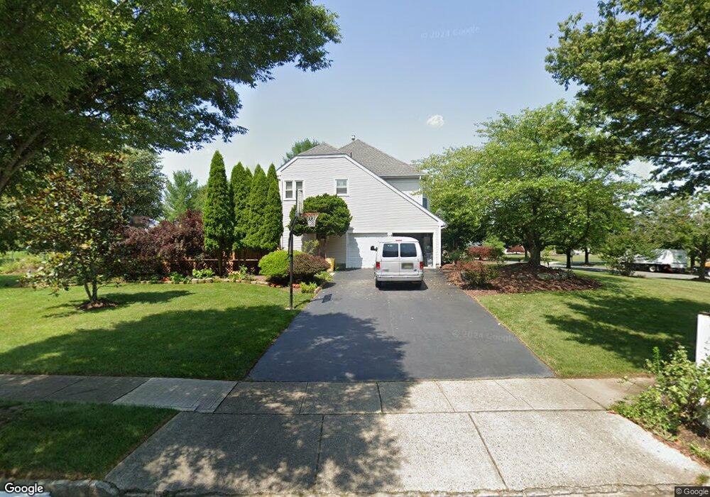
2 Perrine Path Princeton Junction, NJ 08550
Estimated Value: $1,197,357 - $1,365,000
4
Beds
3
Baths
3,128
Sq Ft
$404/Sq Ft
Est. Value
About This Home
This home is located at 2 Perrine Path, Princeton Junction, NJ 08550 and is currently estimated at $1,263,089, approximately $403 per square foot. 2 Perrine Path is a home located in Mercer County with nearby schools including Maurice Hawk Elementary School, Millstone River School, and Community Middle School.
Ownership History
Date
Name
Owned For
Owner Type
Purchase Details
Closed on
Oct 16, 2009
Sold by
Meshumar Yochanan and Lichtman Cathy
Bought by
Li Qiang and Chen Jie
Current Estimated Value
Home Financials for this Owner
Home Financials are based on the most recent Mortgage that was taken out on this home.
Original Mortgage
$355,000
Interest Rate
5.06%
Mortgage Type
New Conventional
Purchase Details
Closed on
Jun 2, 2006
Sold by
Burgess Judith
Bought by
Meshumar Yochanan and Litchtman Cathy
Home Financials for this Owner
Home Financials are based on the most recent Mortgage that was taken out on this home.
Original Mortgage
$340,000
Interest Rate
6.62%
Mortgage Type
Purchase Money Mortgage
Purchase Details
Closed on
Nov 21, 1991
Sold by
Calton Homes Inc
Bought by
Burgess Judith S
Create a Home Valuation Report for This Property
The Home Valuation Report is an in-depth analysis detailing your home's value as well as a comparison with similar homes in the area
Home Values in the Area
Average Home Value in this Area
Purchase History
| Date | Buyer | Sale Price | Title Company |
|---|---|---|---|
| Li Qiang | $711,910 | None Available | |
| Meshumar Yochanan | $670,000 | -- | |
| Burgess Judith S | $285,300 | -- |
Source: Public Records
Mortgage History
| Date | Status | Borrower | Loan Amount |
|---|---|---|---|
| Closed | Li Qiang | $355,000 | |
| Previous Owner | Meshumar Yochanan | $340,000 |
Source: Public Records
Tax History Compared to Growth
Tax History
| Year | Tax Paid | Tax Assessment Tax Assessment Total Assessment is a certain percentage of the fair market value that is determined by local assessors to be the total taxable value of land and additions on the property. | Land | Improvement |
|---|---|---|---|---|
| 2025 | $20,511 | $669,200 | $249,400 | $419,800 |
| 2024 | $19,654 | $669,200 | $249,400 | $419,800 |
| 2023 | $19,654 | $669,200 | $249,400 | $419,800 |
| 2022 | $19,273 | $669,200 | $249,400 | $419,800 |
| 2021 | $19,112 | $669,200 | $249,400 | $419,800 |
| 2020 | $18,764 | $669,200 | $249,400 | $419,800 |
| 2019 | $18,550 | $669,200 | $249,400 | $419,800 |
| 2018 | $18,376 | $669,200 | $249,400 | $419,800 |
| 2017 | $17,995 | $669,200 | $249,400 | $419,800 |
| 2016 | $17,607 | $669,200 | $249,400 | $419,800 |
| 2015 | $17,198 | $669,200 | $249,400 | $419,800 |
| 2014 | $16,998 | $669,200 | $249,400 | $419,800 |
Source: Public Records
Map
Nearby Homes
- 32 W Kincaid Dr
- 5 Glengarry Way
- 7 Camas Ct
- 2 Colonial Ct
- 3 Beechtree Ln
- 19 Shadow Dr
- 2 Joanne St
- 12 Corio Ct
- 42 Nassau Place
- 12 Ziff Ln
- 12 Ziff La
- 100 Middlesex Blvd Unit 242
- 100 Middlesex Blvd Unit 211
- 20 Berkshire Dr
- 4 Pond View Dr
- 95 Thoreau Dr
- 90 Princeton Hightstown Rd
- Downeaster Plan at Townes at West Windsor
- Endeavor Plan at Townes at West Windsor
- Beneteau Plan at Townes at West Windsor