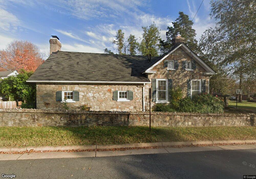
2 Pershing Ave NW Leesburg, VA 20176
Estimated Value: $551,919 - $625,000
3
Beds
3
Baths
1,012
Sq Ft
$580/Sq Ft
Est. Value
About This Home
This home is located at 2 Pershing Ave NW, Leesburg, VA 20176 and is currently estimated at $586,980, approximately $580 per square foot. 2 Pershing Ave NW is a home located in Loudoun County with nearby schools including Frances Hazel Reid Elementary School, Smart's Mill Middle School, and Tuscarora High School.
Ownership History
Date
Name
Owned For
Owner Type
Purchase Details
Closed on
Dec 8, 2023
Sold by
Wysocki Theodore B and Wysocki Rebecca L
Bought by
Theodore Wysocki And Rebecca Wysocki Living T and Wysocki
Current Estimated Value
Purchase Details
Closed on
Feb 12, 2007
Sold by
Sacquety Trkoy J
Bought by
Wysocki Theodore B
Home Financials for this Owner
Home Financials are based on the most recent Mortgage that was taken out on this home.
Original Mortgage
$248,000
Interest Rate
6.24%
Mortgage Type
New Conventional
Create a Home Valuation Report for This Property
The Home Valuation Report is an in-depth analysis detailing your home's value as well as a comparison with similar homes in the area
Home Values in the Area
Average Home Value in this Area
Purchase History
| Date | Buyer | Sale Price | Title Company |
|---|---|---|---|
| Theodore Wysocki And Rebecca Wysocki Living T | -- | None Listed On Document | |
| Wysocki Theodore B | $310,000 | -- |
Source: Public Records
Mortgage History
| Date | Status | Borrower | Loan Amount |
|---|---|---|---|
| Previous Owner | Wysocki Theodore B | $248,000 |
Source: Public Records
Tax History Compared to Growth
Tax History
| Year | Tax Paid | Tax Assessment Tax Assessment Total Assessment is a certain percentage of the fair market value that is determined by local assessors to be the total taxable value of land and additions on the property. | Land | Improvement |
|---|---|---|---|---|
| 2025 | $4,291 | $533,060 | $215,200 | $317,860 |
| 2024 | $4,258 | $492,270 | $211,000 | $281,270 |
| 2023 | $4,049 | $462,790 | $196,000 | $266,790 |
| 2022 | $4,016 | $451,210 | $171,000 | $280,210 |
| 2021 | $3,788 | $386,490 | $143,400 | $243,090 |
| 2020 | $3,455 | $333,770 | $143,400 | $190,370 |
| 2019 | $3,428 | $328,000 | $143,400 | $184,600 |
| 2018 | $3,258 | $300,290 | $123,400 | $176,890 |
| 2017 | $3,121 | $277,410 | $123,400 | $154,010 |
| 2016 | $3,213 | $280,590 | $0 | $0 |
| 2015 | $508 | $154,410 | $0 | $154,410 |
| 2014 | $499 | $149,160 | $0 | $149,160 |
Source: Public Records
Map
Nearby Homes
- 23 Wilson Ave NW
- 0 Wilson Ave NW
- Tisbury Plan at Morven Court
- Addison II Plan at Morven Court
- 403 Inzolia Ct NW
- 332 Loudoun St SW
- 409 Wingate Place SW
- 314 Rock Spring Dr SW
- 227 Dry Mill Rd SW
- 0 Loudoun St SW Unit VALO2106424
- 428 Foxridge Dr SW
- 405 Old Waterford Rd NW
- 403 Old Waterford Rd NW
- 304 Lafayette Place SW
- 239 Old Waterford Rd NW
- 109 Belmont Dr SW
- 40752 Canongate Dr
- 222 Wirt St NW
- 2 Stationmaster St SE Unit 301
- 2 Stationmaster St SE Unit 302
- 2 Pershing Ave NW
- 12 Pershing Ave NW
- 508 W Market St
- 14 Pershing Ave NW
- 604 W Market St
- 11 Pershing Ave NW
- 16 Pershing Ave NW
- 1 Wilson Ave NW
- 504 W Market St
- 5 Wilson Ave NW
- 13 Pershing Ave NW
- 7 Wilson Ave NW
- 18 Pershing Ave NW
- 9 Wilson Ave NW
- 11 Wilson Ave NW
- 424 Mosby Dr SW
- 15 Pershing Ave NW
- 608 W Market St
- 20 Pershing Ave NW
- 15 Wilson Ave NW