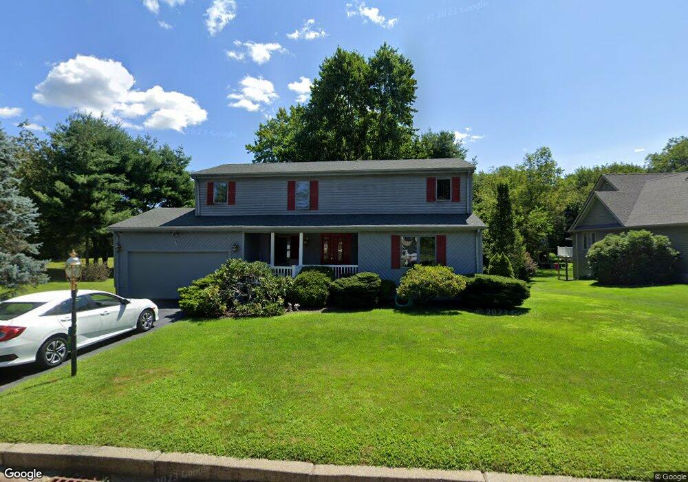
2 Pheasant Run Rd North Smithfield, RI 02896
Estimated Value: $527,982 - $567,000
3
Beds
2
Baths
1,636
Sq Ft
$335/Sq Ft
Est. Value
About This Home
This home is located at 2 Pheasant Run Rd, North Smithfield, RI 02896 and is currently estimated at $548,496, approximately $335 per square foot. 2 Pheasant Run Rd is a home located in Providence County with nearby schools including North Smithfield Elementary School, North Smithfield Middle School, and North Smithfield High School.
Ownership History
Date
Name
Owned For
Owner Type
Purchase Details
Closed on
Jul 20, 1994
Sold by
Brilhante Christian S and Brilhante Pauline
Bought by
Lapierre Gerard A and Lapierre Jeannine
Current Estimated Value
Home Financials for this Owner
Home Financials are based on the most recent Mortgage that was taken out on this home.
Original Mortgage
$62,000
Interest Rate
8.19%
Create a Home Valuation Report for This Property
The Home Valuation Report is an in-depth analysis detailing your home's value as well as a comparison with similar homes in the area
Home Values in the Area
Average Home Value in this Area
Purchase History
| Date | Buyer | Sale Price | Title Company |
|---|---|---|---|
| Lapierre Gerard A | $162,000 | -- |
Source: Public Records
Mortgage History
| Date | Status | Borrower | Loan Amount |
|---|---|---|---|
| Closed | Lapierre Gerard A | $62,000 |
Source: Public Records
Tax History Compared to Growth
Tax History
| Year | Tax Paid | Tax Assessment Tax Assessment Total Assessment is a certain percentage of the fair market value that is determined by local assessors to be the total taxable value of land and additions on the property. | Land | Improvement |
|---|---|---|---|---|
| 2024 | $5,497 | $372,200 | $125,700 | $246,500 |
| 2023 | $5,304 | $372,200 | $125,700 | $246,500 |
| 2022 | $5,177 | $372,200 | $125,700 | $246,500 |
| 2021 | $5,210 | $319,800 | $118,900 | $200,900 |
| 2020 | $5,210 | $319,800 | $118,900 | $200,900 |
| 2019 | $5,075 | $319,800 | $118,900 | $200,900 |
| 2018 | $4,336 | $251,500 | $113,500 | $138,000 |
| 2017 | $4,230 | $251,500 | $113,500 | $138,000 |
| 2016 | $4,115 | $251,500 | $113,500 | $138,000 |
| 2015 | $4,213 | $252,600 | $113,500 | $139,100 |
| 2014 | $4,047 | $252,600 | $113,500 | $139,100 |
Source: Public Records
Map
Nearby Homes
- 1 Robin Way
- 8 Vincent Ave
- 2 Raymond St
- 127 Greenville Rd
- 132 Greenville Rd
- 36 Old Louisquisset Pike Unit 208
- 36 Old Louisquisset Pike Unit 202
- 36 Old Louisquisset Pike Unit 206
- 36 Old Louisquisset Pike Unit 204
- 36 Old Louisquisset Pike Unit 209
- 36 Old Louisquisset Pike Unit 109
- 36 Old Louisquisset Pike Unit 107
- 36 Old Louisquisset Pike Unit 108
- 36 Old Louisquisset Pike Unit 104
- 36 Old Louisquisset Pike Unit 106
- 36 Old Louisquisset Pike Unit 105
- 36 Old Louisquisset Pike Unit 101
- 0 Chester St
- 60 White Pkwy
- 0 Lot A Old Smithfield Rd N
- 8 Pheasant Run Rd
- 7 Pheasant Run Rd
- 9 Pheasant Run Rd
- 10 Pheasant Run Rd
- 5 Pheasant Run Rd
- 22 Deerfield Dr
- 1 Pheasant Run Rd
- 0 Hanton Rd Unit 1172221
- 0 Hanton Rd Unit 1186518
- 0 Hanton Rd Unit 1258615
- 4 Robin Way
- 6 Robin Way
- 180 Hanton Rd
- 20 Deerfield Dr
- 25 Deerfield Dr
- 23 Deerfield Dr
- 2 Robin Way
- 3 Robin Way
- 5 Robin Way
- 7 Robin Way