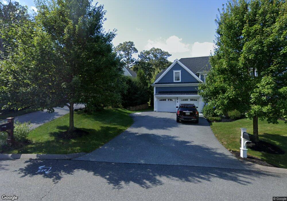
2 Presbrey Place Natick, MA 01760
Estimated Value: $1,144,534 - $1,326,000
4
Beds
3
Baths
2,476
Sq Ft
$503/Sq Ft
Est. Value
About This Home
This home is located at 2 Presbrey Place, Natick, MA 01760 and is currently estimated at $1,244,634, approximately $502 per square foot. 2 Presbrey Place is a home located in Middlesex County with nearby schools including Natick High School, Memorial Elementary School, and J F Kennedy Middle School.
Ownership History
Date
Name
Owned For
Owner Type
Purchase Details
Closed on
Nov 16, 1992
Sold by
Wb&T Rlty Corp
Bought by
Mason Michael J and Mason Julie M
Current Estimated Value
Home Financials for this Owner
Home Financials are based on the most recent Mortgage that was taken out on this home.
Original Mortgage
$135,000
Interest Rate
7.88%
Mortgage Type
Purchase Money Mortgage
Create a Home Valuation Report for This Property
The Home Valuation Report is an in-depth analysis detailing your home's value as well as a comparison with similar homes in the area
Home Values in the Area
Average Home Value in this Area
Purchase History
| Date | Buyer | Sale Price | Title Company |
|---|---|---|---|
| Mason Michael J | $207,343 | -- |
Source: Public Records
Mortgage History
| Date | Status | Borrower | Loan Amount |
|---|---|---|---|
| Open | Mason Michael J | $150,000 | |
| Closed | Mason Michael J | $133,000 | |
| Closed | Mason Michael J | $135,000 |
Source: Public Records
Tax History Compared to Growth
Tax History
| Year | Tax Paid | Tax Assessment Tax Assessment Total Assessment is a certain percentage of the fair market value that is determined by local assessors to be the total taxable value of land and additions on the property. | Land | Improvement |
|---|---|---|---|---|
| 2025 | $11,307 | $945,400 | $477,100 | $468,300 |
| 2024 | $10,986 | $896,100 | $450,600 | $445,500 |
| 2023 | $10,814 | $855,500 | $450,800 | $404,700 |
| 2022 | $10,210 | $765,400 | $375,100 | $390,300 |
| 2021 | $9,780 | $718,600 | $354,600 | $364,000 |
| 2020 | $9,571 | $703,200 | $339,200 | $364,000 |
| 2019 | $8,938 | $703,200 | $339,200 | $364,000 |
| 2018 | $8,744 | $670,000 | $324,500 | $345,500 |
| 2017 | $8,116 | $601,600 | $262,300 | $339,300 |
| 2016 | $8,119 | $598,300 | $262,300 | $336,000 |
| 2015 | $7,883 | $570,400 | $262,300 | $308,100 |
Source: Public Records
Map
Nearby Homes
- 216-218 S Main St
- 6 Ambler Ct
- 16 West St
- 47 High St
- 25 Forest Ave
- 16 Wayside Rd Unit 14
- 16 Wayside Rd
- 48 Graystone Ln
- 8 Floral Avenue Extension
- 8 Floral Ave Unit 8
- 5 Deer Path
- 1 Fern St
- 58 W Central St
- 48 S Main St Unit 7
- 15 Church St Unit 3
- 21 Harvest Moon Dr
- 49 Summer St
- 11 Avon St
- 10 Sundance Way
- 6B Lincoln St Unit 6B