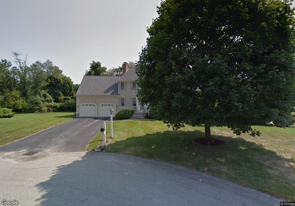
2 Ralston Rd South Weymouth, MA 02190
South Weymouth NeighborhoodEstimated Value: $1,167,000 - $1,508,000
4
Beds
5
Baths
3,538
Sq Ft
$357/Sq Ft
Est. Value
About This Home
This home is located at 2 Ralston Rd, South Weymouth, MA 02190 and is currently estimated at $1,264,439, approximately $357 per square foot. 2 Ralston Rd is a home located in Norfolk County with nearby schools including Ralph Talbot Primary School, Abigail Adams Middle School, and Weymouth Middle School Chapman.
Ownership History
Date
Name
Owned For
Owner Type
Purchase Details
Closed on
Aug 12, 2004
Sold by
Berman Mary M and Berman Robert M
Bought by
2 Ralston Road Rt
Current Estimated Value
Purchase Details
Closed on
Mar 22, 1991
Sold by
Evco Inc
Bought by
Berman Robert M and Berman Mary M
Home Financials for this Owner
Home Financials are based on the most recent Mortgage that was taken out on this home.
Original Mortgage
$150,000
Interest Rate
9.27%
Mortgage Type
Purchase Money Mortgage
Create a Home Valuation Report for This Property
The Home Valuation Report is an in-depth analysis detailing your home's value as well as a comparison with similar homes in the area
Home Values in the Area
Average Home Value in this Area
Purchase History
| Date | Buyer | Sale Price | Title Company |
|---|---|---|---|
| 2 Ralston Road Rt | -- | -- | |
| Berman Robert M | $250,000 | -- |
Source: Public Records
Mortgage History
| Date | Status | Borrower | Loan Amount |
|---|---|---|---|
| Previous Owner | Berman Robert M | $160,000 | |
| Previous Owner | Berman Robert M | $150,000 |
Source: Public Records
Tax History Compared to Growth
Tax History
| Year | Tax Paid | Tax Assessment Tax Assessment Total Assessment is a certain percentage of the fair market value that is determined by local assessors to be the total taxable value of land and additions on the property. | Land | Improvement |
|---|---|---|---|---|
| 2025 | $12,467 | $1,234,400 | $244,800 | $989,600 |
| 2024 | $11,307 | $1,101,000 | $233,200 | $867,800 |
| 2023 | $10,518 | $1,006,500 | $235,500 | $771,000 |
| 2022 | $10,129 | $883,900 | $218,100 | $665,800 |
| 2021 | $9,738 | $829,500 | $218,100 | $611,400 |
| 2020 | $8,902 | $746,800 | $218,100 | $528,700 |
| 2019 | $8,678 | $716,000 | $209,700 | $506,300 |
| 2018 | $8,441 | $675,300 | $199,700 | $475,600 |
| 2017 | $8,243 | $643,500 | $190,200 | $453,300 |
| 2016 | $8,166 | $638,000 | $182,900 | $455,100 |
| 2015 | $7,775 | $602,700 | $182,900 | $419,800 |
| 2014 | $7,443 | $559,600 | $170,200 | $389,400 |
Source: Public Records
Map
Nearby Homes
- 5 Oak St
- 206 Pine St
- 41 Oak St
- 446 Ralph Talbot St
- 261 Pleasant St Unit 5
- 17 Sears Rd
- 120 Burkhall St Unit K
- 11 White St
- 159 Tall Oaks Dr Unit D
- 121 Tall Oaks Dr Unit Q
- 200 Burkhall St Unit 803
- 45 Union St
- 26 Leahaven Rd
- 299 Union St
- 27 Park Ave
- 54 Old Quarry Dr
- 32 Weaver Rd
- 17 Buchanan Ln
- 79 Tilden Rd
- 18 Ben Hogan Landing Unit 18
- 5 Ralston Rd
- 258 Ralph Talbot St
- 248 Ralph Talbot St
- 8 Ralston Rd
- 20 Ralston Rd
- 15 Ralston Rd
- 68 Bradford Rd
- 240 Ralph Talbot St
- 245 Ralph Talbot St
- 60 Bradford Rd
- 65 Bradford Rd
- 65 Bradford Rd
- 273 Ralph Talbot St
- 249 Ralph Talbot St Unit Rear Lot
- 249 Ralph Talbot St
- 230 Ralph Talbot St
- 88 Jordan Dr
- 52 Bradford Rd
- 34 Ralston Rd
- 241 Ralph Talbot St