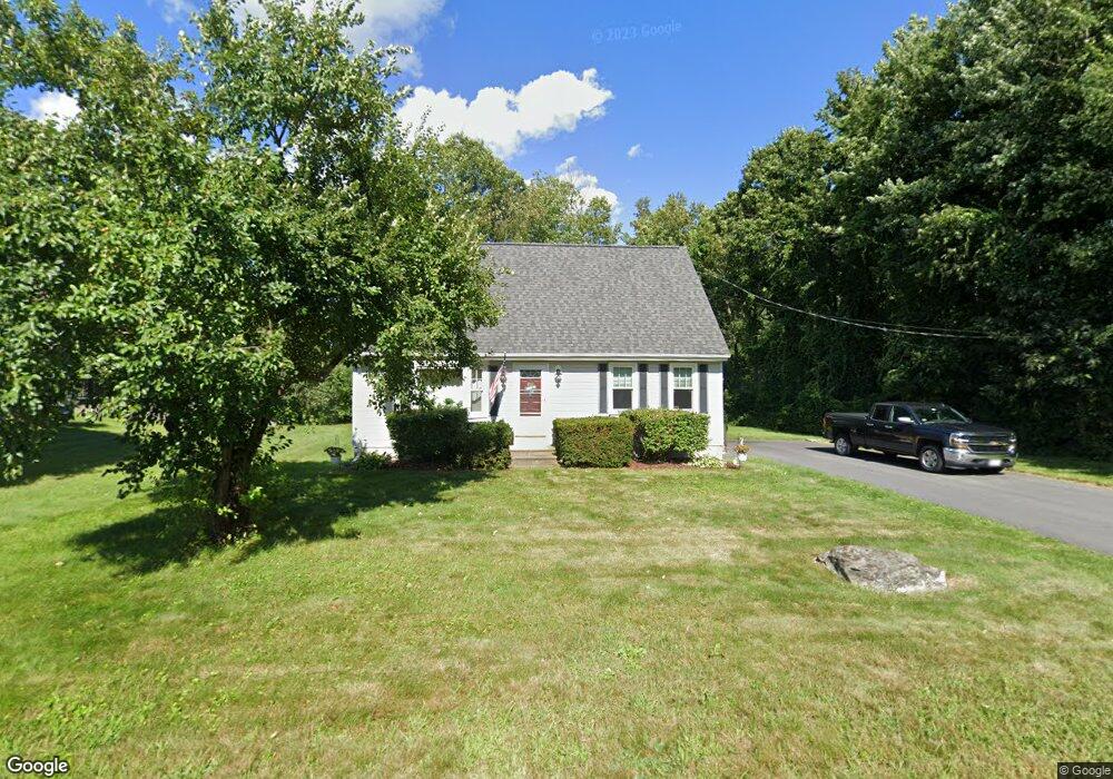
2 Rolling Ridge Rd Rutland, MA 01543
Estimated Value: $437,000 - $494,000
3
Beds
2
Baths
1,428
Sq Ft
$334/Sq Ft
Est. Value
About This Home
This home is located at 2 Rolling Ridge Rd, Rutland, MA 01543 and is currently estimated at $477,178, approximately $334 per square foot. 2 Rolling Ridge Rd is a home located in Worcester County with nearby schools including Wachusett Regional High School.
Ownership History
Date
Name
Owned For
Owner Type
Purchase Details
Closed on
Apr 1, 1992
Sold by
C B Blair Bldrs Inc
Bought by
Welch John G and Welch Karen
Current Estimated Value
Home Financials for this Owner
Home Financials are based on the most recent Mortgage that was taken out on this home.
Original Mortgage
$109,100
Interest Rate
8.73%
Mortgage Type
Purchase Money Mortgage
Create a Home Valuation Report for This Property
The Home Valuation Report is an in-depth analysis detailing your home's value as well as a comparison with similar homes in the area
Home Values in the Area
Average Home Value in this Area
Purchase History
| Date | Buyer | Sale Price | Title Company |
|---|---|---|---|
| Welch John G | $114,900 | -- |
Source: Public Records
Mortgage History
| Date | Status | Borrower | Loan Amount |
|---|---|---|---|
| Open | Welch John G | $125,000 | |
| Closed | Welch John G | $109,800 | |
| Closed | Welch John G | $109,100 |
Source: Public Records
Tax History Compared to Growth
Tax History
| Year | Tax Paid | Tax Assessment Tax Assessment Total Assessment is a certain percentage of the fair market value that is determined by local assessors to be the total taxable value of land and additions on the property. | Land | Improvement |
|---|---|---|---|---|
| 2025 | $5,252 | $368,800 | $95,000 | $273,800 |
| 2024 | $4,707 | $317,400 | $85,300 | $232,100 |
| 2023 | $4,346 | $316,800 | $80,400 | $236,400 |
| 2022 | $4,328 | $274,100 | $68,100 | $206,000 |
| 2021 | $4,177 | $250,100 | $68,100 | $182,000 |
| 2020 | $4,337 | $246,300 | $64,100 | $182,200 |
| 2019 | $4,340 | $242,600 | $58,700 | $183,900 |
| 2018 | $4,123 | $227,400 | $58,700 | $168,700 |
| 2017 | $3,811 | $208,000 | $58,700 | $149,300 |
| 2016 | $3,502 | $201,600 | $58,800 | $142,800 |
| 2015 | $3,260 | $184,700 | $58,800 | $125,900 |
| 2014 | $3,160 | $184,700 | $58,800 | $125,900 |
Source: Public Records
Map
Nearby Homes
- 10 Beechwood Dr
- 7 Prescott St
- 21 Highland Park Rd
- 176 Maple Ave Unit 1-38
- 176 Maple Ave Unit 3-25
- 176 Maple Ave Unit 2-26
- 85 Maple Ave Unit A
- 189 Maple Ave
- 27 Lewis St
- 11 Lewis St
- 21 Lewis St
- 2 Forest Hill Dr
- 12 Lewis St
- 6 Lewis St
- 2226 Main St
- 132 Fidelity Dr Unit 61
- 10 Fidelity Dr Unit 5
- 28 Forest Hill Dr
- 32 Pommogussett Rd Unit 1
- 25 Watson Ln
- 85 Prescott St
- 4 Rolling Ridge Rd
- 1 Rolling Ridge Rd
- 34 Orchard Hill Dr
- 32 Orchard Hill Dr
- 3 Rolling Ridge Rd
- 6 Rolling Ridge Rd
- 30 Orchard Hill Dr
- 5 Rolling Ridge Rd
- 75 Prescott St
- 28 Orchard Hill Dr
- 8 Rolling Ridge Rd
- 73 Prescott St
- 7 Rolling Ridge Rd
- 26 Orchard Hill Dr
- 31 Orchard Hill Dr
- 71 Prescott St
- 10 Rolling Ridge Rd
- 9 Rolling Ridge Rd
- 24 Orchard Hill Dr