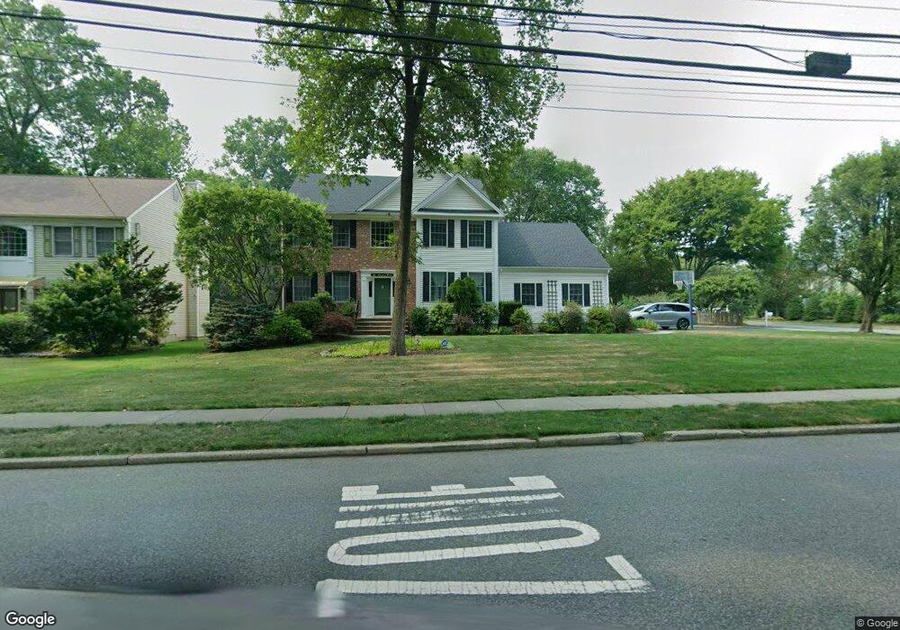
2 Romary Ct Glen Rock, NJ 07452
Estimated Value: $1,471,000 - $2,029,000
4
Beds
3
Baths
2,931
Sq Ft
$572/Sq Ft
Est. Value
About This Home
This home is located at 2 Romary Ct, Glen Rock, NJ 07452 and is currently estimated at $1,677,956, approximately $572 per square foot. 2 Romary Ct is a home located in Bergen County with nearby schools including Glen Rock Middle School, Glen Rock High School, and Academy Of Our Lady At St Catharine.
Ownership History
Date
Name
Owned For
Owner Type
Purchase Details
Closed on
Jun 25, 2018
Sold by
Foley Paul and Foley Joyce
Bought by
Leib Michael A and Lieb Marissa D
Current Estimated Value
Home Financials for this Owner
Home Financials are based on the most recent Mortgage that was taken out on this home.
Original Mortgage
$780,000
Outstanding Balance
$676,079
Interest Rate
4.6%
Mortgage Type
Purchase Money Mortgage
Estimated Equity
$1,001,877
Purchase Details
Closed on
May 8, 1997
Sold by
Greenway Development Co Inc
Bought by
Foley Paul and Foley Joyce
Home Financials for this Owner
Home Financials are based on the most recent Mortgage that was taken out on this home.
Original Mortgage
$175,000
Interest Rate
8.12%
Create a Home Valuation Report for This Property
The Home Valuation Report is an in-depth analysis detailing your home's value as well as a comparison with similar homes in the area
Home Values in the Area
Average Home Value in this Area
Purchase History
| Date | Buyer | Sale Price | Title Company |
|---|---|---|---|
| Leib Michael A | $975,000 | -- | |
| Foley Paul | $489,900 | -- |
Source: Public Records
Mortgage History
| Date | Status | Borrower | Loan Amount |
|---|---|---|---|
| Open | Leib Michael A | $780,000 | |
| Previous Owner | Foley Paul | $175,000 |
Source: Public Records
Tax History Compared to Growth
Tax History
| Year | Tax Paid | Tax Assessment Tax Assessment Total Assessment is a certain percentage of the fair market value that is determined by local assessors to be the total taxable value of land and additions on the property. | Land | Improvement |
|---|---|---|---|---|
| 2025 | $30,056 | $925,100 | $339,400 | $585,700 |
| 2024 | $28,886 | $914,100 | $339,400 | $574,700 |
| 2023 | $28,163 | $914,100 | $339,400 | $574,700 |
| 2022 | $28,163 | $914,100 | $339,400 | $574,700 |
| 2021 | $27,816 | $914,100 | $339,400 | $574,700 |
| 2020 | $27,871 | $914,100 | $339,400 | $574,700 |
| 2019 | $27,140 | $914,100 | $339,400 | $574,700 |
| 2018 | $26,390 | $914,100 | $339,400 | $574,700 |
| 2017 | $25,878 | $914,100 | $339,400 | $574,700 |
| 2016 | $25,503 | $914,100 | $339,400 | $574,700 |
| 2015 | $25,101 | $914,100 | $339,400 | $574,700 |
| 2014 | $24,772 | $914,100 | $339,400 | $574,700 |
Source: Public Records
Map
Nearby Homes
- 43 Hazelhurst Ave
- 14 Oaklynn Place
- 327 Harristown Rd
- 909 S Maple Ave
- 19 Iris Cir
- 153 Glen Ave
- 110 Radburn Rd
- 47 Heathcote Rd
- 274 Cornwall Rd
- 155 Main St
- 209 Cornwall Rd
- 251 Boulevard
- 26 Gaynor Place
- 600 Doremus Ave
- 135 Pinelynn Rd
- 8-24 Fern St Unit 1X
- 8 Bristol Place Unit 1X
- 472 Rock Rd
- 6 Godwin Ave Unit 1X
- 90 Delmar Ave
- 421 Harristown Rd
- 4 Romary Ct
- 416 Harristown Rd
- 6 Romary Ct
- 422 Harristown Rd
- 437 Harristown Rd
- 412 Harristown Rd
- 428 Harristown Rd
- 3 Romary Ct
- 406 Harristown Rd
- 434 Harristown Rd
- 8 Romary Ct
- 5 Romary Ct
- 440 Harristown Rd
- 445 Harristown Rd
- 30 Brookfield Ave
- 26 Brookfield Ave
- 10 Romary Ct
- 266 Rodney St
- 20 Brookfield Ave