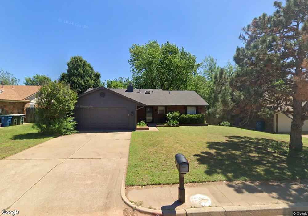
2 S Lockeport Dr Edmond, OK 73003
Oak Brook NeighborhoodEstimated Value: $194,000 - $226,000
3
Beds
2
Baths
1,331
Sq Ft
$162/Sq Ft
Est. Value
About This Home
This home is located at 2 S Lockeport Dr, Edmond, OK 73003 and is currently estimated at $215,196, approximately $161 per square foot. 2 S Lockeport Dr is a home with nearby schools including Ida Freeman Elementary School, Cheyenne Middle School, and North High School.
Ownership History
Date
Name
Owned For
Owner Type
Purchase Details
Closed on
Apr 14, 2021
Sold by
Nani Investmetns Llc
Bought by
Andrews Jeremy David
Current Estimated Value
Home Financials for this Owner
Home Financials are based on the most recent Mortgage that was taken out on this home.
Original Mortgage
$166,920
Outstanding Balance
$150,829
Interest Rate
3.05%
Mortgage Type
FHA
Estimated Equity
$64,367
Purchase Details
Closed on
Nov 17, 2020
Sold by
Neel Donna J
Bought by
Nani Investments Llc
Create a Home Valuation Report for This Property
The Home Valuation Report is an in-depth analysis detailing your home's value as well as a comparison with similar homes in the area
Home Values in the Area
Average Home Value in this Area
Purchase History
| Date | Buyer | Sale Price | Title Company |
|---|---|---|---|
| Andrews Jeremy David | $170,000 | Oklahoma City Abstract & Tit | |
| Nani Investments Llc | $116,000 | Chicago Title Oklahoma Co |
Source: Public Records
Mortgage History
| Date | Status | Borrower | Loan Amount |
|---|---|---|---|
| Open | Andrews Jeremy David | $166,920 |
Source: Public Records
Tax History Compared to Growth
Tax History
| Year | Tax Paid | Tax Assessment Tax Assessment Total Assessment is a certain percentage of the fair market value that is determined by local assessors to be the total taxable value of land and additions on the property. | Land | Improvement |
|---|---|---|---|---|
| 2024 | $2,035 | $20,494 | $3,432 | $17,062 |
| 2023 | $2,035 | $19,519 | $3,475 | $16,044 |
| 2022 | $1,945 | $18,590 | $3,730 | $14,860 |
| 2021 | $1,690 | $16,225 | $3,730 | $12,495 |
| 2020 | $905 | $10,589 | $2,352 | $8,237 |
| 2019 | $910 | $10,589 | $2,378 | $8,211 |
| 2018 | $915 | $10,589 | $0 | $0 |
| 2017 | $911 | $10,588 | $2,441 | $8,147 |
| 2016 | $909 | $10,588 | $2,380 | $8,208 |
| 2015 | $908 | $10,588 | $2,403 | $8,185 |
| 2014 | $907 | $10,588 | $2,500 | $8,088 |
Source: Public Records
Map
Nearby Homes
- 84 Kimberly Dr
- 2016 Emerald Brook Ct
- 2112 W Rockypoint Dr
- 1824 Woody Ln
- 1725 Shady Ct
- 301 Bluegrass Ln
- 344 Abilene Ave
- 109 Woodbridge Cir
- 1632 Laurel Place
- 1812 Foxfire Rd
- 1804 Foxfire Rd
- 1905 Fox Hunt Ln
- 613 Blue Ridge Dr
- 1821 Zion Place
- 1308 Isabella Dr
- 781 N Santa fe Ave
- 2517 Antelope Cir
- 1420 Salem Ave
- 232 Dooley Creek Ln
- 1509 Concord Ct
- 4 S Lockeport Dr
- 6 N Lockeport Dr
- 117 Kimberly Dr
- 109 Kimberly Dr
- 10 N Lockeport Dr
- 3 N Lockeport Dr
- 125 Kimberly Dr
- 101 Kimberly Dr
- 5 S Lockeport Dr
- 7 N Lockeport Dr
- 9 S Lockeport Dr
- 12 S Lockeport Dr
- 133 Kimberly Dr
- 93 Kimberly Dr
- 11 N Lockeport Dr
- 16 N Lockeport Dr
- 6 N Grand Fork Dr
- 13 N Lockeport Dr
- 2 Grand Fork Rd
- 141 Kimberly Dr