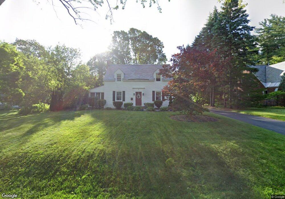
2 S Maple Ln Albany, NY 12211
Estimated Value: $401,000 - $483,000
3
Beds
2
Baths
1,120
Sq Ft
$395/Sq Ft
Est. Value
About This Home
This home is located at 2 S Maple Ln, Albany, NY 12211 and is currently estimated at $441,881, approximately $394 per square foot. 2 S Maple Ln is a home located in Albany County with nearby schools including Loudonville Elementary School, Shaker Junior High School, and Shaker High School.
Ownership History
Date
Name
Owned For
Owner Type
Purchase Details
Closed on
Dec 21, 2007
Sold by
Orourke C
Bought by
Napierksi Carol Anne
Current Estimated Value
Home Financials for this Owner
Home Financials are based on the most recent Mortgage that was taken out on this home.
Original Mortgage
$148,000
Outstanding Balance
$91,388
Interest Rate
6.27%
Mortgage Type
New Conventional
Estimated Equity
$350,493
Purchase Details
Closed on
Jul 11, 2007
Home Financials for this Owner
Home Financials are based on the most recent Mortgage that was taken out on this home.
Original Mortgage
$174,960
Interest Rate
6.54%
Create a Home Valuation Report for This Property
The Home Valuation Report is an in-depth analysis detailing your home's value as well as a comparison with similar homes in the area
Home Values in the Area
Average Home Value in this Area
Purchase History
| Date | Buyer | Sale Price | Title Company |
|---|---|---|---|
| Napierksi Carol Anne | $267,000 | -- | |
| -- | $218,700 | -- | |
| Orourke Cj | $218,700 | None Available |
Source: Public Records
Mortgage History
| Date | Status | Borrower | Loan Amount |
|---|---|---|---|
| Open | Napierksi Carol Anne | $148,000 | |
| Previous Owner | Orourke Cj | $174,960 |
Source: Public Records
Tax History
| Year | Tax Paid | Tax Assessment Tax Assessment Total Assessment is a certain percentage of the fair market value that is determined by local assessors to be the total taxable value of land and additions on the property. | Land | Improvement |
|---|---|---|---|---|
| 2025 | $6,313 | $149,500 | $37,400 | $112,100 |
| 2024 | $6,313 | $149,500 | $37,400 | $112,100 |
| 2023 | $6,164 | $149,500 | $37,400 | $112,100 |
| 2022 | $6,037 | $149,500 | $37,400 | $112,100 |
| 2021 | $6,010 | $149,500 | $37,400 | $112,100 |
| 2020 | $5,294 | $146,500 | $36,600 | $109,900 |
| 2019 | $2,972 | $146,500 | $36,600 | $109,900 |
| 2018 | $5,192 | $146,500 | $36,600 | $109,900 |
| 2017 | $3,227 | $146,500 | $36,600 | $109,900 |
| 2016 | $5,017 | $146,500 | $36,600 | $109,900 |
| 2015 | -- | $146,500 | $36,600 | $109,900 |
| 2014 | -- | $146,500 | $36,600 | $109,900 |
Source: Public Records
Map
Nearby Homes
Your Personal Tour Guide
Ask me questions while you tour the home.