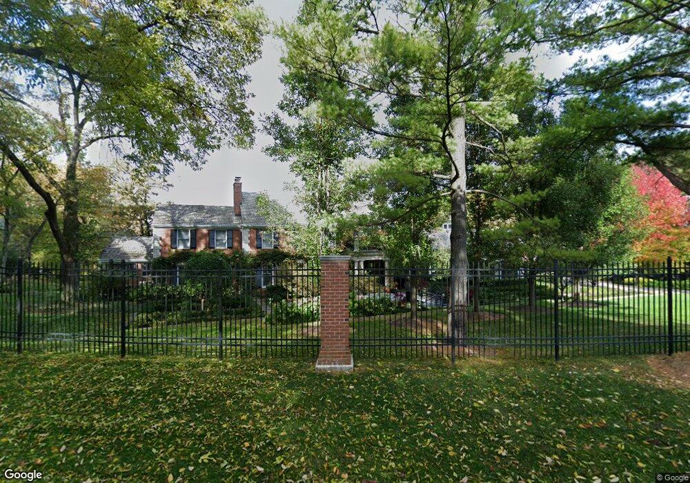
2 Saville Row Barrington, IL 60010
North Barrington Hills NeighborhoodEstimated Value: $1,179,468 - $1,572,000
5
Beds
6
Baths
5,405
Sq Ft
$259/Sq Ft
Est. Value
About This Home
This home is located at 2 Saville Row, Barrington, IL 60010 and is currently estimated at $1,400,823, approximately $259 per square foot. 2 Saville Row is a home located in McHenry County with nearby schools including Countryside Elementary School, Barrington Middle School Station Campus, and Barrington High School.
Ownership History
Date
Name
Owned For
Owner Type
Purchase Details
Closed on
May 18, 2012
Sold by
Carter Culp Cathy and Culp Joseph F
Bought by
Carter Cathy and Revocable Trust Agreement Of Cathy Carte
Current Estimated Value
Purchase Details
Closed on
Nov 4, 2005
Sold by
Chicago Title Land Trust Co
Bought by
Culp Joseph F and Carter Culp Cathy
Home Financials for this Owner
Home Financials are based on the most recent Mortgage that was taken out on this home.
Original Mortgage
$1,000,000
Outstanding Balance
$542,211
Interest Rate
5.87%
Mortgage Type
Purchase Money Mortgage
Estimated Equity
$858,612
Create a Home Valuation Report for This Property
The Home Valuation Report is an in-depth analysis detailing your home's value as well as a comparison with similar homes in the area
Home Values in the Area
Average Home Value in this Area
Purchase History
| Date | Buyer | Sale Price | Title Company |
|---|---|---|---|
| Carter Cathy | -- | Mt | |
| Culp Joseph F | $1,350,000 | Stewart Title Company |
Source: Public Records
Mortgage History
| Date | Status | Borrower | Loan Amount |
|---|---|---|---|
| Open | Culp Joseph F | $1,000,000 |
Source: Public Records
Tax History Compared to Growth
Tax History
| Year | Tax Paid | Tax Assessment Tax Assessment Total Assessment is a certain percentage of the fair market value that is determined by local assessors to be the total taxable value of land and additions on the property. | Land | Improvement |
|---|---|---|---|---|
| 2024 | $28,505 | $403,771 | $92,442 | $311,329 |
| 2023 | $30,947 | $361,123 | $82,678 | $278,445 |
| 2022 | $25,440 | $314,996 | $99,132 | $215,864 |
| 2021 | $24,707 | $293,456 | $92,353 | $201,103 |
| 2020 | $26,883 | $303,111 | $89,084 | $214,027 |
| 2019 | $23,974 | $304,000 | $130,320 | $173,680 |
| 2018 | $30,366 | $372,638 | $120,388 | $252,250 |
| 2017 | $29,135 | $351,048 | $113,413 | $237,635 |
| 2016 | $27,889 | $329,251 | $106,371 | $222,880 |
| 2013 | -- | $307,147 | $99,229 | $207,918 |
Source: Public Records
Map
Nearby Homes
- 3 Saville Row
- 727 Old Hunt Rd
- 9500 Church Rd
- 460 Hunters Way
- 1006 Pine St
- 400 Crestview Rd
- 346 Bristol Ln Unit 6361
- 500 Tower Place
- 1200 Hillcrest Ave
- 1221 Lincoln Ave
- 208 S River Rd
- 209 Gladys Ave
- 11 Moate Ln
- 2313 Evergreen Ave Unit 80
- 9802 Gallek Rd
- Lot 1 Asbury Ave
- 9814 River Bluff Ln
- 111 Grace Ln
- LOT 2 Asbury Ave
- 6 Jacqueline Ln
- 10304 Braeburn Rd
- 1 Saville Row
- 8 Saville Row
- 4 Saville Row
- 210C Braeburn Rd
- 7 Saville Row
- 10306 Braeburn Rd
- 211 Braeburn Rd
- 212 Braeburn Rd
- 19 Burning Oak Trail
- 5 Saville Row
- 207 Braeburn Rd
- 1605 Burning Oak Trail
- 6 Saville Row
- 1603 Burning Oak Trail
- 10418 Braeburn Rd
- 203 Braeburn Rd
- 17 Burning Oak Trail
- 21 Burning Oak Trail
- 1313 Plumtree Rd