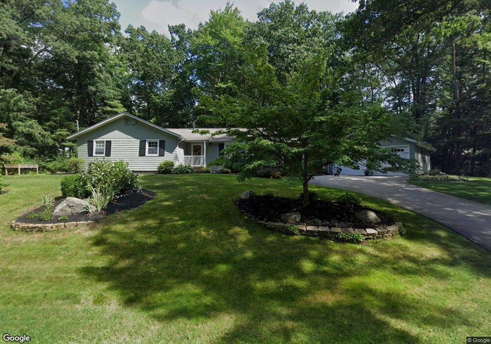
2 Scott Ave Nashua, NH 03062
Southwest Nashua NeighborhoodEstimated Value: $701,000 - $797,000
3
Beds
2
Baths
1,724
Sq Ft
$434/Sq Ft
Est. Value
About This Home
This home is located at 2 Scott Ave, Nashua, NH 03062 and is currently estimated at $748,277, approximately $434 per square foot. 2 Scott Ave is a home located in Hillsborough County with nearby schools including Bicentennial Elementary School, Fairgrounds Middle School, and Nashua High School South.
Ownership History
Date
Name
Owned For
Owner Type
Purchase Details
Closed on
Jun 25, 2025
Sold by
Beoridge Llc
Bought by
Ward Ft and Ward
Current Estimated Value
Purchase Details
Closed on
Oct 7, 2016
Sold by
Jancie M Martin Ret and Martin
Bought by
Morrell Peter and Brickey Lori
Home Financials for this Owner
Home Financials are based on the most recent Mortgage that was taken out on this home.
Original Mortgage
$250,000
Interest Rate
3.43%
Mortgage Type
New Conventional
Create a Home Valuation Report for This Property
The Home Valuation Report is an in-depth analysis detailing your home's value as well as a comparison with similar homes in the area
Home Values in the Area
Average Home Value in this Area
Purchase History
| Date | Buyer | Sale Price | Title Company |
|---|---|---|---|
| Ward Ft | $739,933 | None Available | |
| Ward Ft | $739,933 | None Available | |
| Morrell Peter | $355,000 | -- | |
| Morrell Peter | $355,000 | -- |
Source: Public Records
Mortgage History
| Date | Status | Borrower | Loan Amount |
|---|---|---|---|
| Previous Owner | Morrell Peter | $250,000 |
Source: Public Records
Tax History
| Year | Tax Paid | Tax Assessment Tax Assessment Total Assessment is a certain percentage of the fair market value that is determined by local assessors to be the total taxable value of land and additions on the property. | Land | Improvement |
|---|---|---|---|---|
| 2025 | $9,841 | $584,700 | $188,400 | $396,300 |
| 2024 | $9,297 | $584,700 | $188,400 | $396,300 |
| 2023 | $8,896 | $488,000 | $150,700 | $337,300 |
| 2022 | $8,818 | $488,000 | $150,700 | $337,300 |
| 2021 | $7,978 | $343,600 | $110,500 | $233,100 |
| 2020 | $7,769 | $343,600 | $110,500 | $233,100 |
| 2019 | $7,477 | $343,600 | $110,500 | $233,100 |
| 2018 | $7,264 | $342,500 | $110,500 | $232,000 |
| 2017 | $6,809 | $264,000 | $95,100 | $168,900 |
| 2016 | $6,618 | $264,000 | $95,100 | $168,900 |
| 2015 | $6,476 | $264,000 | $95,100 | $168,900 |
| 2014 | $6,349 | $264,000 | $95,100 | $168,900 |
Source: Public Records
Map
Nearby Homes
- 137 Peele Rd
- 16 Emerson Rd
- 3 Appaloosa Place
- 8 Oakdale Ave
- 256 E Dunstable Rd
- 4 Chelsea Ct
- 17 Bicentennial Dr
- 57 Timberline Dr
- 8 Collier Ct
- 2 Prestwick Trail Unit U8
- 2 Prestwick Trail Unit 2
- 20 Salmon Brook Dr
- 19 Lisa Dr
- 22 Taschereau Blvd
- 70 Spindlewick Dr
- 15 Taschereau Blvd
- 21 Cannon Dr
- 16 Stillwater Dr Unit U111
- 10 Weymouth Dr
- 17 Custom St
- 75 Tennyson Ave
- 61 Tennyson Ave
- 84 Tennyson Ave
- 8 Scott Ave
- 9 Scott Ave
- 88 Shelley Dr
- 78 Tennyson Ave
- 60 Tennyson Ave
- 60 Tennyson Ave Unit House
- 60 Tennyson Ave
- 60 Tennyson Ave Unit Main Floor
- 2 Marlowe Rd
- 59 Tennyson Ave
- 88 Tennyson Ave
- 8 Kipling St
- 12 Kipling St
- 12 Shadwell Rd
- 10 Shadwell Rd
- 10 Marlowe Rd
- 14 Shadwell Rd
Your Personal Tour Guide
Ask me questions while you tour the home.