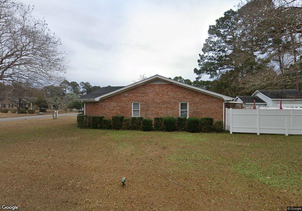
2 Shawnee Trail Myrtle Beach, SC 29588
Estimated Value: $335,842 - $353,000
3
Beds
2
Baths
2,002
Sq Ft
$174/Sq Ft
Est. Value
About This Home
This home is located at 2 Shawnee Trail, Myrtle Beach, SC 29588 and is currently estimated at $347,961, approximately $173 per square foot. 2 Shawnee Trail is a home located in Horry County with nearby schools including Socastee Elementary School, Forestbrook Middle School, and Socastee High School.
Ownership History
Date
Name
Owned For
Owner Type
Purchase Details
Closed on
Jan 29, 2018
Sold by
Apperson Stephen L
Bought by
Apperson Stephen L and Apperson Irene
Current Estimated Value
Home Financials for this Owner
Home Financials are based on the most recent Mortgage that was taken out on this home.
Original Mortgage
$195,106
Outstanding Balance
$163,320
Interest Rate
3.99%
Mortgage Type
VA
Estimated Equity
$184,641
Create a Home Valuation Report for This Property
The Home Valuation Report is an in-depth analysis detailing your home's value as well as a comparison with similar homes in the area
Home Values in the Area
Average Home Value in this Area
Purchase History
| Date | Buyer | Sale Price | Title Company |
|---|---|---|---|
| Apperson Stephen L | -- | -- |
Source: Public Records
Mortgage History
| Date | Status | Borrower | Loan Amount |
|---|---|---|---|
| Open | Apperson Stephen L | $195,106 |
Source: Public Records
Tax History
| Year | Tax Paid | Tax Assessment Tax Assessment Total Assessment is a certain percentage of the fair market value that is determined by local assessors to be the total taxable value of land and additions on the property. | Land | Improvement |
|---|---|---|---|---|
| 2025 | $689 | $0 | $0 | $0 |
| 2024 | $689 | $14,480 | $4,000 | $10,480 |
| 2023 | $689 | $7,412 | $1,140 | $6,272 |
| 2021 | $601 | $7,412 | $1,140 | $6,272 |
| 2020 | $515 | $7,412 | $1,140 | $6,272 |
| 2019 | $2,325 | $7,412 | $1,140 | $6,272 |
| 2018 | $420 | $14,435 | $1,110 | $13,325 |
| 2017 | $405 | $6,186 | $1,110 | $5,076 |
| 2016 | -- | $6,186 | $1,110 | $5,076 |
| 2015 | $412 | $6,186 | $1,110 | $5,076 |
| 2014 | $382 | $6,186 | $1,110 | $5,076 |
Source: Public Records
Map
Nearby Homes
- 2 Sioux Trail
- 4 Plantation Rd
- 71 Plantation Rd
- 5567 Rosewood Dr
- 29 Cheyenne Rd Unit MB
- 303 Clear Creek Cir
- 124 Manor Cir
- 400 Meadowbrook Dr
- 218 Rice Mill Dr
- 209 Stonebrook Dr
- 407 Meadowbrook Dr
- 5724 Dogwood Cir
- 403 Brandymill Blvd
- 368 Cattle Drive Cir
- 389 Cattle Drive Cir
- 105 Old Carriage Ct
- 339 Burchwood Ln
- 2397 River Rd
- 252 Stonebrook Dr
- 424 Wallingford Cir
- 4 Shawnee Trail
- 17 Plantation Rd
- 18 Plantation Rd
- 20 Plantation Rd
- 6 Shawnee Trail
- 1 Shawnee Trail Unit MB
- 14 Apache Trail
- 16 Plantation Rd
- 19 Plantation Rd
- 22 Plantation Rd
- 3 Shawnee Trail
- 14 Plantation Rd
- 10 Apache Trail
- 16 Apache Trail
- 24 Plantation Rd Unit 24 Plantation Road
- 24 Plantation Rd
- TBD Plantation Rd Unit 84 PLANTATION ROAD (
- TBD Plantation Rd Unit cimerron plantation
- 11 Plantation Rd
- 21 Plantation Rd
Your Personal Tour Guide
Ask me questions while you tour the home.