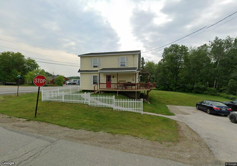
2 Shepard Rd Belfast, ME 04915
Estimated Value: $294,000 - $618,000
3
Beds
1
Bath
869
Sq Ft
$473/Sq Ft
Est. Value
About This Home
This home is located at 2 Shepard Rd, Belfast, ME 04915 and is currently estimated at $410,967, approximately $472 per square foot. 2 Shepard Rd is a home located in Waldo County with nearby schools including Cornerspring Children's House and The School At Sweetser - Belfast.
Ownership History
Date
Name
Owned For
Owner Type
Purchase Details
Closed on
Dec 3, 2010
Sold by
Maddocks Peter J and Maddocks Jennifer M
Bought by
Maddocks Peter J
Current Estimated Value
Purchase Details
Closed on
Jul 14, 2006
Sold by
Grant Justin
Bought by
Maddocks Peter J and Maddocks Jennifer M
Home Financials for this Owner
Home Financials are based on the most recent Mortgage that was taken out on this home.
Original Mortgage
$130,000
Outstanding Balance
$75,793
Interest Rate
6.71%
Mortgage Type
Stand Alone Second
Estimated Equity
$335,174
Create a Home Valuation Report for This Property
The Home Valuation Report is an in-depth analysis detailing your home's value as well as a comparison with similar homes in the area
Home Values in the Area
Average Home Value in this Area
Purchase History
| Date | Buyer | Sale Price | Title Company |
|---|---|---|---|
| Maddocks Peter J | -- | -- | |
| Maddocks Peter J | -- | -- |
Source: Public Records
Mortgage History
| Date | Status | Borrower | Loan Amount |
|---|---|---|---|
| Open | Maddocks Peter J | $130,000 | |
| Closed | Maddocks Peter J | $24,375 |
Source: Public Records
Tax History
| Year | Tax Paid | Tax Assessment Tax Assessment Total Assessment is a certain percentage of the fair market value that is determined by local assessors to be the total taxable value of land and additions on the property. | Land | Improvement |
|---|---|---|---|---|
| 2025 | $4,569 | $279,600 | $67,800 | $211,800 |
| 2024 | $4,287 | $278,400 | $67,800 | $210,600 |
| 2023 | $3,150 | $156,700 | $32,500 | $124,200 |
| 2022 | $3,193 | $149,200 | $32,500 | $116,700 |
| 2021 | $3,282 | $149,200 | $32,500 | $116,700 |
| 2020 | $3,304 | $141,800 | $32,500 | $109,300 |
| 2019 | $3,247 | $141,800 | $32,500 | $109,300 |
| 2018 | $3,219 | $141,800 | $32,500 | $109,300 |
| 2017 | $3,105 | $141,800 | $32,500 | $109,300 |
| 2016 | $3,034 | $132,500 | $23,200 | $109,300 |
| 2015 | $2,968 | $132,500 | $23,200 | $109,300 |
| 2014 | $2,869 | $132,500 | $23,200 | $109,300 |
| 2013 | $2,756 | $132,500 | $23,200 | $109,300 |
Source: Public Records
Map
Nearby Homes
- 050-C-1 W Waldo Rd
- 99 Waterville Rd
- 17 Marsh Rd
- 86 Oak Hill Rd
- 20 Springbrook Dr Unit TH-6
- 55 Londonderry Ln
- 000 Merriam Rd
- 388 High St
- 225 Waldo Ave
- 100 Belmont Ave Unit 2
- 162 Waldo Ave
- 0 Robbins Rd Unit 1634953
- 9 Rolerson Rd
- 101 Waldo Ave Unit 3-1
- Lot 5 Waukeag Way
- 53 Lincolnville Ave
- 183 Main St
- 18 Waldo Ave
- 2 Swan Lake Ave
- 9 James St
- "0" Shepard
- """0""" Shepard Rd
- 4 Shepard Rd
- 190 Waterville Rd
- 185 Waterville Rd
- 0 Head of Tide Rd Unit 637843
- 0 Head of Tide Rd Unit 831302
- 0 Head of Tide Rd Unit 637881
- 0 Head of Tide Rd Unit 252379
- 0 Head of Tide Rd Unit 206369
- 0 Head of Tide Rd Unit 1220305
- 0 Head of Tide Rd Unit 944906
- 0 Head of the Tide Rd Unit 1009990
- 0 Head of Tide Rd Unit 1055553
- 4 Head of the Tide Rd
- 181 Waterville Rd Unit 137
- 6 Head of the Tide Rd
- 180 Waterville Rd
- 2 Head of the Tide Rd
- 196 Waterville Rd
Your Personal Tour Guide
Ask me questions while you tour the home.