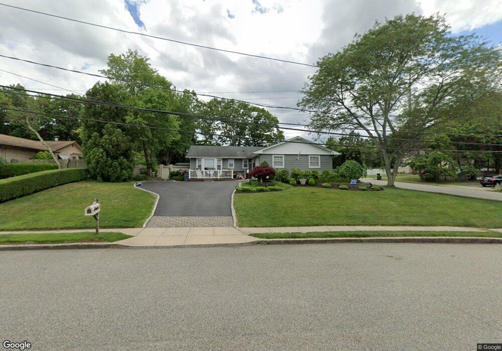
2 Spacecraft Ln Hauppauge, NY 11788
Estimated Value: $690,722 - $814,000
Studio
--
Bath
--
Sq Ft
19,166
Sq Ft Lot
About This Home
This home is located at 2 Spacecraft Ln, Hauppauge, NY 11788 and is currently estimated at $747,681. 2 Spacecraft Ln is a home located in Suffolk County with nearby schools including Hauppauge Middle School and Hauppauge High School.
Ownership History
Date
Name
Owned For
Owner Type
Purchase Details
Closed on
Sep 25, 2003
Sold by
Prudential Residential Services
Bought by
Pirnat Mark and Pirnat Melissa
Current Estimated Value
Home Financials for this Owner
Home Financials are based on the most recent Mortgage that was taken out on this home.
Original Mortgage
$322,000
Outstanding Balance
$149,645
Interest Rate
6.15%
Mortgage Type
Purchase Money Mortgage
Estimated Equity
$598,036
Purchase Details
Closed on
Jun 18, 2003
Sold by
Clarke Richard Thomas and Clarke Janet L
Bought by
Prudential Residential Services
Create a Home Valuation Report for This Property
The Home Valuation Report is an in-depth analysis detailing your home's value as well as a comparison with similar homes in the area
Home Values in the Area
Average Home Value in this Area
Purchase History
| Date | Buyer | Sale Price | Title Company |
|---|---|---|---|
| Pirnat Mark | $430,000 | Chicago Title Insurance Co | |
| Prudential Residential Services | $430,000 | Chicago Title Insurance Co |
Source: Public Records
Mortgage History
| Date | Status | Borrower | Loan Amount |
|---|---|---|---|
| Open | Pirnat Mark | $322,000 |
Source: Public Records
Tax History
| Year | Tax Paid | Tax Assessment Tax Assessment Total Assessment is a certain percentage of the fair market value that is determined by local assessors to be the total taxable value of land and additions on the property. | Land | Improvement |
|---|---|---|---|---|
| 2024 | $10,544 | $49,250 | $13,200 | $36,050 |
| 2023 | $10,544 | $49,250 | $13,200 | $36,050 |
| 2022 | $8,447 | $49,250 | $13,200 | $36,050 |
| 2021 | $8,447 | $49,250 | $13,200 | $36,050 |
| 2020 | $8,708 | $49,250 | $13,200 | $36,050 |
| 2019 | $8,447 | $0 | $0 | $0 |
| 2018 | -- | $49,250 | $13,200 | $36,050 |
| 2017 | $8,918 | $49,250 | $13,200 | $36,050 |
| 2016 | $8,555 | $49,250 | $13,200 | $36,050 |
| 2015 | -- | $49,250 | $13,200 | $36,050 |
| 2014 | -- | $49,250 | $13,200 | $36,050 |
Source: Public Records
Map
Nearby Homes
- 11 Dale Ln
- NC Seusing Blvd
- 111 Schneider Ln
- 19 Fairview Place
- 43 Harrison Ave
- 24 Ridge Ct
- 154 Mac Arthur Blvd
- 378 Mac Arthur Blvd
- 11 Marlo Ln
- 123 Feller Dr
- 1010 Motor Pkwy
- 639 Townline Rd
- 288 Feller Dr
- 59 Adams Rd
- 100 Hawthorne Ave
- 71 Adams Rd Unit E 2A
- 346 Ridgefield Rd
- 11 Mcgowan Ln
- 22 E Halley Ln
- 18 Hilliard Ave
- 6 Spacecraft Ln
- 10 Spacecraft Ln
- 113 Atlantic Place
- 120 Atlantic Place
- 116 Atlantic Place
- 127 Atlantic Place
- 126 Atlantic Place
- 9 Spacecraft Ln
- 14 Spacecraft Ln
- 109 Atlantic Place
- 131 Atlantic Place
- 15 Spacecraft Ln
- 130 Atlantic Place
- 18 Spacecraft Ln
- 105 Atlantic Place
- 108 Atlantic Place
- 135 Atlantic Place
- 19 Spacecraft Ln
- 341 Hubbs Ave
- 345 Hubbs Ave
Your Personal Tour Guide
Ask me questions while you tour the home.