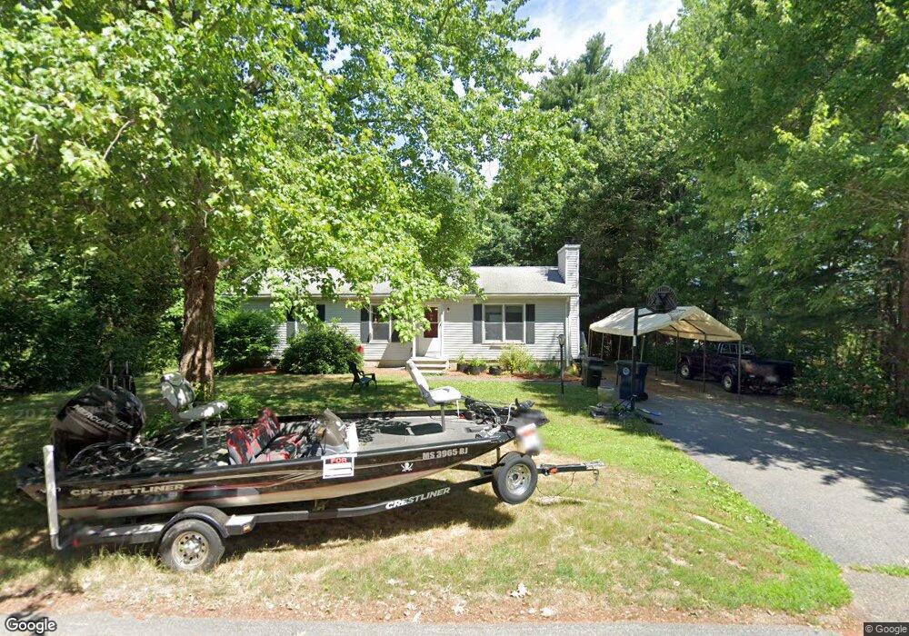
2 Stanley Rd Medway, MA 02053
Estimated Value: $555,000 - $734,000
3
Beds
2
Baths
1,152
Sq Ft
$551/Sq Ft
Est. Value
About This Home
This home is located at 2 Stanley Rd, Medway, MA 02053 and is currently estimated at $634,720, approximately $550 per square foot. 2 Stanley Rd is a home located in Norfolk County with nearby schools including John D. McGovern Elementary School, Burke-Memorial Elementary, and Medway Middle School.
Ownership History
Date
Name
Owned For
Owner Type
Purchase Details
Closed on
Jul 14, 2005
Sold by
Rances Grant and Rances Butler F
Bought by
Power Deborah M and Power Michael F
Current Estimated Value
Home Financials for this Owner
Home Financials are based on the most recent Mortgage that was taken out on this home.
Original Mortgage
$230,000
Outstanding Balance
$120,140
Interest Rate
5.67%
Mortgage Type
Purchase Money Mortgage
Estimated Equity
$514,580
Purchase Details
Closed on
Jul 18, 1995
Sold by
Leesberg Kenneth A and Leeseberg Candace M
Bought by
Butler Grant and Butler Frances B
Home Financials for this Owner
Home Financials are based on the most recent Mortgage that was taken out on this home.
Original Mortgage
$105,600
Interest Rate
7.7%
Mortgage Type
Purchase Money Mortgage
Purchase Details
Closed on
Dec 31, 1991
Sold by
Sebio Michelle V
Bought by
Leeseberg Candace M and Leeseberg Ken A
Home Financials for this Owner
Home Financials are based on the most recent Mortgage that was taken out on this home.
Original Mortgage
$100,740
Interest Rate
8.62%
Mortgage Type
Purchase Money Mortgage
Create a Home Valuation Report for This Property
The Home Valuation Report is an in-depth analysis detailing your home's value as well as a comparison with similar homes in the area
Home Values in the Area
Average Home Value in this Area
Purchase History
| Date | Buyer | Sale Price | Title Company |
|---|---|---|---|
| Power Deborah M | $287,500 | -- | |
| Butler Grant | $132,000 | -- | |
| Leeseberg Candace M | $116,900 | -- |
Source: Public Records
Mortgage History
| Date | Status | Borrower | Loan Amount |
|---|---|---|---|
| Open | Power Deborah M | $230,000 | |
| Previous Owner | Leeseberg Candace M | $105,600 | |
| Previous Owner | Leeseberg Candace M | $100,740 |
Source: Public Records
Tax History Compared to Growth
Tax History
| Year | Tax Paid | Tax Assessment Tax Assessment Total Assessment is a certain percentage of the fair market value that is determined by local assessors to be the total taxable value of land and additions on the property. | Land | Improvement |
|---|---|---|---|---|
| 2025 | $7,051 | $494,800 | $305,100 | $189,700 |
| 2024 | $7,125 | $494,800 | $305,100 | $189,700 |
| 2023 | $6,639 | $416,500 | $252,800 | $163,700 |
| 2022 | $6,560 | $387,500 | $224,500 | $163,000 |
| 2021 | $6,431 | $368,300 | $207,100 | $161,200 |
| 2020 | $6,179 | $353,100 | $191,900 | $161,200 |
| 2019 | $5,917 | $348,700 | $191,900 | $156,800 |
| 2018 | $6,004 | $340,000 | $183,200 | $156,800 |
| 2017 | $5,557 | $310,100 | $159,000 | $151,100 |
| 2016 | $5,509 | $304,200 | $153,100 | $151,100 |
| 2015 | $5,333 | $292,400 | $141,300 | $151,100 |
| 2014 | $4,561 | $242,100 | $141,400 | $100,700 |
Source: Public Records
Map
Nearby Homes
- 15 Broad Acres Farm Rd
- 12 Longmeadow Ln
- 6 Freedom Trail
- 78 Fisher St
- 4 Deerfield Rd
- 116 Winthrop St
- 176 Main St Unit 3
- 85 Fisher St
- 5 Fales St
- 19 Sycamore Way Unit L40
- 14 Heritage Dr
- 220 Main St Unit 220
- 36 Lovering St
- 28 Wellington St
- 6 Rainbow Dr
- 39 West St
- 7 Hill St
- 22 Sunset Dr
- 56 Paul Rd
- 12 Lovering St
- 4 Stanley Rd
- 1 Stanley Rd
- 3 Stanley Rd
- 1 Stanley Rd
- 5 Stanley Rd
- 104 Summer St
- 6 Stanley Rd
- 6 Spring St
- 4 Summer Hill Rd Unit 4
- 4 Summer Hill Rd Unit a
- 4 Spring St
- 8 Stanley Rd
- 6 Summer Hill Rd
- 2 Spring St
- 8 Blueberry Hill Rd
- 4 Blueberry Hill Rd
- 116 Summer St
- 8 Summer Hill Rd
- 5 Spring St
- 3 Summer Hill Rd