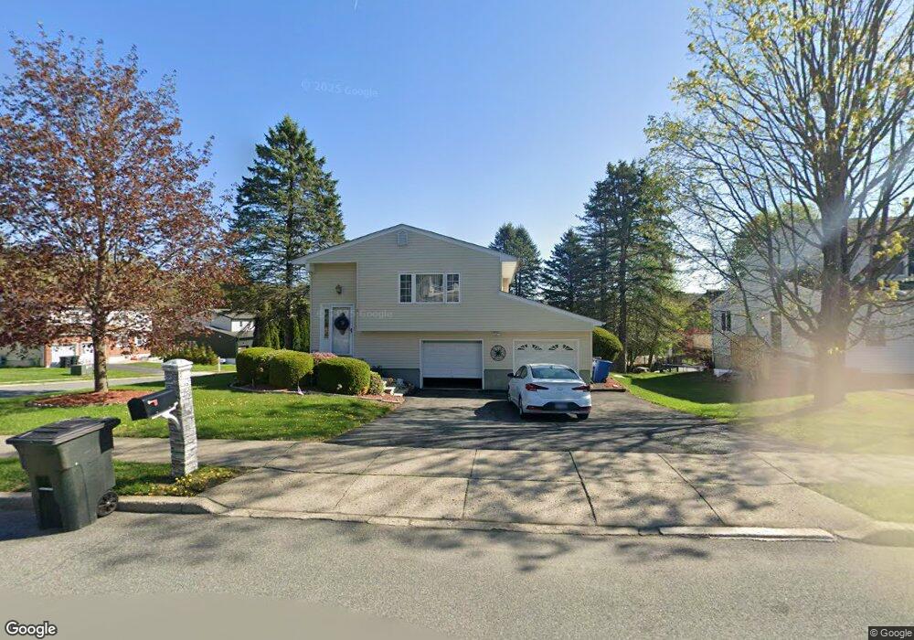
2 Sutherland Dr Monroe, NY 10950
Estimated Value: $562,000 - $582,000
4
Beds
2
Baths
1,162
Sq Ft
$493/Sq Ft
Est. Value
About This Home
This home is located at 2 Sutherland Dr, Monroe, NY 10950 and is currently estimated at $572,492, approximately $492 per square foot. 2 Sutherland Dr is a home located in Orange County with nearby schools including Monroe-Woodbury Middle School, Monroe-Woodbury High School, and St. Paul Christian Education Center.
Ownership History
Date
Name
Owned For
Owner Type
Purchase Details
Closed on
Mar 26, 2015
Sold by
Psarakis Emmanuel
Bought by
Psarakis Emmanuil and Psarakis Psarakis
Current Estimated Value
Purchase Details
Closed on
Jan 31, 2000
Sold by
Gilmore William
Bought by
Psarakis Emmanuel and Psarakis Nicolette
Home Financials for this Owner
Home Financials are based on the most recent Mortgage that was taken out on this home.
Original Mortgage
$150,800
Interest Rate
7.98%
Mortgage Type
Purchase Money Mortgage
Purchase Details
Closed on
Jul 22, 1998
Sold by
Bankers Trust Company Of California Na
Bought by
Gilmore William
Home Financials for this Owner
Home Financials are based on the most recent Mortgage that was taken out on this home.
Original Mortgage
$132,000
Interest Rate
6.78%
Purchase Details
Closed on
Sep 23, 1993
Sold by
Va
Bought by
Bankers Trust Company Of California Na
Create a Home Valuation Report for This Property
The Home Valuation Report is an in-depth analysis detailing your home's value as well as a comparison with similar homes in the area
Home Values in the Area
Average Home Value in this Area
Purchase History
| Date | Buyer | Sale Price | Title Company |
|---|---|---|---|
| Psarakis Emmanuil | -- | -- | |
| Psarakis Emmanuel | $188,500 | -- | |
| Gilmore William | $118,100 | Allied Title Agency Inc | |
| Bankers Trust Company Of California Na | $100,000 | -- |
Source: Public Records
Mortgage History
| Date | Status | Borrower | Loan Amount |
|---|---|---|---|
| Previous Owner | Psarakis Emmanuel | $150,800 | |
| Previous Owner | Gilmore William | $132,000 |
Source: Public Records
Tax History
| Year | Tax Paid | Tax Assessment Tax Assessment Total Assessment is a certain percentage of the fair market value that is determined by local assessors to be the total taxable value of land and additions on the property. | Land | Improvement |
|---|---|---|---|---|
| 2024 | $13,614 | $58,000 | $15,000 | $43,000 |
| 2023 | $13,614 | $58,000 | $15,000 | $43,000 |
| 2022 | $13,178 | $58,000 | $15,000 | $43,000 |
| 2021 | $13,262 | $58,000 | $15,000 | $43,000 |
| 2020 | $12,187 | $58,000 | $15,000 | $43,000 |
| 2019 | $11,924 | $58,000 | $15,000 | $43,000 |
| 2018 | $11,924 | $58,000 | $15,000 | $43,000 |
| 2017 | $11,688 | $58,000 | $15,000 | $43,000 |
| 2016 | $11,687 | $58,000 | $15,000 | $43,000 |
| 2015 | -- | $58,000 | $15,000 | $43,000 |
| 2014 | -- | $58,000 | $15,000 | $43,000 |
Source: Public Records
Map
Nearby Homes
- 14 Half Hollow Turn
- 19 Half Hollow Turn
- 24 Pearsall Dr
- 26 Hidden Creek Blvd
- 3 Forshee St
- 10 Silas Seaman St
- 26 Peter Turner Rd
- 26 Silas Seaman St Unit 85
- 27 Forshee St
- 19 James Rd
- 5 Seeley Bull St
- 421 Spring St
- 26 Seeley Bull St
- 74 Lois Ln
- 261 Spring St
- 86 Albert Ct
- 37 Aldo Ct
- 44 Natalie Ct
- 33 Winchester Dr
- 11 Cunningham Dr
- 4 Sutherland Dr
- 10 Pearsall Dr
- 5 Pearsall Dr
- 6 Sutherland Dr
- 7 Pearsall Dr
- 1 Sutherland Dr
- 3 Pearsall Dr
- 9 Pearsall Dr
- 12 Pearsall Dr
- 3 Sutherland Dr
- 8 Sutherland Dr
- 1 Pearsall Dr
- 5 Sutherland Dr
- 11 Pearsall Dr
- 14 Pearsall Dr
- 40 Freeland St
- 40 County Hwy-40
- 7 Sutherland Dr
- 4 Half Hollow Turn
- 10 Sutherland Dr
Your Personal Tour Guide
Ask me questions while you tour the home.