Estimated Value: $265,000 - $366,000
--
Bed
--
Bath
1,816
Sq Ft
$168/Sq Ft
Est. Value
About This Home
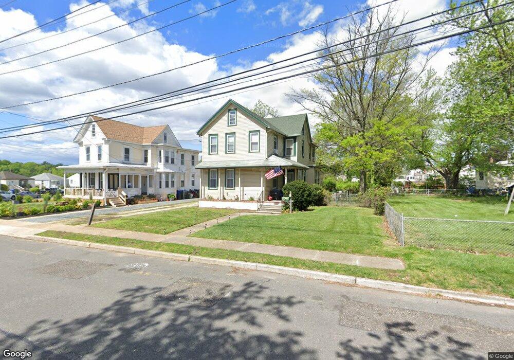
This home is located at 2 Tatum St, West Deptford, NJ 08096 and is currently estimated at $305,092, approximately $168 per square foot. 2 Tatum St is a home located in Gloucester County with nearby schools including Oakview Elementary School, Red Bank Elementary School, and Green-Fields Elementary School.
Ownership History
Date
Name
Owned For
Owner Type
Purchase Details
Closed on
Apr 14, 2023
Sold by
Gabriele Nicholas
Bought by
Christmas Daniel
Current Estimated Value
Home Financials for this Owner
Home Financials are based on the most recent Mortgage that was taken out on this home.
Original Mortgage
$174,489
Outstanding Balance
$169,684
Interest Rate
6.65%
Mortgage Type
New Conventional
Estimated Equity
$135,408
Purchase Details
Closed on
Mar 27, 2020
Sold by
Sees Sandy M and Mcguire Sandy M
Bought by
Gabriele Nicholas
Purchase Details
Closed on
Jun 30, 1997
Sold by
Duffield Brian J and Doan Catherine H
Bought by
Sees Sandy M
Home Financials for this Owner
Home Financials are based on the most recent Mortgage that was taken out on this home.
Original Mortgage
$106,000
Interest Rate
7.86%
Mortgage Type
FHA
Purchase Details
Closed on
Aug 30, 1995
Sold by
Taylor Lois J
Bought by
Duffield Brian J
Create a Home Valuation Report for This Property
The Home Valuation Report is an in-depth analysis detailing your home's value as well as a comparison with similar homes in the area
Home Values in the Area
Average Home Value in this Area
Purchase History
| Date | Buyer | Sale Price | Title Company |
|---|---|---|---|
| Christmas Daniel | $232,653 | Homestead Title | |
| Christmas Daniel | $232,653 | Homestead Title | |
| Gabriele Nicholas | $110,000 | Homestead Title Agency Inc | |
| Sees Sandy M | $106,500 | Homestead Title Agency | |
| Duffield Brian J | $45,000 | -- |
Source: Public Records
Mortgage History
| Date | Status | Borrower | Loan Amount |
|---|---|---|---|
| Open | Christmas Daniel | $174,489 | |
| Closed | Christmas Daniel | $174,489 | |
| Previous Owner | Sees Sandy M | $106,000 |
Source: Public Records
Tax History Compared to Growth
Tax History
| Year | Tax Paid | Tax Assessment Tax Assessment Total Assessment is a certain percentage of the fair market value that is determined by local assessors to be the total taxable value of land and additions on the property. | Land | Improvement |
|---|---|---|---|---|
| 2025 | $6,450 | $184,700 | $49,300 | $135,400 |
| 2024 | $6,367 | $184,700 | $49,300 | $135,400 |
| 2023 | $6,367 | $184,700 | $49,300 | $135,400 |
| 2022 | $6,337 | $184,700 | $49,300 | $135,400 |
| 2021 | $6,315 | $184,700 | $49,300 | $135,400 |
| 2020 | $6,300 | $184,700 | $49,300 | $135,400 |
| 2019 | $6,125 | $184,700 | $49,300 | $135,400 |
| 2018 | $5,958 | $184,700 | $49,300 | $135,400 |
| 2017 | $5,820 | $184,700 | $49,300 | $135,400 |
| 2016 | $5,657 | $184,700 | $49,300 | $135,400 |
| 2015 | $5,390 | $184,700 | $49,300 | $135,400 |
| 2014 | $5,122 | $184,700 | $49,300 | $135,400 |
Source: Public Records
Map
Nearby Homes
- 302 W Red Bank Ave
- 654 Frances Ave
- 46 Lynn Dr
- 626 Green St
- 30 N Broad St
- 193 Dubois Ave
- 7 Victorian Way
- 3 Victorian Way
- 2 Victorian Way
- 131 Watkins Ave
- 195 Delaware St
- 204 Hunter St
- 17 Watkins Ave
- 38 Watkins Ave
- 34 S Jackson St
- 210 Lawnton Ave
- 71 Cooper St
- 121 Crescent Ave
- 41 Crescent Ave
- 43 Curtis Ave
- 6 Tatum St
- 101 Red Bank Ct
- 103 W Red Bank Ave
- 105 W Red Bank Ave
- 112 Underwood Ave
- 107 W Red Bank Ave
- 116 Underwood Ave
- 17305 W Red Bank Ave Unit 305A
- 17302 W Red Bank Ave Unit 302A
- 173025 W Red Bank Ave Unit 302&5A
- 109 W Red Bank Ave
- 101 Underwood Ave
- 414 Tatum St
- 111 W Red Bank Ave
- 111 Underwood Ave
- 122 Underwood Ave
- 100 W Red Bank Ave
- 115 Underwood Ave
- 113 W Red Bank Ave
- 128 Underwood Ave