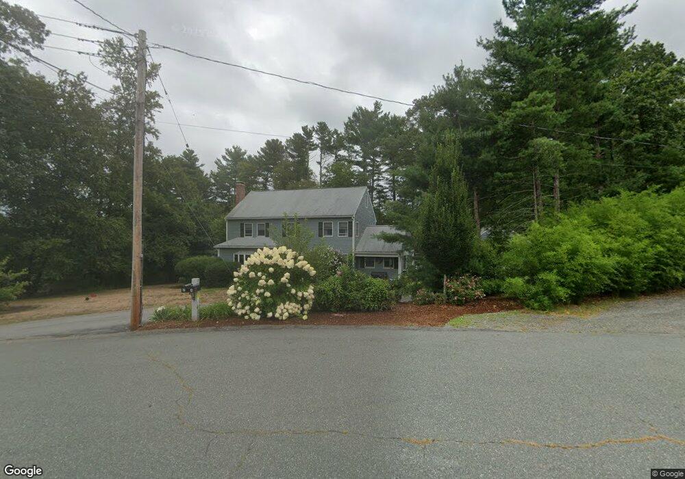
2 Tower Hill Cir Hanover, MA 02339
Estimated Value: $892,569 - $1,043,000
3
Beds
2
Baths
2,604
Sq Ft
$364/Sq Ft
Est. Value
About This Home
This home is located at 2 Tower Hill Cir, Hanover, MA 02339 and is currently estimated at $948,392, approximately $364 per square foot. 2 Tower Hill Cir is a home located in Plymouth County with nearby schools including Hanover High School, Cadence Academy Preschool - Hanover, and The Master's Academy.
Ownership History
Date
Name
Owned For
Owner Type
Purchase Details
Closed on
Jul 30, 1997
Sold by
Salvucci Thomas F
Bought by
Salvucci Joseph R and Salvucci Christine M
Current Estimated Value
Create a Home Valuation Report for This Property
The Home Valuation Report is an in-depth analysis detailing your home's value as well as a comparison with similar homes in the area
Home Values in the Area
Average Home Value in this Area
Purchase History
| Date | Buyer | Sale Price | Title Company |
|---|---|---|---|
| Salvucci Joseph R | $232,000 | -- | |
| Salvucci Joseph R | $232,000 | -- |
Source: Public Records
Mortgage History
| Date | Status | Borrower | Loan Amount |
|---|---|---|---|
| Open | Salvucci Joseph R | $100,000 | |
| Closed | Salvucci Joseph R | $138,300 | |
| Closed | Salvucci Joseph R | $141,000 |
Source: Public Records
Tax History Compared to Growth
Tax History
| Year | Tax Paid | Tax Assessment Tax Assessment Total Assessment is a certain percentage of the fair market value that is determined by local assessors to be the total taxable value of land and additions on the property. | Land | Improvement |
|---|---|---|---|---|
| 2025 | $9,627 | $779,500 | $273,100 | $506,400 |
| 2024 | $9,381 | $730,600 | $273,100 | $457,500 |
| 2023 | $9,086 | $673,500 | $248,200 | $425,300 |
| 2022 | $9,335 | $612,100 | $235,800 | $376,300 |
| 2021 | $27,541 | $540,200 | $192,200 | $348,000 |
| 2020 | $5,169 | $536,200 | $203,500 | $332,700 |
| 2019 | $8,448 | $514,800 | $203,500 | $311,300 |
| 2018 | $5,358 | $491,100 | $203,500 | $287,600 |
| 2017 | $7,016 | $424,700 | $203,900 | $220,800 |
| 2016 | $6,764 | $401,200 | $185,300 | $215,900 |
| 2015 | $6,258 | $387,500 | $171,600 | $215,900 |
Source: Public Records
Map
Nearby Homes
- 53 Chestnut St
- 62 Larchmont Ln
- 265 Silver St
- 276 Woodland Dr
- 14 Longwood Ln Unit 14
- 70 Dillingham Way
- 118 Bates Way
- 116 Spring Meadow Ln
- 375 Webster St
- 8 Old Farm Rd
- 114 Main St
- 107 Wildcat Ln
- 7 Assinippi Ave Unit 306
- 250 Center St
- 51 Cervelli Farm Dr
- 37 Dr
- 23 Cervelli Farm Dr
- 38 Cervelli Farm Dr
- 9 Cervelli Farm Dr
- 1239 Main St